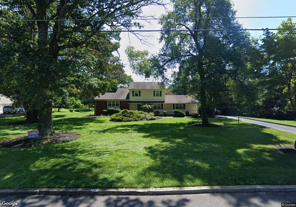
96 Jamestown Rd Belle Mead, NJ 08502
Estimated Value: $779,799 - $928,000
4
Beds
3
Baths
2,395
Sq Ft
$346/Sq Ft
Est. Value
About This Home
This home is located at 96 Jamestown Rd, Belle Mead, NJ 08502 and is currently estimated at $829,200, approximately $346 per square foot. 96 Jamestown Rd is a home located in Somerset County with nearby schools including Orchard Hill Elementary School, Montgomery Lower Mid School, and Village Elementary School.
Ownership History
Date
Name
Owned For
Owner Type
Purchase Details
Closed on
Dec 15, 2008
Sold by
Camper Benton B and Camper Sena H
Bought by
Karam Joseph M and Skau Marianne
Current Estimated Value
Home Financials for this Owner
Home Financials are based on the most recent Mortgage that was taken out on this home.
Original Mortgage
$298,350
Outstanding Balance
$248,777
Interest Rate
6.27%
Mortgage Type
Purchase Money Mortgage
Estimated Equity
$580,423
Purchase Details
Closed on
Jul 18, 1990
Sold by
Camper Benton B and Camper Carolyn
Bought by
Camper Benton B and Camper Carolyn
Create a Home Valuation Report for This Property
The Home Valuation Report is an in-depth analysis detailing your home's value as well as a comparison with similar homes in the area
Home Values in the Area
Average Home Value in this Area
Purchase History
| Date | Buyer | Sale Price | Title Company |
|---|---|---|---|
| Karam Joseph M | $526,500 | None Available | |
| Camper Benton B | -- | -- |
Source: Public Records
Mortgage History
| Date | Status | Borrower | Loan Amount |
|---|---|---|---|
| Open | Karam Joseph M | $298,350 |
Source: Public Records
Tax History Compared to Growth
Tax History
| Year | Tax Paid | Tax Assessment Tax Assessment Total Assessment is a certain percentage of the fair market value that is determined by local assessors to be the total taxable value of land and additions on the property. | Land | Improvement |
|---|---|---|---|---|
| 2025 | $14,859 | $433,700 | $260,300 | $173,400 |
| 2024 | $14,859 | $433,700 | $260,300 | $173,400 |
| 2023 | $14,846 | $433,700 | $260,300 | $173,400 |
| 2022 | $13,974 | $433,700 | $260,300 | $173,400 |
| 2021 | $13,857 | $433,700 | $260,300 | $173,400 |
| 2020 | $13,744 | $433,700 | $260,300 | $173,400 |
| 2019 | $13,653 | $433,700 | $260,300 | $173,400 |
| 2018 | $13,336 | $433,700 | $260,300 | $173,400 |
| 2017 | $13,106 | $433,700 | $260,300 | $173,400 |
| 2016 | $12,877 | $433,700 | $260,300 | $173,400 |
| 2015 | $12,582 | $433,700 | $260,300 | $173,400 |
| 2014 | $12,430 | $433,700 | $260,300 | $173,400 |
Source: Public Records
Map
Nearby Homes
- 11 Briar Hill Ct
- 161 Grayson Dr
- 87 Meadow Lark Ln
- 100 Knickerbocker Dr
- 43 Dead Tree Run Rd
- 74 Harlingen Rd
- 79 Green Ave
- 38 Van Doren Way
- 52 Ketcham Rd
- 167 Dead Tree Run Rd
- 15 Willow Run Ln
- 21 Harlingen Rd
- 0 Township Line Rd
- 40 Johnson Dr
- 68 Johnson Dr
- 1105 Rhoads Dr Unit 1105
- 125 Tomahawk Ct
- 10 Fredrick Ct
- 93 Mosher Rd
- 44 Bridle Path
- 102 Jamestown Rd
- 90 Jamestown Rd
- 110 Jamestown Rd
- 86 Jamestown Rd
- 89 Jamestown Rd
- 99 Jamestown Rd
- 341 Bellemead Griggstown Rd
- 79 Jamestown Rd
- 82 Jamestown Rd
- 313 Bellemead Griggstown Rd
- 313 Griggstown Rd
- 345 Bellemead Griggstown Rd
- 382 Harlingen Rd
- 376 Harlingen Rd
- 390 Harlingen Rd
- 67 Jamestown Rd
- 20 Cheston Ct
- 5 Red Oak Way
- 370 Harlingen Rd
- 303 Bellemead Griggstown Rd