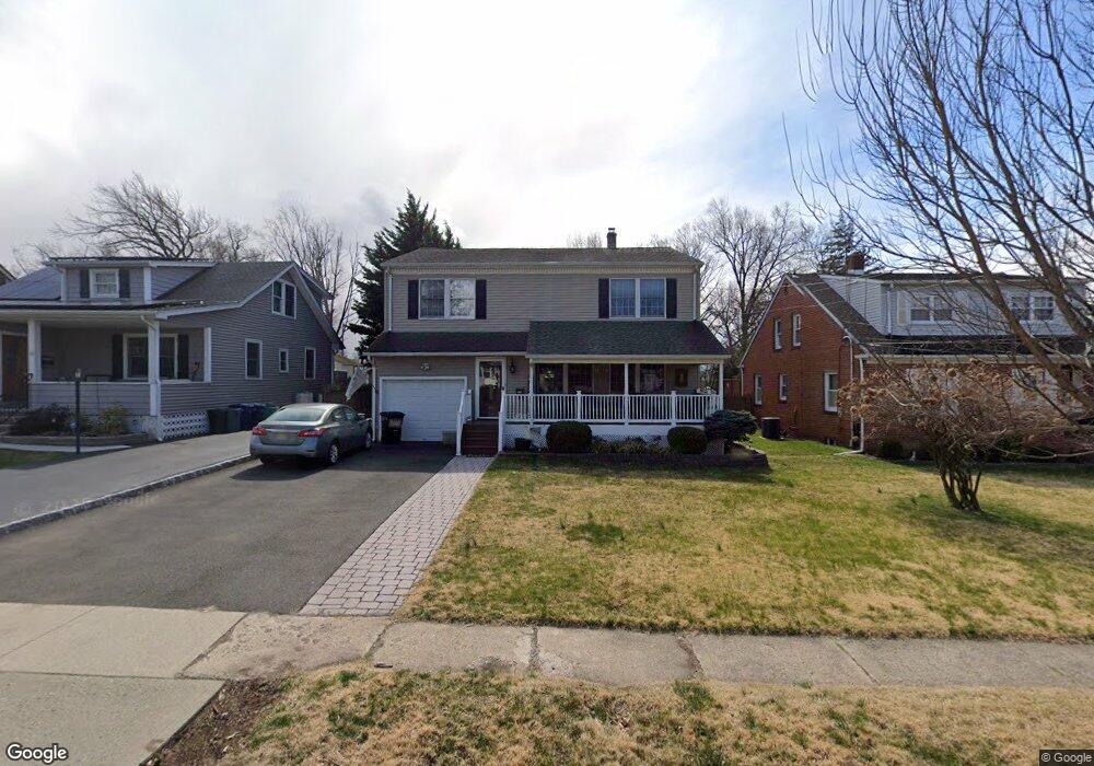
96 Lenox Ave Maywood, NJ 07607
Estimated Value: $746,000 - $865,000
--
Bed
--
Bath
2,338
Sq Ft
$350/Sq Ft
Est. Value
About This Home
This home is located at 96 Lenox Ave, Maywood, NJ 07607 and is currently estimated at $818,791, approximately $350 per square foot. 96 Lenox Ave is a home located in Bergen County with nearby schools including Maywood Avenue Elementary School, Memorial Elementary School, and Ben Porat Yosef.
Ownership History
Date
Name
Owned For
Owner Type
Purchase Details
Closed on
Jun 27, 2012
Sold by
Schenone Richard R and Schenone Maria F
Bought by
Brunetto Dominic and Contento Jeannine M
Current Estimated Value
Home Financials for this Owner
Home Financials are based on the most recent Mortgage that was taken out on this home.
Original Mortgage
$215,000
Outstanding Balance
$149,042
Interest Rate
3.76%
Mortgage Type
New Conventional
Estimated Equity
$669,749
Purchase Details
Closed on
Jan 13, 1997
Sold by
Moore Dorothy
Bought by
Schenone Richard R and Schenone Maria F
Home Financials for this Owner
Home Financials are based on the most recent Mortgage that was taken out on this home.
Original Mortgage
$100,000
Interest Rate
7.5%
Create a Home Valuation Report for This Property
The Home Valuation Report is an in-depth analysis detailing your home's value as well as a comparison with similar homes in the area
Home Values in the Area
Average Home Value in this Area
Purchase History
| Date | Buyer | Sale Price | Title Company |
|---|---|---|---|
| Brunetto Dominic | $420,000 | -- | |
| Schenone Richard R | $160,000 | -- |
Source: Public Records
Mortgage History
| Date | Status | Borrower | Loan Amount |
|---|---|---|---|
| Open | Brunetto Dominic | $215,000 | |
| Previous Owner | Schenone Richard R | $100,000 |
Source: Public Records
Tax History Compared to Growth
Tax History
| Year | Tax Paid | Tax Assessment Tax Assessment Total Assessment is a certain percentage of the fair market value that is determined by local assessors to be the total taxable value of land and additions on the property. | Land | Improvement |
|---|---|---|---|---|
| 2025 | $13,340 | $671,100 | $353,600 | $317,500 |
| 2024 | $12,795 | $619,900 | $321,700 | $298,200 |
| 2023 | $12,384 | $594,300 | $307,400 | $286,900 |
| 2022 | $12,384 | $542,700 | $282,400 | $260,300 |
| 2021 | $12,243 | $503,000 | $252,400 | $250,600 |
| 2020 | $12,978 | $410,700 | $193,400 | $217,300 |
| 2019 | $12,781 | $410,700 | $193,400 | $217,300 |
| 2018 | $12,498 | $410,700 | $193,400 | $217,300 |
| 2017 | $12,296 | $410,700 | $193,400 | $217,300 |
| 2016 | $11,919 | $410,700 | $193,400 | $217,300 |
| 2015 | $11,590 | $410,700 | $193,400 | $217,300 |
| 2014 | $11,426 | $410,700 | $193,400 | $217,300 |
Source: Public Records
Map
Nearby Homes
- 40 W Central Ave
- 350 Maywood Ave
- 345 Jaeger Ave
- 122 Hartwich St
- 49 E Pleasant Ave
- 86 Parkway
- 47 Colling Ave
- 137 Hartwich St
- 50 Oak St
- 483 Colonial Terrace Unit 10
- 25 Marinus St
- 6 Central Ave Unit 1
- 37 Terrace Ave
- 486 Blanchard Terrace Unit 70
- 486 Blanchard Terrace Unit 78
- 493 W Anderson St
- 644 Wyoming Ave
- 461 Heath Place Unit 23
- 175 Rochelle Ave Unit 222
- 175 Rochelle Ave