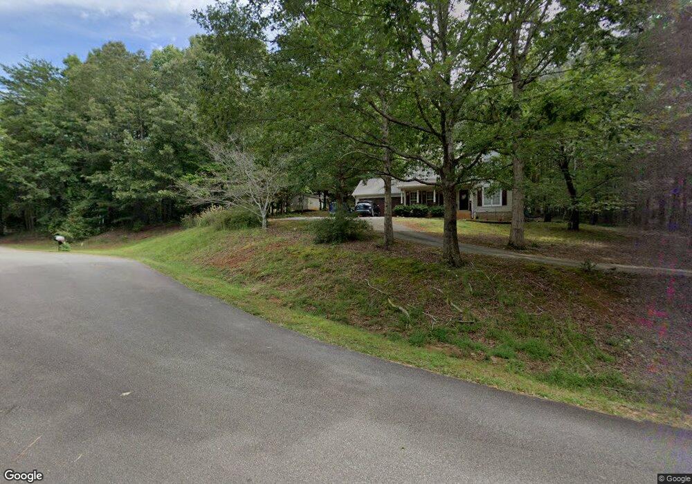
96 Michaels Ln Cleveland, GA 30528
Estimated Value: $313,638 - $371,000
3
Beds
2
Baths
1,536
Sq Ft
$226/Sq Ft
Est. Value
About This Home
This home is located at 96 Michaels Ln, Cleveland, GA 30528 and is currently estimated at $347,410, approximately $226 per square foot. 96 Michaels Ln is a home located in White County with nearby schools including White County 9th Grade Academy, Tesnatee Gap Elementary (Old White County Intermediate), and Jack P. Nix Elementary School.
Ownership History
Date
Name
Owned For
Owner Type
Purchase Details
Closed on
Aug 20, 2020
Sold by
Fountain Thomas
Bought by
Yarbrough Calib B
Current Estimated Value
Home Financials for this Owner
Home Financials are based on the most recent Mortgage that was taken out on this home.
Original Mortgage
$197,979
Outstanding Balance
$175,621
Interest Rate
3%
Mortgage Type
New Conventional
Estimated Equity
$171,789
Purchase Details
Closed on
Sep 26, 2014
Sold by
Federal Home Loan Mortgage Corporation
Bought by
Fountain Thomas Cameron
Home Financials for this Owner
Home Financials are based on the most recent Mortgage that was taken out on this home.
Original Mortgage
$132,551
Interest Rate
4.16%
Mortgage Type
New Conventional
Purchase Details
Closed on
Jun 3, 2014
Sold by
Citimortgage Inc
Bought by
Federal Home Loan Mortgage Corporation
Create a Home Valuation Report for This Property
The Home Valuation Report is an in-depth analysis detailing your home's value as well as a comparison with similar homes in the area
Home Values in the Area
Average Home Value in this Area
Purchase History
| Date | Buyer | Sale Price | Title Company |
|---|---|---|---|
| Yarbrough Calib B | $196,000 | -- | |
| Fountain Thomas Cameron | $129,900 | -- | |
| Federal Home Loan Mortgage Corporation | $118,330 | -- | |
| Citimortgage Inc | $118,330 | -- |
Source: Public Records
Mortgage History
| Date | Status | Borrower | Loan Amount |
|---|---|---|---|
| Open | Yarbrough Calib B | $197,979 | |
| Previous Owner | Fountain Thomas Cameron | $132,551 |
Source: Public Records
Tax History Compared to Growth
Tax History
| Year | Tax Paid | Tax Assessment Tax Assessment Total Assessment is a certain percentage of the fair market value that is determined by local assessors to be the total taxable value of land and additions on the property. | Land | Improvement |
|---|---|---|---|---|
| 2025 | $1,940 | $93,144 | $12,000 | $81,144 |
| 2024 | $1,940 | $93,144 | $12,000 | $81,144 |
| 2023 | $1,852 | $81,672 | $12,000 | $69,672 |
| 2022 | $1,665 | $70,172 | $10,000 | $60,172 |
| 2021 | $1,646 | $61,396 | $10,000 | $51,396 |
| 2020 | $1,508 | $53,572 | $9,600 | $43,972 |
| 2019 | $1,512 | $53,572 | $9,600 | $43,972 |
| 2018 | $1,479 | $52,372 | $8,400 | $43,972 |
| 2017 | $1,365 | $48,808 | $8,400 | $40,408 |
| 2016 | $1,366 | $48,808 | $8,400 | $40,408 |
| 2015 | $1,303 | $122,020 | $8,400 | $40,408 |
| 2014 | -- | $112,780 | $0 | $0 |
Source: Public Records
Map
Nearby Homes
- 109 Driskell Rd
- 256 Dogwood Ln
- 250 Truelove Rd
- 179 Garrison Dr
- 0 Underwood Farm Rd Unit 10620914
- 152 Grand View Dr
- 0 Grand View Dr Unit 10479899
- 221 Grand View Dr
- 61 Pine Ln
- 329 Leisure Acres Dr
- 611 Highway 75 S
- 488 Old Highway 75 S
- 150 Hardwood Dr
- 2523 Westmoreland Rd
- 57 Autumnwood Way
- 0 College View Dr Unit LOT 3 10541620
- 0 Old Highway 75 S Unit 7656742
- 147 Briarwood Dr
- 00 Partin Rd
- 0 Partin Rd Unit LOT 1 10539978
- 96 Michaels Ln Unit 8
- 1854 Highway 75 S
- 72 Michaels Ln
- 344 Hamilton Dr
- 370 Hamilton Dr
- 1826 Highway 75 S
- 1856 Highway 75 S
- 1856 Highway 75 S
- 322 Hamilton Dr
- 126 Hamilton Dr
- 380 Hamilton Dr
- 321 Hamilton Dr
- 0 Stonebrook Ln Unit 21 7124079
- 0 Stonebrook Ln Unit 9078069
- 0 Stonebrook Ln Unit 7244623
- 0 Stonebrook Ln Unit 7411166
- 0 Stonebrook Trail Unit 8439942
- 0 Stonebrook Trail Unit 8308420
- 0 Stonebrook Trail Unit 8281547
- 0 Stonebrook Trail Unit 37 7132355