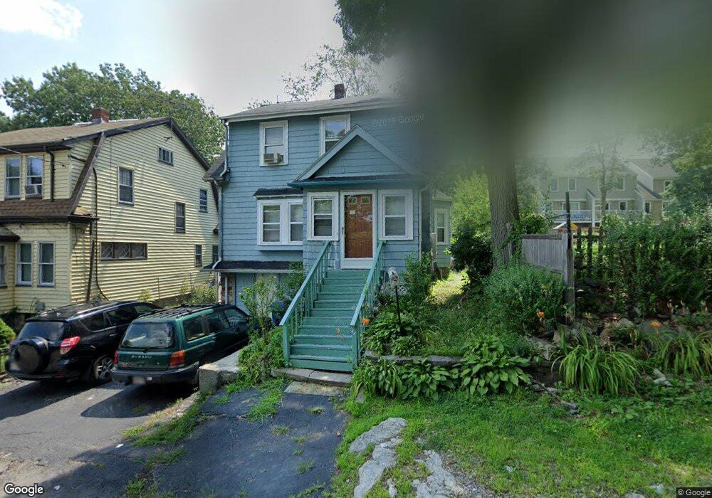
96 Roanoke Rd Mattapan, MA 02126
Hyde Park NeighborhoodEstimated Value: $500,000 - $661,000
3
Beds
2
Baths
1,485
Sq Ft
$397/Sq Ft
Est. Value
About This Home
This home is located at 96 Roanoke Rd, Mattapan, MA 02126 and is currently estimated at $589,898, approximately $397 per square foot. 96 Roanoke Rd is a home located in Suffolk County with nearby schools including Boston Preparatory Charter Public School and Sacred Heart STEM School.
Ownership History
Date
Name
Owned For
Owner Type
Purchase Details
Closed on
Sep 14, 1998
Sold by
Metellus Jeanette
Bought by
Metellus Sylvio and Metellus Marlene
Current Estimated Value
Purchase Details
Closed on
Aug 23, 1996
Sold by
Transamerica Fncl Svc
Bought by
Metellus Jeanette
Create a Home Valuation Report for This Property
The Home Valuation Report is an in-depth analysis detailing your home's value as well as a comparison with similar homes in the area
Home Values in the Area
Average Home Value in this Area
Purchase History
| Date | Buyer | Sale Price | Title Company |
|---|---|---|---|
| Metellus Sylvio | $125,000 | -- | |
| Metellus Jeanette | $70,000 | -- |
Source: Public Records
Mortgage History
| Date | Status | Borrower | Loan Amount |
|---|---|---|---|
| Open | Metellus Jeanette | $97,000 | |
| Closed | Metellus Jeanette | $99,000 |
Source: Public Records
Tax History
| Year | Tax Paid | Tax Assessment Tax Assessment Total Assessment is a certain percentage of the fair market value that is determined by local assessors to be the total taxable value of land and additions on the property. | Land | Improvement |
|---|---|---|---|---|
| 2025 | $4,827 | $416,800 | $137,700 | $279,100 |
| 2024 | $4,323 | $396,600 | $138,000 | $258,600 |
| 2023 | $3,980 | $370,600 | $129,000 | $241,600 |
| 2022 | $3,734 | $343,200 | $119,400 | $223,800 |
| 2021 | $3,332 | $312,300 | $110,600 | $201,700 |
| 2020 | $2,936 | $278,000 | $100,200 | $177,800 |
| 2019 | $2,791 | $264,800 | $81,100 | $183,700 |
| 2018 | $2,644 | $252,300 | $81,100 | $171,200 |
| 2017 | $2,428 | $229,300 | $81,100 | $148,200 |
| 2016 | $2,473 | $224,800 | $81,100 | $143,700 |
| 2015 | $2,720 | $224,600 | $74,000 | $150,600 |
| 2014 | $2,638 | $209,700 | $74,000 | $135,700 |
Source: Public Records
Map
Nearby Homes
- 87 Victoria Heights Rd
- 65 Victoria Heights Rd Unit 65
- 265 Hebron St
- 19 Tacoma St
- 0 Tina Ave
- 179 Hebron St
- 34 Ridlon Rd
- 19 Melba Way
- 52 Taunton Ave
- 72 Livermore St
- 175 Clare Ave Unit B3
- 800 Hyde Park Ave Unit 3
- 514 Metropolitan Ave Unit 514A
- 766 Hyde Park Ave
- 18 Rugby Rd
- 231 Itasca St
- 519 Metropolitan Ave
- 839-843 Cummins Hwy
- 895 Hyde Park Ave Unit 2
- 6 Ramsdell Ave Unit 4
- 92 Roanoke Rd
- 92 Roanoke Rd
- 86 Roanoke Rd
- 104 Roanoke Rd
- 86 Roanoke Rd
- 109 Annafran St
- 82 Roanoke Rd
- 25 Noah St
- 76 Roanoke Rd
- 127 Pleasantview St
- 124 Pleasantview St
- 121 Pleasantview St
- 70 Roanoke Rd
- 91 Annafran St
- 100 Annafran St
- 100 Annafran St Unit 1 Fam
- 102 Pleasantview St
- 21 Noah St
- 96 Annafran St
- 109 Pleasantview St
Your Personal Tour Guide
Ask me questions while you tour the home.