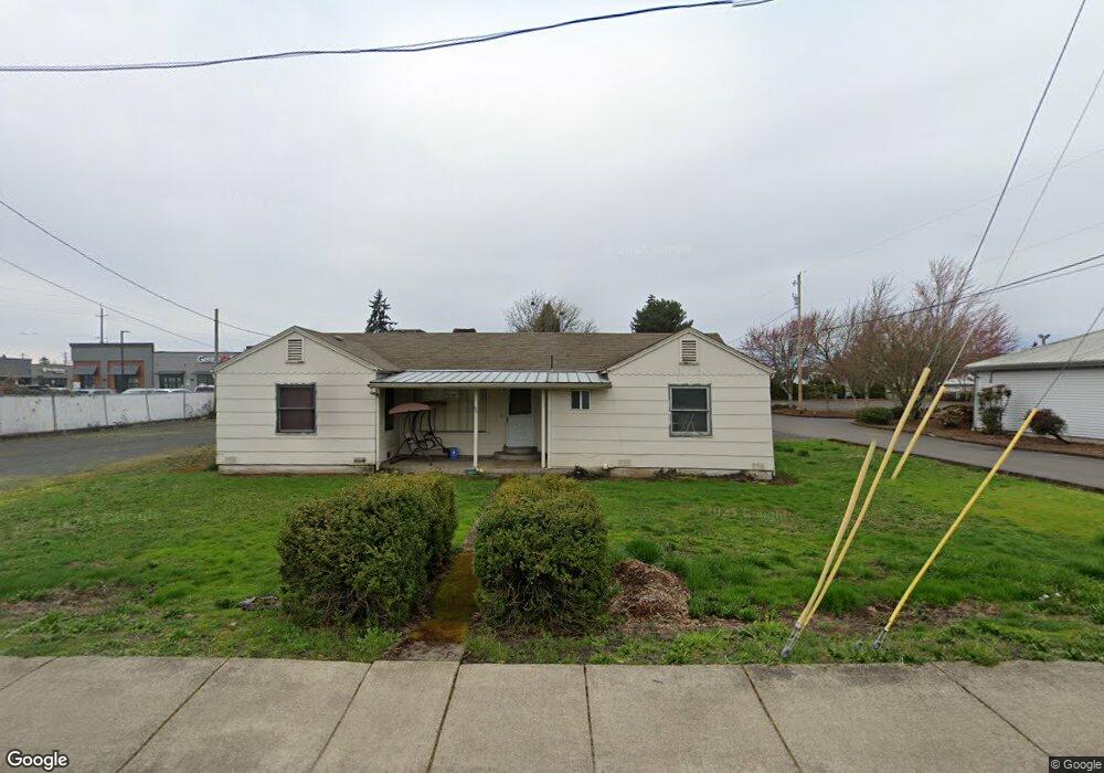
96 S Airport Rd Lebanon, OR 97355
Estimated Value: $273,470
3
Beds
1
Bath
1,280
Sq Ft
$214/Sq Ft
Est. Value
About This Home
This home is located at 96 S Airport Rd, Lebanon, OR 97355 and is currently estimated at $273,470, approximately $213 per square foot. 96 S Airport Rd is a home located in Linn County with nearby schools including Cascades School, Seven Oak Middle School, and Lebanon High School.
Ownership History
Date
Name
Owned For
Owner Type
Purchase Details
Closed on
Jan 29, 2009
Sold by
The Southside Church Of Christ
Bought by
State Of Oregon
Current Estimated Value
Purchase Details
Closed on
Oct 13, 2005
Sold by
Swander Stanley L
Bought by
The Southside Church Of Christ
Home Financials for this Owner
Home Financials are based on the most recent Mortgage that was taken out on this home.
Original Mortgage
$50,000
Interest Rate
5.63%
Mortgage Type
Seller Take Back
Create a Home Valuation Report for This Property
The Home Valuation Report is an in-depth analysis detailing your home's value as well as a comparison with similar homes in the area
Home Values in the Area
Average Home Value in this Area
Purchase History
| Date | Buyer | Sale Price | Title Company |
|---|---|---|---|
| State Of Oregon | $2,800 | Amerititle | |
| The Southside Church Of Christ | $100,000 | Lawyers Title Ins |
Source: Public Records
Mortgage History
| Date | Status | Borrower | Loan Amount |
|---|---|---|---|
| Previous Owner | The Southside Church Of Christ | $50,000 |
Source: Public Records
Tax History Compared to Growth
Tax History
| Year | Tax Paid | Tax Assessment Tax Assessment Total Assessment is a certain percentage of the fair market value that is determined by local assessors to be the total taxable value of land and additions on the property. | Land | Improvement |
|---|---|---|---|---|
| 2025 | -- | -- | -- | -- |
| 2024 | -- | -- | -- | -- |
| 2023 | $0 | $0 | $0 | $0 |
| 2022 | $0 | $0 | $0 | $0 |
| 2021 | $0 | $92,420 | $0 | $0 |
| 2020 | $0 | $89,730 | $0 | $0 |
| 2019 | $0 | $87,120 | $0 | $0 |
| 2018 | $0 | $84,590 | $0 | $0 |
| 2017 | $0 | $82,130 | $0 | $0 |
| 2016 | $0 | $79,740 | $0 | $0 |
| 2015 | -- | $77,420 | $0 | $0 |
| 2014 | -- | $75,170 | $0 | $0 |
Source: Public Records
Map
Nearby Homes
- 2055 Larson Ln
- 115 S Airport Rd
- 196 S Airport Rd
- 165 S Airport Rd
- 1975 S 2nd St
- 2093 Larson Ln
- 195 S Airport Rd
- 1977 S 2nd St
- 0 S Airport Rd
- 0 S Airport Rd Unit 23244603
- 0 S Airport Rd Unit 14037760
- 0 S Airport Rd Unit 16449661
- 0 S Airport Rd Unit 301 17145079
- 0 S Airport Rd Unit 301 18302920
- 1985 S 2nd St
- 2009 S 2nd St
- 2081 Luna Way Unit 4
- 1920 S 2nd St
- 1956 S 2nd St
- 1940 S 2nd St