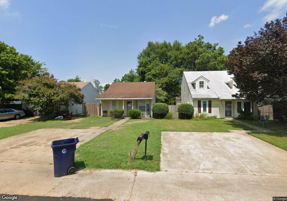
96 Sherwood Cove Marion, AR 72364
Estimated Value: $94,000 - $100,000
3
Beds
1
Bath
874
Sq Ft
$111/Sq Ft
Est. Value
About This Home
This home is located at 96 Sherwood Cove, Marion, AR 72364 and is currently estimated at $97,293, approximately $111 per square foot. 96 Sherwood Cove is a home located in Crittenden County with nearby schools including Herbert Carter Global Community Magnet School, Marion Visual Performing Arts Magnet, and Marion Junior High School.
Ownership History
Date
Name
Owned For
Owner Type
Purchase Details
Closed on
Jun 24, 2011
Sold by
Federal National Mortgage Association
Bought by
Macklin Willie J
Current Estimated Value
Purchase Details
Closed on
Jun 16, 2011
Sold by
Federal National Mortgage Association
Bought by
Macklin Willie J
Purchase Details
Closed on
Jan 10, 2011
Sold by
White Mary Ann and White Calvin
Bought by
First Home Mortgage Inc
Purchase Details
Closed on
Dec 31, 2010
Bought by
Federal National Mortgage Asso
Purchase Details
Closed on
Jul 30, 2004
Sold by
Not Provided
Bought by
White Calvin and White Mary Ann
Purchase Details
Closed on
Mar 1, 1989
Bought by
Johnson Carnell
Purchase Details
Closed on
Dec 1, 1987
Bought by
Clements Cathy
Purchase Details
Closed on
Apr 1, 1986
Bought by
To
Purchase Details
Closed on
Oct 1, 1985
Bought by
To
Create a Home Valuation Report for This Property
The Home Valuation Report is an in-depth analysis detailing your home's value as well as a comparison with similar homes in the area
Home Values in the Area
Average Home Value in this Area
Purchase History
| Date | Buyer | Sale Price | Title Company |
|---|---|---|---|
| Macklin Willie J | -- | -- | |
| Macklin Willie J | -- | -- | |
| First Home Mortgage Inc | -- | -- | |
| Federal National Mortgage Asso | $51,100 | -- | |
| White Calvin | $63,000 | -- | |
| Johnson Carnell | $45,000 | -- | |
| Clements Cathy | $38,000 | -- | |
| To | $38,000 | -- | |
| To | $35,000 | -- |
Source: Public Records
Tax History Compared to Growth
Tax History
| Year | Tax Paid | Tax Assessment Tax Assessment Total Assessment is a certain percentage of the fair market value that is determined by local assessors to be the total taxable value of land and additions on the property. | Land | Improvement |
|---|---|---|---|---|
| 2024 | $409 | $6,860 | $1,300 | $5,560 |
| 2023 | $409 | $6,860 | $1,300 | $5,560 |
| 2022 | $409 | $6,860 | $1,300 | $5,560 |
| 2021 | $409 | $6,860 | $1,300 | $5,560 |
| 2020 | $385 | $6,860 | $1,300 | $5,560 |
| 2019 | $425 | $7,130 | $2,500 | $4,630 |
| 2018 | $389 | $7,130 | $2,500 | $4,630 |
| 2017 | $389 | $7,130 | $2,500 | $4,630 |
| 2016 | $367 | $7,130 | $2,500 | $4,630 |
| 2015 | $392 | $7,130 | $2,500 | $4,630 |
| 2014 | $488 | $8,910 | $2,500 | $6,410 |
Source: Public Records
Map
Nearby Homes
- 92 S Currie Ave
- 52 S Currie Ave
- 316 River Wind Dr
- 256 Rivertrace Dr
- 29 Shafer Ave
- 218 Blair Dr
- 216 Pine St
- 292 Shiloh Dr
- 0 Block St
- 130 Barton Cove
- 152 Barton Cove
- 84 Henry St
- 271 Rivertrace Dr
- 144 Henry St
- 99 Meadowbrook Cir
- 614 N East Lake Dr N
- 804 Winston Cove
- 102 Gannt St
- 235 Blair Dr
- 606 Julia Dr