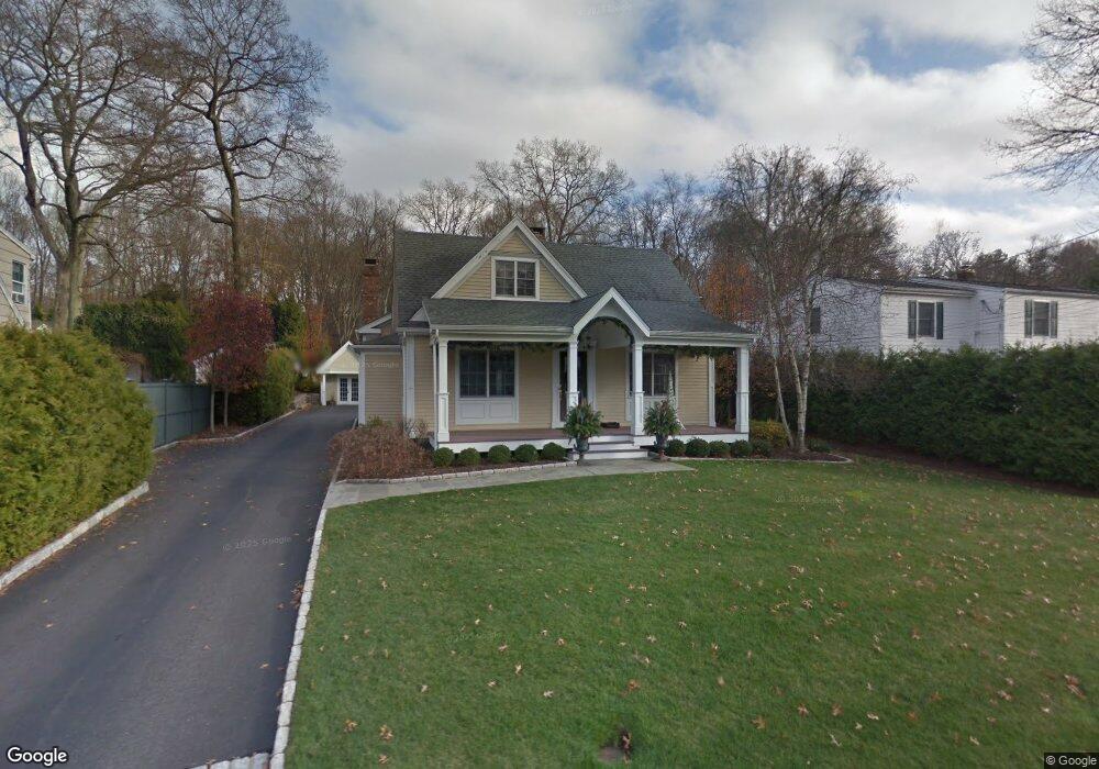
96 Woods End Rd Fairfield, CT 06824
University NeighborhoodEstimated Value: $486,000 - $1,227,011
4
Beds
4
Baths
2,541
Sq Ft
$312/Sq Ft
Est. Value
About This Home
This home is located at 96 Woods End Rd, Fairfield, CT 06824 and is currently estimated at $794,003, approximately $312 per square foot. 96 Woods End Rd is a home located in Fairfield County with nearby schools including Riverfield Elementary School, Roger Ludlowe Middle School, and Fairfield Ludlowe High School.
Ownership History
Date
Name
Owned For
Owner Type
Purchase Details
Closed on
Apr 15, 2014
Sold by
Garofalo Mark
Bought by
Lesko Kevin and Lesko Pauline
Current Estimated Value
Home Financials for this Owner
Home Financials are based on the most recent Mortgage that was taken out on this home.
Original Mortgage
$150,000
Interest Rate
4.25%
Purchase Details
Closed on
Aug 13, 1999
Sold by
Pusateri John R and Pusateri Eliz
Bought by
Lesko Kevin M and Lesko Pauline L
Create a Home Valuation Report for This Property
The Home Valuation Report is an in-depth analysis detailing your home's value as well as a comparison with similar homes in the area
Home Values in the Area
Average Home Value in this Area
Purchase History
| Date | Buyer | Sale Price | Title Company |
|---|---|---|---|
| Lesko Kevin | $257,500 | -- | |
| Lesko Kevin | $257,500 | -- | |
| Lesko Kevin M | $300,000 | -- | |
| Lesko Kevin M | $300,000 | -- |
Source: Public Records
Mortgage History
| Date | Status | Borrower | Loan Amount |
|---|---|---|---|
| Open | Lesko Kevin M | $601,450 | |
| Closed | Lesko Kevin M | $150,000 |
Source: Public Records
Tax History
| Year | Tax Paid | Tax Assessment Tax Assessment Total Assessment is a certain percentage of the fair market value that is determined by local assessors to be the total taxable value of land and additions on the property. | Land | Improvement |
|---|---|---|---|---|
| 2025 | $13,386 | $471,520 | $325,850 | $145,670 |
| 2024 | $13,155 | $471,520 | $325,850 | $145,670 |
| 2023 | $12,972 | $471,520 | $325,850 | $145,670 |
| 2022 | $12,844 | $471,520 | $325,850 | $145,670 |
| 2021 | $12,722 | $471,520 | $325,850 | $145,670 |
| 2020 | $13,086 | $488,460 | $322,490 | $165,970 |
| 2019 | $13,086 | $488,460 | $322,490 | $165,970 |
| 2018 | $12,876 | $488,460 | $322,490 | $165,970 |
| 2017 | $12,612 | $488,460 | $322,490 | $165,970 |
| 2016 | $12,431 | $488,460 | $322,490 | $165,970 |
| 2015 | $12,387 | $499,660 | $339,850 | $159,810 |
| 2014 | $12,192 | $499,660 | $339,850 | $159,810 |
Source: Public Records
Map
Nearby Homes
- 82 Woods End Rd
- 110 Woods End Rd
- 38 Thor Place
- 66 Woods End Rd
- 126 Woods End Rd
- 123 Woods End Rd
- 123 Woods End Rd Unit A
- 107 Woods End Rd
- 140 Woods End Rd
- 40 Thor Place
- 91 Woods End Rd
- 123a Woods End Rd
- 71 Woods End Rd
- 39 Thor Place
- 82 Deer Run Rd
- 47 Woods End Rd
- 137 Woods End Rd
- 36 Woods End Rd
- 13 Thor Place
Your Personal Tour Guide
Ask me questions while you tour the home.