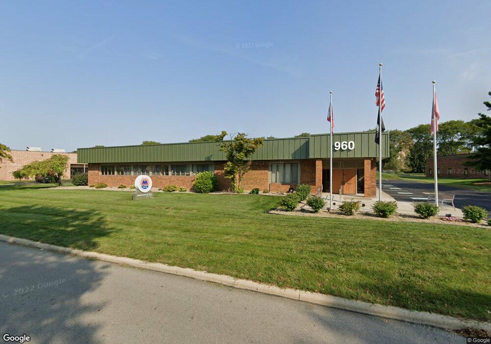
960 Checkrein Ave Columbus, OH 43229
Estimated Value: $946,225
--
Bed
--
Bath
7,733
Sq Ft
$122/Sq Ft
Est. Value
About This Home
This home is located at 960 Checkrein Ave, Columbus, OH 43229 and is currently estimated at $946,225, approximately $122 per square foot. 960 Checkrein Ave is a home located in Franklin County with nearby schools including Wilson Hill Elementary School, Kilbourne Middle School, and Thomas Worthington High School.
Ownership History
Date
Name
Owned For
Owner Type
Purchase Details
Closed on
Jul 15, 2019
Sold by
960 Checkrein Ave Ltd
Bought by
American Veterans Of World War Ii Amvets
Current Estimated Value
Purchase Details
Closed on
Jun 22, 1992
Purchase Details
Closed on
Apr 24, 1992
Create a Home Valuation Report for This Property
The Home Valuation Report is an in-depth analysis detailing your home's value as well as a comparison with similar homes in the area
Home Values in the Area
Average Home Value in this Area
Purchase History
| Date | Buyer | Sale Price | Title Company |
|---|---|---|---|
| American Veterans Of World War Ii Amvets | $562,500 | Elite Land Title | |
| -- | $500,000 | -- | |
| -- | -- | -- |
Source: Public Records
Tax History Compared to Growth
Tax History
| Year | Tax Paid | Tax Assessment Tax Assessment Total Assessment is a certain percentage of the fair market value that is determined by local assessors to be the total taxable value of land and additions on the property. | Land | Improvement |
|---|---|---|---|---|
| 2024 | -- | $259,710 | $75,010 | $184,700 |
| 2023 | $24,296 | $259,700 | $75,005 | $184,695 |
| 2022 | $0 | $249,130 | $66,010 | $183,120 |
| 2021 | $24,296 | $249,130 | $66,010 | $183,120 |
| 2020 | $24,296 | $249,130 | $66,010 | $183,120 |
| 2019 | $23,350 | $226,450 | $59,990 | $166,460 |
| 2018 | $22,557 | $226,450 | $59,990 | $166,460 |
| 2017 | $21,633 | $226,450 | $59,990 | $166,460 |
| 2016 | $22,298 | $221,900 | $59,990 | $161,910 |
| 2015 | $22,280 | $221,900 | $59,990 | $161,910 |
| 2014 | $22,270 | $221,900 | $59,990 | $161,910 |
| 2013 | $10,897 | $221,900 | $59,990 | $161,910 |
Source: Public Records
Map
Nearby Homes
- 1294 Clydesdale Ct
- 1268 Kildale Ct
- 1322 Bolenhill Ct
- 1409 Bosworth Place
- 6211 Parkdale Dr
- 1421 Bosworth Place
- 6189 Northgap Dr
- 1288 Oakfield Dr N
- 1171 Newbury Dr
- 6647 Eastland Ct
- 6407 Faircrest Rd
- 0 Proprietors Rd Unit 225002452
- 6458 Faircrest Rd
- 1460 Burnley Square N
- 930 Proprietors Rd
- 463 E North St Unit D-5
- 1635 Tendril Ct
- 1549 Alpine Dr
- 5990 Ambleside Dr
- 6342 Bellmeadow Dr
- 6665 Singletree Dr
- 915 Schrock Rd
- 985 Schrock Rd
- 6610 Singletree Dr
- 6645 Singletree Dr
- 1001 Schrock Rd
- 6670 Busch Blvd
- 6670 Busch Blvd Unit 6670
- 960 Kingsmill Pkwy
- 6640 Busch Blvd
- 990 Kingsmill Pkwy
- 6600 Busch Blvd
- 1080 Kingsmill Pkwy
- 6665 Busch Blvd
- 6500 Busch Blvd
- 6660 Doubletree Ave
- 1033 Kingsmill Pkwy
- 6525 Kingsmill Ct
- 6460 Busch Blvd
- 0 Kingsmill Ct