Estimated Value: $264,718 - $306,000
Studio
--
Bath
--
Sq Ft
0.27
Acres
About This Home
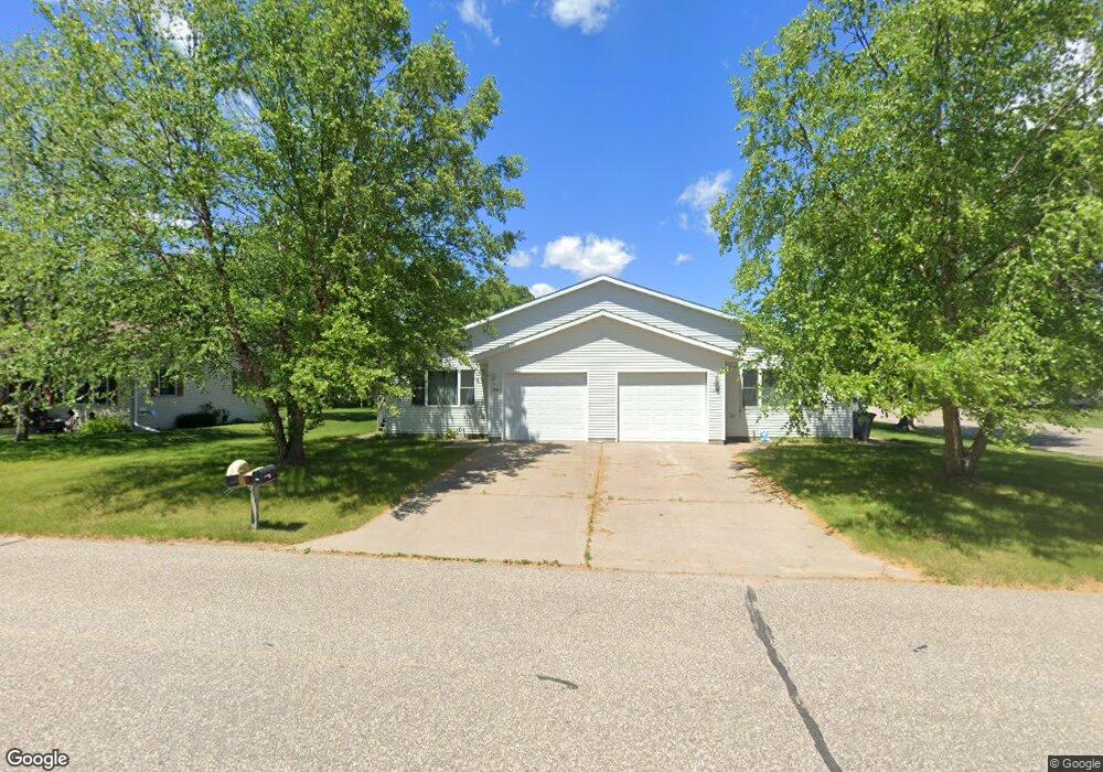
This home is located at 960 E Taft St, Blair, WI 54616 and is currently estimated at $286,180. 960 E Taft St is a home located in Trempealeau County with nearby schools including Blair-Taylor Elementary School, Blair-Taylor Middle/High School, and Pinehill Amish School.
Ownership History
Date
Name
Owned For
Owner Type
Purchase Details
Closed on
Dec 1, 2016
Sold by
Dahl Nathan D and Dahl Hannah L
Bought by
Stephenson Dennis J and Stephenson Cynthia D
Current Estimated Value
Home Financials for this Owner
Home Financials are based on the most recent Mortgage that was taken out on this home.
Original Mortgage
$103,200
Outstanding Balance
$45,414
Interest Rate
2.84%
Mortgage Type
New Conventional
Estimated Equity
$240,766
Purchase Details
Closed on
Jun 15, 2015
Sold by
Dahl Devere O
Bought by
Dahl Nathan D
Create a Home Valuation Report for This Property
The Home Valuation Report is an in-depth analysis detailing your home's value as well as a comparison with similar homes in the area
Purchase History
| Date | Buyer | Sale Price | Title Company |
|---|---|---|---|
| Stephenson Dennis J | $137,600 | Attorney | |
| Dahl Nathan D | $57,500 | -- |
Source: Public Records
Mortgage History
| Date | Status | Borrower | Loan Amount |
|---|---|---|---|
| Open | Stephenson Dennis J | $103,200 |
Source: Public Records
Tax History
| Year | Tax Paid | Tax Assessment Tax Assessment Total Assessment is a certain percentage of the fair market value that is determined by local assessors to be the total taxable value of land and additions on the property. | Land | Improvement |
|---|---|---|---|---|
| 2025 | $4,691 | $273,400 | $9,300 | $264,100 |
| 2024 | $4,801 | $275,400 | $9,300 | $266,100 |
| 2023 | $4,268 | $147,100 | $10,600 | $136,500 |
| 2022 | $4,011 | $147,100 | $10,600 | $136,500 |
| 2021 | $3,460 | $147,100 | $10,600 | $136,500 |
| 2020 | $3,322 | $24,250 | $10,600 | $13,650 |
| 2019 | $3,502 | $147,100 | $10,600 | $136,500 |
| 2018 | $3,043 | $147,100 | $10,600 | $136,500 |
| 2017 | $3,121 | $147,100 | $10,600 | $136,500 |
| 2016 | $2,881 | $147,100 | $10,600 | $136,500 |
| 2015 | $3,403 | $147,100 | $10,600 | $136,500 |
| 2014 | $3,175 | $147,100 | $10,600 | $136,500 |
| 2011 | $3,771 | $161,900 | $10,600 | $151,300 |
Source: Public Records
Map
Nearby Homes
- 128 E Broadway St
- 127 E Broadway St
- N34855 County Rd S
- XX Vold Rd
- N28190 Brekke Ridge Rd
- 0 Joe Coulee Rd
- 00 Joe Coulee Rd
- 211 2nd St
- 21 Hanson St
- 21 Pearl St
- 06 Lot 6 Elm Ln
- 011 Lot 11 Elm Ln
- 05 Lot 5 Elm Ln
- 010 Lot 10 Elm Ln
- 37508 Haug Rd
- 18191 Hopkins St
- 36180 Main St Unit 1 & 2
- 36015 Main St
- 36180 Main St
- 18654 Hobson St
- 615 E Broadway St
- 958 E Taft St
- 951 E Taft St
- 1001 E Broadway St
- 614 E Maple St
- 624 E Maple St
- 664 E Maple St
- 615 E Olson St
- 631 E Taft St
- 652 E Olson St
- 651 E Broadway St
- 615 E Broadway St
- 805 E Broadway St
- 506 E Olson St
- 519 E Broadway St
- 511 E Broadway St
- 632 E Broadway St
- 664 E Maple St
- 1012 E Taft St
- 807 E Taft St
Your Personal Tour Guide
Ask me questions while you tour the home.