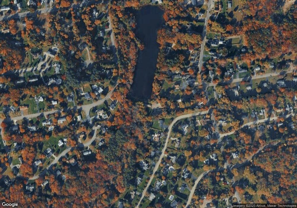
960 Main St Hanover, MA 02339
Estimated Value: $636,000 - $708,000
4
Beds
2
Baths
1,715
Sq Ft
$384/Sq Ft
Est. Value
About This Home
This home is located at 960 Main St, Hanover, MA 02339 and is currently estimated at $658,373, approximately $383 per square foot. 960 Main St is a home located in Plymouth County with nearby schools including Hanover High School, South Shore Charter Public School, and Norwell KinderCare.
Ownership History
Date
Name
Owned For
Owner Type
Purchase Details
Closed on
Dec 10, 2019
Sold by
State Rt
Bought by
116 State Llc
Current Estimated Value
Purchase Details
Closed on
Jun 7, 2010
Sold by
Dooley Kevin
Bought by
State Rt and Dooley Kevin
Purchase Details
Closed on
Jun 8, 2009
Sold by
Suisse First Boston Cs
Bought by
Dooley Kevin
Purchase Details
Closed on
Dec 12, 2008
Sold by
Mchugh James F
Bought by
Us Bk
Create a Home Valuation Report for This Property
The Home Valuation Report is an in-depth analysis detailing your home's value as well as a comparison with similar homes in the area
Home Values in the Area
Average Home Value in this Area
Purchase History
| Date | Buyer | Sale Price | Title Company |
|---|---|---|---|
| 116 State Llc | -- | None Available | |
| State Rt | -- | -- | |
| Dooley Kevin | $131,000 | -- | |
| Us Bk | $174,000 | -- |
Source: Public Records
Mortgage History
| Date | Status | Borrower | Loan Amount |
|---|---|---|---|
| Previous Owner | Us Bk | $50,000 | |
| Previous Owner | Us Bk | $242,450 | |
| Previous Owner | Us Bk | $80,000 |
Source: Public Records
Tax History Compared to Growth
Tax History
| Year | Tax Paid | Tax Assessment Tax Assessment Total Assessment is a certain percentage of the fair market value that is determined by local assessors to be the total taxable value of land and additions on the property. | Land | Improvement |
|---|---|---|---|---|
| 2025 | $6,759 | $547,300 | $336,600 | $210,700 |
| 2024 | $7,027 | $547,300 | $336,600 | $210,700 |
| 2023 | $6,574 | $487,300 | $306,300 | $181,000 |
| 2022 | $6,167 | $404,400 | $255,400 | $149,000 |
| 2021 | $6,160 | $377,200 | $232,300 | $144,900 |
| 2020 | $6,087 | $373,200 | $232,300 | $140,900 |
| 2019 | $5,678 | $346,000 | $232,300 | $113,700 |
| 2018 | $5,553 | $341,100 | $232,300 | $108,800 |
| 2017 | $5,774 | $349,500 | $237,600 | $111,900 |
| 2016 | $5,528 | $327,900 | $216,000 | $111,900 |
| 2015 | $5,394 | $334,000 | $235,600 | $98,400 |
Source: Public Records
Map
Nearby Homes
- 70 Dillingham Way
- 73 Shingle Mill Ln
- 375 Webster St
- 1239 Main St
- 53 Chestnut St
- 50 Village Ln
- 120 Deerfield Ln
- 3 Blueberry Ct
- 7 Assinippi Ave Unit 205
- 7 Assinippi Ave Unit 306
- 62 Larchmont Ln
- 214 Washington St Unit 24
- 214 Washington St Unit 28
- 205 Pond St
- 206-208 Hinghm St
- 18 Colby St
- 55 Turner Rd
- 436 E Water St
- 49 Liberty St
- 107 Manzella Ct
- 958 Main St
- 31 Setterland Farm Rd
- 80 Hacketts Pond Dr
- 45 Setterland Farm Rd
- 970 Main St
- 978 Main St
- 30 Setterland Farm Rd
- 88 Hacketts Pond Dr
- 57 Setterland Farm Rd
- 20 Country Rd
- 964 Main St
- 38 Setterland Farm Rd
- 79 Hacketts Pond Dr
- 974 Main St
- 55 Hacketts Pond Dr
- 982 Main St
- 956 Main St
- 942 Main St
- 56 Setterland Farm Rd
- 28 Country Rd
