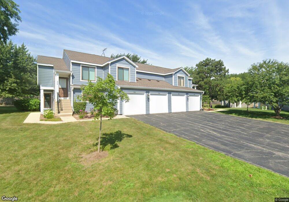
960 Manchester Cir Unit 11B Schaumburg, IL 60193
South Schaumburg NeighborhoodEstimated Value: $263,109 - $293,000
2
Beds
1
Bath
1,200
Sq Ft
$232/Sq Ft
Est. Value
About This Home
This home is located at 960 Manchester Cir Unit 11B, Schaumburg, IL 60193 and is currently estimated at $278,527, approximately $232 per square foot. 960 Manchester Cir Unit 11B is a home located in Cook County with nearby schools including Michael Collins Elementary School, Robert Frost Junior High School, and J B Conant High School.
Ownership History
Date
Name
Owned For
Owner Type
Purchase Details
Closed on
Jul 29, 2016
Sold by
Dominguez Adllin
Bought by
Dominguez Jose
Current Estimated Value
Purchase Details
Closed on
Jun 20, 2012
Sold by
Dominguez Jose A
Bought by
Dominguez Jose A and Dominguez Adlin
Purchase Details
Closed on
Dec 29, 1993
Sold by
Harris Bank Roselle
Bought by
Dominguez Jose A
Home Financials for this Owner
Home Financials are based on the most recent Mortgage that was taken out on this home.
Original Mortgage
$85,600
Interest Rate
7.16%
Mortgage Type
FHA
Create a Home Valuation Report for This Property
The Home Valuation Report is an in-depth analysis detailing your home's value as well as a comparison with similar homes in the area
Home Values in the Area
Average Home Value in this Area
Purchase History
| Date | Buyer | Sale Price | Title Company |
|---|---|---|---|
| Dominguez Jose | -- | None Available | |
| Dominguez Jose A | -- | None Available | |
| Dominguez Jose A | $59,333 | -- |
Source: Public Records
Mortgage History
| Date | Status | Borrower | Loan Amount |
|---|---|---|---|
| Closed | Dominguez Jose A | $85,600 |
Source: Public Records
Tax History Compared to Growth
Tax History
| Year | Tax Paid | Tax Assessment Tax Assessment Total Assessment is a certain percentage of the fair market value that is determined by local assessors to be the total taxable value of land and additions on the property. | Land | Improvement |
|---|---|---|---|---|
| 2024 | $3,993 | $17,570 | $4,117 | $13,453 |
| 2023 | $3,843 | $17,570 | $4,117 | $13,453 |
| 2022 | $3,843 | $17,570 | $4,117 | $13,453 |
| 2021 | $3,280 | $14,152 | $2,245 | $11,907 |
| 2020 | $3,291 | $14,152 | $2,245 | $11,907 |
| 2019 | $3,296 | $15,725 | $2,245 | $13,480 |
| 2018 | $2,247 | $10,922 | $1,871 | $9,051 |
| 2017 | $2,229 | $10,922 | $1,871 | $9,051 |
| 2016 | $2,327 | $10,922 | $1,871 | $9,051 |
| 2015 | $2,120 | $9,711 | $1,684 | $8,027 |
| 2014 | $2,113 | $9,711 | $1,684 | $8,027 |
| 2013 | $2,042 | $9,711 | $1,684 | $8,027 |
Source: Public Records
Map
Nearby Homes
- 126 Manchester Ct Unit 61B
- 916 Manchester Cir Unit 91A
- 36 Shore Dr
- 205 Nantucket Harbor Unit 104
- 1100 Boston Harbor Unit 7004
- 421 E Wise Rd
- 124 E Monterey Ave
- 426 E Niagara Ave
- 733 Limerick Ln Unit 7333D
- 711 Tipperary Ct Unit 2D
- 712 Tipperary Ct Unit 1C
- 727 Killarney Ct Unit 1C
- 631 Derry Ct Unit 3C
- 635 Limerick Ln Unit 2B
- 614 Tralee Ct Unit 2-C
- 553 Stone Gate Cir
- 718 N Point Dr
- 620 S Point Dr
- 421 Summit Dr
- 415 Laconia Ln
- 966 Manchester Cir Unit 11A
- 966 Manchester Cir Unit 1A
- 964 Manchester Cir Unit 12A
- 962 Manchester Cir Unit 12B
- 137 Manchester Ct
- 137 Manchester Ct Unit 21A
- 133 Manchester Ct Unit 22B
- 135 Manchester Ct Unit 22A
- 131 Manchester Ct Unit 21B
- 941 Tracy Ct
- 967 Manchester Cir Unit 161B
- 961 Manchester Cir Unit 161A
- 937 Tracy Ct
- 963 Manchester Cir Unit 162A
- 965 Manchester Cir Unit 162B
- 965 Manchester Cir Unit 965
- 957 Manchester Cir Unit 151B
- 955 Manchester Cir Unit 152B
- 933 Tracy Ct
- 127 Manchester Ct Unit 31A