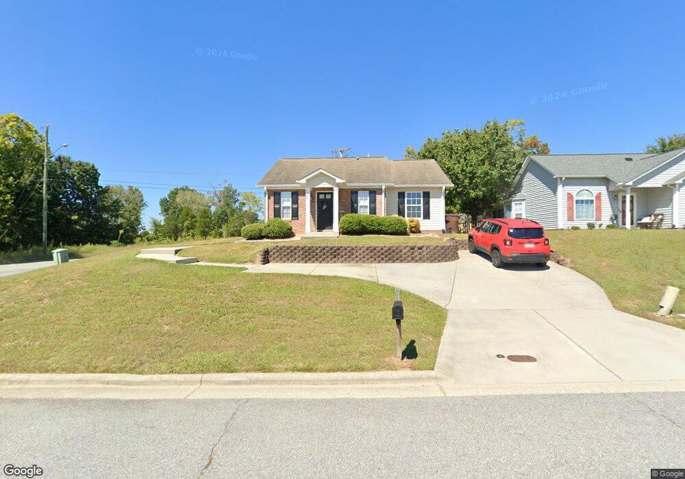
960 Saint Ann Dr High Point, NC 27265
Estimated Value: $183,000 - $245,000
3
Beds
2
Baths
1,276
Sq Ft
$173/Sq Ft
Est. Value
About This Home
This home is located at 960 Saint Ann Dr, High Point, NC 27265 and is currently estimated at $221,209, approximately $173 per square foot. 960 Saint Ann Dr is a home located in Davidson County with nearby schools including Friendship Elementary School, Ledford Middle School, and Ledford High School.
Ownership History
Date
Name
Owned For
Owner Type
Purchase Details
Closed on
Jun 26, 2008
Sold by
Williard Stewart Inc
Bought by
Williard Stewart Real Estate Llc
Current Estimated Value
Home Financials for this Owner
Home Financials are based on the most recent Mortgage that was taken out on this home.
Original Mortgage
$76,060
Outstanding Balance
$48,819
Interest Rate
5.97%
Mortgage Type
Purchase Money Mortgage
Estimated Equity
$172,390
Purchase Details
Closed on
Apr 15, 2003
Sold by
Westover Park Llc
Bought by
Williard-Stewart Inc
Purchase Details
Closed on
Aug 1, 1996
Create a Home Valuation Report for This Property
The Home Valuation Report is an in-depth analysis detailing your home's value as well as a comparison with similar homes in the area
Purchase History
| Date | Buyer | Sale Price | Title Company |
|---|---|---|---|
| Williard Stewart Real Estate Llc | $76,500 | None Available | |
| Williard-Stewart Inc | $63,000 | -- | |
| -- | -- | -- |
Source: Public Records
Mortgage History
| Date | Status | Borrower | Loan Amount |
|---|---|---|---|
| Open | Williard Stewart Real Estate Llc | $76,060 |
Source: Public Records
Tax History
| Year | Tax Paid | Tax Assessment Tax Assessment Total Assessment is a certain percentage of the fair market value that is determined by local assessors to be the total taxable value of land and additions on the property. | Land | Improvement |
|---|---|---|---|---|
| 2025 | $1,601 | $136,870 | $0 | $0 |
| 2024 | $1,601 | $136,870 | $0 | $0 |
| 2023 | $1,561 | $136,870 | $0 | $0 |
| 2022 | $1,561 | $136,870 | $0 | $0 |
| 2021 | $1,601 | $136,870 | $0 | $0 |
| 2020 | $1,171 | $100,140 | $0 | $0 |
| 2019 | $1,189 | $100,140 | $0 | $0 |
| 2018 | $1,189 | $100,140 | $0 | $0 |
| 2017 | $1,189 | $100,140 | $0 | $0 |
| 2016 | $1,189 | $100,140 | $0 | $0 |
| 2015 | $1,192 | $100,140 | $0 | $0 |
| 2014 | $1,179 | $97,950 | $0 | $0 |
Source: Public Records
Map
Nearby Homes
- 5430 Forester Dr
- 5430 Forester Dr Unit 2D
- 2703 Camillia Cove
- 795 Avalon Springs Ct
- 2705 Camillia Cove
- 609 Ladford Ln
- 2215 Shadow Valley Rd Unit H
- 606 Three Oaks Dr
- 2630 Ingleside Dr Unit 2D
- 1005 Tesh Ct
- 1329 Bayswater Dr
- 1366 Bayswater Dr
- 754 Hitchcock Way
- 1513 Birkdale Ct
- 118 Asbill Ave
- 6148 Tory Ct
- 220 Hedgecock Rd
- 6112 Hedgecock Cir
- 6112 Hedgecock Cir Unit 3B
- 1616 Heathcliff Rd
- 958 Saint Ann Dr
- 956 Saint Ann Dr
- 959 Saint Ann Dr
- 2470 Shadow Valley Rd
- 954 Saint Ann Dr
- 957 Saint Ann Dr
- 2468 Shadow Valley Rd
- 955 Saint Ann Dr
- 952 Saint Ann Dr
- 2471 Shadow Valley Rd
- 2466 Shadow Valley Rd
- 953 Saint Ann Dr
- 901 Westover Dr Unit C
- 2469 Shadow Valley Rd
- 950 Saint Ann Dr
- 901C Westover Dr
- 2467 Aston Ct
- 2464 Shadow Valley Rd
- 2467 Shadow Valley Rd
- 948 Saint Ann Dr
Your Personal Tour Guide
Ask me questions while you tour the home.