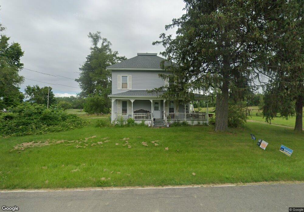
960 W Dewey Rd Owosso, MI 48867
Estimated Value: $161,000 - $214,000
3
Beds
1
Bath
1,495
Sq Ft
$130/Sq Ft
Est. Value
About This Home
This home is located at 960 W Dewey Rd, Owosso, MI 48867 and is currently estimated at $193,611, approximately $129 per square foot. 960 W Dewey Rd is a home located in Shiawassee County with nearby schools including Owosso High School, Salem Lutheran School, and Owosso Christian School.
Ownership History
Date
Name
Owned For
Owner Type
Purchase Details
Closed on
Apr 29, 2016
Sold by
Nick Randall
Bought by
Trim Kimberly
Current Estimated Value
Purchase Details
Closed on
Mar 15, 2016
Sold by
Nick Ryan
Bought by
Nick Randall
Purchase Details
Closed on
Mar 8, 2016
Sold by
Ditech Financial Llc
Bought by
Fannie Mae
Purchase Details
Closed on
Nov 27, 2015
Sold by
Ott Rosemarie and Ott Rosemarie
Bought by
Green Tree Servicing Llc
Purchase Details
Closed on
Jun 8, 2011
Sold by
Bressette John and Bressette Crystal
Bought by
Nick Ryan and Nick Randall
Purchase Details
Closed on
Sep 23, 2009
Sold by
Deutsche Bank National Trust
Bought by
Bressette John and Bressette Crystal
Purchase Details
Closed on
Mar 26, 2005
Sold by
Tweeddale Yishana M and Ordiway Joseph B
Bought by
Ordiway Joseph B
Home Financials for this Owner
Home Financials are based on the most recent Mortgage that was taken out on this home.
Original Mortgage
$98,625
Interest Rate
8.55%
Mortgage Type
New Conventional
Create a Home Valuation Report for This Property
The Home Valuation Report is an in-depth analysis detailing your home's value as well as a comparison with similar homes in the area
Home Values in the Area
Average Home Value in this Area
Purchase History
| Date | Buyer | Sale Price | Title Company |
|---|---|---|---|
| Trim Kimberly | $116 | -- | |
| Trim Kimberly | $116 | -- | |
| Nick Randall | -- | -- | |
| Fannie Mae | $116 | -- | |
| Green Tree Servicing Llc | $152,500 | -- | |
| Nick Ryan | $53,500 | -- | |
| Bressette John | $27,000 | -- | |
| Ordiway Joseph B | -- | Transcontinental Title Co |
Source: Public Records
Mortgage History
| Date | Status | Borrower | Loan Amount |
|---|---|---|---|
| Previous Owner | Ordiway Joseph B | $98,625 |
Source: Public Records
Tax History
| Year | Tax Paid | Tax Assessment Tax Assessment Total Assessment is a certain percentage of the fair market value that is determined by local assessors to be the total taxable value of land and additions on the property. | Land | Improvement |
|---|---|---|---|---|
| 2025 | $1,809 | $85,100 | $0 | $0 |
| 2024 | $1,844 | $82,000 | $0 | $0 |
| 2023 | $666 | $77,200 | $0 | $0 |
| 2022 | $634 | $70,000 | $0 | $0 |
| 2021 | $1,611 | $58,200 | $0 | $0 |
| 2020 | $1,609 | $55,600 | $0 | $0 |
| 2019 | $1,580 | $50,300 | $0 | $0 |
| 2018 | $1,595 | $49,600 | $0 | $0 |
| 2017 | $2,203 | $47,500 | $0 | $0 |
| 2016 | -- | $47,500 | $0 | $0 |
| 2015 | -- | $44,800 | $0 | $0 |
| 2014 | $5 | $41,400 | $0 | $0 |
Source: Public Records
Map
Nearby Homes
- 1648 S M 52
- 1627 Michigan 52
- 1585 Michigan 52
- 2590 S Morrice Rd
- 539 W Wildwood Dr
- 1610 W South St
- V/L W South St
- V/l # 11 W South St
- 1236 Walnut St
- 1907 Krouse Rd
- 1116 State St
- 1046 S Pearce St
- 1131 S Shiawassee St
- 1011 State St
- 421 Prindle St
- 414 Prindle St
- 1105 Palmer Ave
- 315 Prindle St
- 1002 S Shiawassee St
- 825 Ament St
- 1989 S Morrice Rd
- 1989 S Morrice Rd
- 1990 S Morrice Rd
- 2000 S Morrice Rd
- 1980 S Morrice Rd
- 2010 S Morrice Rd
- 2010 S Morrice Rd
- 2020 S Morrice Rd
- 1966 S Morrice Rd
- 810 W Dewey Rd
- 825 W Dewey Rd
- 1947 S Morrice Rd
- 1946 S Morrice Rd
- 2084 S Morrice Rd
- 2135 S Morrice Rd
- 795 W Dewey Rd
- 2142 S Morrice Rd
- 1936 S Morrice Rd
- 2145 S Morrice Rd
Your Personal Tour Guide
Ask me questions while you tour the home.