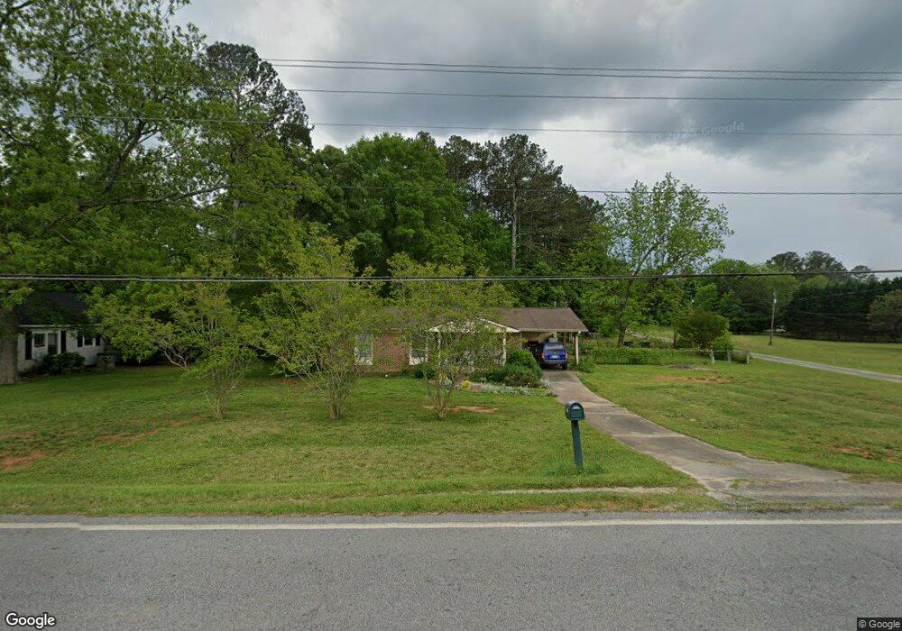
960 W Ellis Rd Griffin, GA 30223
Spalding County NeighborhoodEstimated Value: $140,827 - $230,000
2
Beds
1
Bath
1,075
Sq Ft
$177/Sq Ft
Est. Value
About This Home
This home is located at 960 W Ellis Rd, Griffin, GA 30223 and is currently estimated at $190,457, approximately $177 per square foot. 960 W Ellis Rd is a home located in Spalding County with nearby schools including Orrs Elementary School, Carver Road Middle School, and Griffin High School.
Ownership History
Date
Name
Owned For
Owner Type
Purchase Details
Closed on
Apr 26, 1990
Sold by
Goodroad Deborah G
Bought by
Cunningham Carol Ann
Current Estimated Value
Purchase Details
Closed on
Jan 1, 1986
Sold by
Oxford Deborah G
Bought by
Goodroad Deborah G
Purchase Details
Closed on
Oct 17, 1985
Sold by
Oxford John Lee and Oxford Deborah G
Bought by
Oxford Deborah G
Purchase Details
Closed on
Aug 27, 1977
Sold by
Steele Joe F
Bought by
Oxford John Lee and Oxford Deborah G
Purchase Details
Closed on
Nov 16, 1965
Bought by
Steele Joe F
Create a Home Valuation Report for This Property
The Home Valuation Report is an in-depth analysis detailing your home's value as well as a comparison with similar homes in the area
Home Values in the Area
Average Home Value in this Area
Purchase History
| Date | Buyer | Sale Price | Title Company |
|---|---|---|---|
| Cunningham Carol Ann | $45,000 | -- | |
| Goodroad Deborah G | -- | -- | |
| Oxford Deborah G | -- | -- | |
| Oxford John Lee | $24,200 | -- | |
| Steele Joe F | -- | -- |
Source: Public Records
Tax History Compared to Growth
Tax History
| Year | Tax Paid | Tax Assessment Tax Assessment Total Assessment is a certain percentage of the fair market value that is determined by local assessors to be the total taxable value of land and additions on the property. | Land | Improvement |
|---|---|---|---|---|
| 2024 | $989 | $29,422 | $8,000 | $21,422 |
| 2023 | $1,004 | $29,422 | $8,000 | $21,422 |
| 2022 | $1,023 | $29,936 | $8,000 | $21,936 |
| 2021 | $946 | $27,812 | $8,000 | $19,812 |
| 2020 | $949 | $27,812 | $8,000 | $19,812 |
| 2019 | $863 | $24,989 | $8,000 | $16,989 |
| 2018 | $801 | $22,763 | $7,200 | $15,563 |
| 2017 | $779 | $22,763 | $7,200 | $15,563 |
| 2016 | $793 | $22,763 | $7,200 | $15,563 |
| 2015 | $818 | $22,763 | $7,200 | $15,563 |
| 2014 | $834 | $22,763 | $7,200 | $15,563 |
Source: Public Records
Map
Nearby Homes
- 228 Westchester Dr
- 106 Cheshire Dr
- 1044 W Ellis Rd
- 0 N Pine Hill Rd Unit 10465642
- 0 N Pine Hill Rd Unit 10465641
- 0 N Pine Hill Rd Unit 10465639
- 0 N Pine Hill Rd Unit 10465638
- 0 N Pine Hill Rd Unit 10465637
- 312 Ac W Ellis Rd
- 425 Audubon Cir
- 0 Westmoreland Rd Unit 10545005
- 405 N Pine Hill Rd
- 1804, 1796 W Mcintosh Rd
- 1812 W Mcintosh Rd
- 223 Patriots Way
- 101 Lexington Place Dr
- 1851 Abbey Rd
- 4920 Fayetteville Rd
- 4940 Fayetteville Rd
- 4946 Fayetteville Rd
- 952 W Ellis Rd
- 980 W Ellis Rd
- 974 W Ellis Rd
- 984 W Ellis Rd
- 101 Wexford Dr
- 203 Westchester Dr
- 103 Wexford Dr
- 207 Westchester Dr
- 890 W Ellis Rd
- 205 Westchester Dr
- 201 Westchester Dr
- 206 Westchester Dr
- 0 Wexford Dr Unit 8124914
- 870 W Ellis Rd
- 267 Westchester Dr
- 204 Westchester Dr
- 16 Charlotte Cir
- 104 Wexford Dr
- 210 Westchester Dr
- 102 Wexford Dr