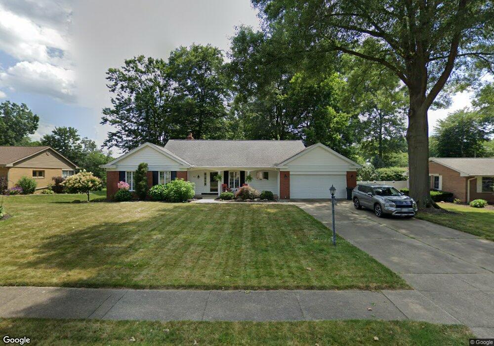
960 W Milton St Alliance, OH 44601
Estimated Value: $282,000 - $333,000
3
Beds
3
Baths
1,954
Sq Ft
$158/Sq Ft
Est. Value
About This Home
This home is located at 960 W Milton St, Alliance, OH 44601 and is currently estimated at $308,241, approximately $157 per square foot. 960 W Milton St is a home located in Stark County with nearby schools including Alliance Elementary School at Rockhill, Alliance Intermediate School at Northside, and Alliance Middle School.
Ownership History
Date
Name
Owned For
Owner Type
Purchase Details
Closed on
Nov 21, 2018
Sold by
Bugara Pamela K
Bought by
Bugara Michael
Current Estimated Value
Purchase Details
Closed on
May 28, 2010
Sold by
Hanna David J
Bought by
Bugara Michael and Bugara Pamela K
Home Financials for this Owner
Home Financials are based on the most recent Mortgage that was taken out on this home.
Original Mortgage
$132,000
Outstanding Balance
$89,201
Interest Rate
5.14%
Mortgage Type
New Conventional
Estimated Equity
$219,040
Purchase Details
Closed on
Jul 17, 2009
Sold by
Couchie Carolyn D and Couchie Wilbur E
Bought by
Couchie Carolyn D and The Carolyn D Couchie Revocable Trust
Create a Home Valuation Report for This Property
The Home Valuation Report is an in-depth analysis detailing your home's value as well as a comparison with similar homes in the area
Home Values in the Area
Average Home Value in this Area
Purchase History
| Date | Buyer | Sale Price | Title Company |
|---|---|---|---|
| Bugara Michael | -- | None Available | |
| Bugara Michael | $165,000 | Attorney | |
| Couchie Carolyn D | -- | None Available |
Source: Public Records
Mortgage History
| Date | Status | Borrower | Loan Amount |
|---|---|---|---|
| Open | Bugara Michael | $132,000 |
Source: Public Records
Tax History Compared to Growth
Tax History
| Year | Tax Paid | Tax Assessment Tax Assessment Total Assessment is a certain percentage of the fair market value that is determined by local assessors to be the total taxable value of land and additions on the property. | Land | Improvement |
|---|---|---|---|---|
| 2025 | -- | $84,700 | $26,180 | $58,520 |
| 2024 | -- | $84,700 | $26,180 | $58,520 |
| 2023 | $2,445 | $70,010 | $20,550 | $49,460 |
| 2022 | $2,478 | $70,010 | $20,550 | $49,460 |
| 2021 | $2,480 | $70,010 | $20,550 | $49,460 |
| 2020 | $2,464 | $65,590 | $17,850 | $47,740 |
| 2019 | $2,429 | $65,590 | $17,850 | $47,740 |
| 2018 | $2,440 | $65,590 | $17,850 | $47,740 |
| 2017 | $2,232 | $59,890 | $14,950 | $44,940 |
| 2016 | $2,250 | $59,890 | $14,950 | $44,940 |
| 2015 | $2,270 | $59,890 | $14,950 | $44,940 |
| 2014 | $213 | $56,220 | $14,040 | $42,180 |
| 2013 | $1,104 | $56,220 | $14,040 | $42,180 |
Source: Public Records
Map
Nearby Homes
- 2839 S Rockhill Ave
- 1059 Oakwood Dr
- 3101 Ridgehill Ave
- 2112 Blenheim Ave
- 2220 Western Ave
- 884 W College Rd
- 2050 Federal Ave
- 1325 W Beech St
- 1515 S Rockhill Ave
- 0 Winchester St
- 0 Winchester St Unit 5162877
- 236 E Milton St
- 277 W Carol St
- 112 E College St
- 317 E State St
- 1321 Parkway Blvd
- 1201 Overlook Dr
- 555 E Milton St
- 2218 S Freedom Ave
- 3709 S Union Ave
- 940 W Milton St
- 980 W Milton St
- 887 Oakwood Dr
- 920 W Milton St
- 961 W Milton St
- 1000 W Milton St
- 899 Oakwood Dr
- 841 Oakwood Dr
- 981 W Milton St
- 941 W Milton St
- 923 Oakwood Dr
- 860 W Milton St
- 1001 W Milton St
- 921 W Milton St
- 1020 W Milton St
- 831 Oakwood Dr
- 890 Oakwood Dr
- 880 Oakwood Dr
- 861 W Milton St
- 1011 W Milton St