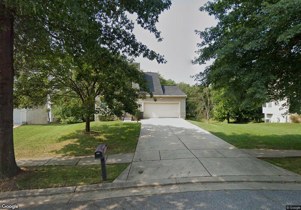
9606 Wesland Cir Randallstown, MD 21133
Estimated Value: $445,678 - $479,000
--
Bed
3
Baths
2,169
Sq Ft
$215/Sq Ft
Est. Value
About This Home
This home is located at 9606 Wesland Cir, Randallstown, MD 21133 and is currently estimated at $466,559, approximately $215 per square foot. 9606 Wesland Cir is a home located in Baltimore County with nearby schools including Deer Park Elementary School, Deer Park Middle Magnet School, and New Town High.
Ownership History
Date
Name
Owned For
Owner Type
Purchase Details
Closed on
Apr 18, 2017
Sold by
Deutsche Bank National Trust Company
Bought by
Adelugba Toyin
Current Estimated Value
Home Financials for this Owner
Home Financials are based on the most recent Mortgage that was taken out on this home.
Original Mortgage
$243,508
Outstanding Balance
$205,557
Interest Rate
4.75%
Mortgage Type
FHA
Estimated Equity
$261,002
Purchase Details
Closed on
Oct 15, 1998
Sold by
Ryland Group Inc
Bought by
Brooks Latanya Crystal and Brooks George London
Create a Home Valuation Report for This Property
The Home Valuation Report is an in-depth analysis detailing your home's value as well as a comparison with similar homes in the area
Home Values in the Area
Average Home Value in this Area
Purchase History
| Date | Buyer | Sale Price | Title Company |
|---|---|---|---|
| Adelugba Toyin | $248,000 | Premium Title | |
| Brooks Latanya Crystal | $169,990 | -- |
Source: Public Records
Mortgage History
| Date | Status | Borrower | Loan Amount |
|---|---|---|---|
| Open | Adelugba Toyin | $243,508 |
Source: Public Records
Tax History Compared to Growth
Tax History
| Year | Tax Paid | Tax Assessment Tax Assessment Total Assessment is a certain percentage of the fair market value that is determined by local assessors to be the total taxable value of land and additions on the property. | Land | Improvement |
|---|---|---|---|---|
| 2025 | $60 | $339,500 | -- | -- |
| 2024 | $60 | $321,200 | $69,800 | $251,400 |
| 2023 | $2,394 | $301,633 | $0 | $0 |
| 2022 | $4,309 | $282,067 | $0 | $0 |
| 2021 | $3,913 | $262,500 | $69,800 | $192,700 |
| 2020 | $3,913 | $248,067 | $0 | $0 |
| 2019 | $3,706 | $233,633 | $0 | $0 |
| 2018 | $3,446 | $219,200 | $69,800 | $149,400 |
| 2017 | $3,296 | $213,300 | $0 | $0 |
| 2016 | $3,241 | $207,400 | $0 | $0 |
| 2015 | $3,241 | $201,500 | $0 | $0 |
| 2014 | $3,241 | $201,500 | $0 | $0 |
Source: Public Records
Map
Nearby Homes
- 4105 Hanwell Rd
- 9519 Branchleigh Rd
- 4108 Brown Bark Cir
- 3903 Red Deer Cir
- 3903 Innerdale Ct
- 9406 Painted Tree Dr
- 9530 John Locke Way
- 3827 Rayton Rd
- 4313 Plinlimmon Dr
- 9931 Tuscarora Rd
- 9112 Meadow Heights Rd
- 9500 Georgian Way
- 17 Bannock Ct
- 3816 Cassandra Rd
- 9435 James MacGowan Ln Unit 439
- 9401 Summer Squal Dr
- 9436 Davy Ln Unit 475
- 4450 Potts Ct Unit 575
- 4550 Chaucer Way Unit 406
- 4264 Cayuga Rd
- 9608 Wesland Cir
- 9602 Wesland Cir
- 4162 Brown Bark Cir
- 4166 Brown Bark Cir
- 9610 Wesland Cir
- 4160 Brown Bark Cir
- 4168 Brown Bark Cir
- 4158 Brown Bark Cir
- 4170 Brown Bark Cir
- 4156 Brown Bark Cir
- 4172 Brown Bark Cir
- 9600 Wesland Cir
- 4154 Brown Bark Cir
- 9601 Wesland Cir
- 4152 Brown Bark Cir
- 9612 Wesland Cir
- 4150 Brown Bark Cir
- 4148 Brown Bark Cir
- 9548 Wesland Cir
- 9603 Wesland Cir