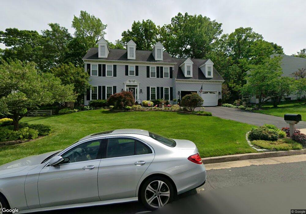
9607 Signal Pointe Way Fairfax Station, VA 22039
Crosspointe NeighborhoodEstimated Value: $1,057,000 - $1,190,962
5
Beds
4
Baths
3,143
Sq Ft
$359/Sq Ft
Est. Value
About This Home
This home is located at 9607 Signal Pointe Way, Fairfax Station, VA 22039 and is currently estimated at $1,129,491, approximately $359 per square foot. 9607 Signal Pointe Way is a home located in Fairfax County with nearby schools including Silverbrook Elementary School, South County Middle School, and South County High School.
Ownership History
Date
Name
Owned For
Owner Type
Purchase Details
Closed on
Jul 21, 2005
Sold by
Dana Gregory J
Bought by
Russell Sydney S
Current Estimated Value
Home Financials for this Owner
Home Financials are based on the most recent Mortgage that was taken out on this home.
Original Mortgage
$652,000
Outstanding Balance
$338,811
Interest Rate
5.59%
Mortgage Type
New Conventional
Estimated Equity
$790,680
Create a Home Valuation Report for This Property
The Home Valuation Report is an in-depth analysis detailing your home's value as well as a comparison with similar homes in the area
Home Values in the Area
Average Home Value in this Area
Purchase History
| Date | Buyer | Sale Price | Title Company |
|---|---|---|---|
| Russell Sydney S | $815,000 | -- |
Source: Public Records
Mortgage History
| Date | Status | Borrower | Loan Amount |
|---|---|---|---|
| Open | Russell Sydney S | $652,000 |
Source: Public Records
Tax History Compared to Growth
Tax History
| Year | Tax Paid | Tax Assessment Tax Assessment Total Assessment is a certain percentage of the fair market value that is determined by local assessors to be the total taxable value of land and additions on the property. | Land | Improvement |
|---|---|---|---|---|
| 2025 | $11,251 | $1,077,660 | $451,000 | $626,660 |
| 2024 | $11,251 | $971,140 | $391,000 | $580,140 |
| 2023 | $10,738 | $951,500 | $391,000 | $560,500 |
| 2022 | $9,368 | $819,200 | $326,000 | $493,200 |
| 2021 | $8,796 | $749,510 | $296,000 | $453,510 |
| 2020 | $8,572 | $724,300 | $284,000 | $440,300 |
| 2019 | $8,434 | $712,670 | $281,000 | $431,670 |
| 2018 | $8,196 | $712,670 | $281,000 | $431,670 |
| 2017 | $8,080 | $695,960 | $266,000 | $429,960 |
| 2016 | $8,136 | $702,250 | $266,000 | $436,250 |
| 2015 | $7,837 | $702,250 | $266,000 | $436,250 |
| 2014 | $7,653 | $687,250 | $251,000 | $436,250 |
Source: Public Records
Map
Nearby Homes
- 8605 Eagle Glen Terrace
- 9712 Thorn Bush Dr
- 8153 Old Barrington Blvd
- 9616 Burnt Oak Dr
- 8811 Ox Rd
- 9596 Oakington Dr
- 8622 Cross Chase Ct
- 8834 Ox Rd
- 7921 Oak Hollow Ln
- 7981 Oak Bridge Ln
- 8197 Cottage Rose Ct
- 8625 Oak Chase Cir
- 10300 Hampton Rd
- The Maiden Plan at Occoquan Overlook - The Woods
- The Biltmore Plan at Occoquan Overlook - The Woods
- The Edgewater Plan at Occoquan Overlook - The Woods
- The Kenmore Plan at Occoquan Overlook - The Woods
- 9205 Franks Point Ln
- 9209 Franks Point Ln
- 10400 Hampton Rd
- 9605 Signal Pointe Way
- 8418 Westpointe Dr
- 9609 Lake Mist Ct
- 9608 Lake Mist Ct
- 9608 Signal Pointe Way
- 8416 Westpointe Dr
- 9603 Signal Pointe Way
- 9606 Signal Pointe Way
- 8420 Westpointe Dr
- 9606 Lake Mist Ct
- 9607 Lake Mist Ct
- 9614 Crosspointe Dr
- 8414 Westpointe Dr
- 9604 Signal Pointe Way
- 9612 Crosspointe Dr
- 8415 Westpointe Dr
- 8406 Westpointe Dr
- 9601 Signal Pointe Way
- 9604 Lake Mist Ct
- 8408 Westpointe Dr