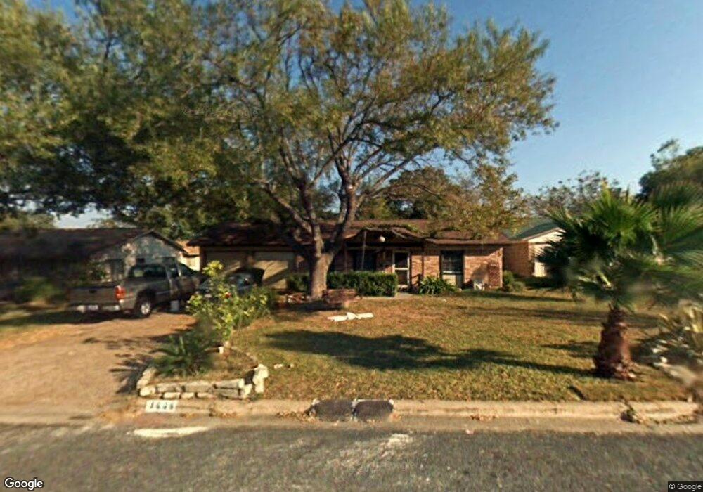
9608 Newfoundland Cir Austin, TX 78758
North Austin NeighborhoodEstimated Value: $397,400 - $492,000
3
Beds
2
Baths
1,250
Sq Ft
$354/Sq Ft
Est. Value
About This Home
This home is located at 9608 Newfoundland Cir, Austin, TX 78758 and is currently estimated at $442,350, approximately $353 per square foot. 9608 Newfoundland Cir is a home located in Travis County with nearby schools including Cook Elementary School, Burnet Middle School, and Navarro Early College High School.
Ownership History
Date
Name
Owned For
Owner Type
Purchase Details
Closed on
Aug 18, 1998
Sold by
Reed Susan Zanette Wright and Mcguire Deborah Lee Wright
Bought by
Flores Josue and Flores Rosa M
Current Estimated Value
Home Financials for this Owner
Home Financials are based on the most recent Mortgage that was taken out on this home.
Original Mortgage
$67,500
Outstanding Balance
$14,057
Interest Rate
6.9%
Estimated Equity
$428,293
Purchase Details
Closed on
Nov 3, 1993
Sold by
Wright Willie
Bought by
Wright William W
Create a Home Valuation Report for This Property
The Home Valuation Report is an in-depth analysis detailing your home's value as well as a comparison with similar homes in the area
Home Values in the Area
Average Home Value in this Area
Purchase History
| Date | Buyer | Sale Price | Title Company |
|---|---|---|---|
| Flores Josue | -- | Texas American Title Company | |
| Wright William W | -- | -- |
Source: Public Records
Mortgage History
| Date | Status | Borrower | Loan Amount |
|---|---|---|---|
| Open | Flores Josue | $67,500 |
Source: Public Records
Tax History Compared to Growth
Tax History
| Year | Tax Paid | Tax Assessment Tax Assessment Total Assessment is a certain percentage of the fair market value that is determined by local assessors to be the total taxable value of land and additions on the property. | Land | Improvement |
|---|---|---|---|---|
| 2025 | $6,049 | $398,914 | $211,918 | $186,996 |
| 2023 | $5,211 | $370,696 | $0 | $0 |
| 2022 | $6,655 | $336,996 | $0 | $0 |
| 2021 | $6,668 | $306,360 | $125,000 | $282,207 |
| 2020 | $5,974 | $278,509 | $125,000 | $193,335 |
| 2018 | $5,096 | $230,173 | $125,000 | $177,301 |
| 2017 | $4,667 | $209,248 | $75,000 | $167,780 |
| 2016 | $4,242 | $190,225 | $60,000 | $146,426 |
| 2015 | $3,370 | $172,932 | $20,000 | $156,046 |
| 2014 | $3,370 | $157,211 | $0 | $0 |
Source: Public Records
Map
Nearby Homes
- 9614 Newfoundland Cir
- 9506 Mountain Quail Rd
- 9215 Hunters Trace E
- 9214 Hunters Trace E
- 9634 Chukar Cir
- 9417 Singing Quail Dr
- 9228 Partridge Cir
- 1337 Neans Dr
- 10003 Quail Hutch Dr
- 1111 Quail Park Dr
- 10005 Quail Hutch Dr
- 10138 Aspen St
- 1400 Cripple Creek Dr
- 10100 Quail Hutch Dr
- 10107 Oak Hollow Dr
- 9007 Quail Valley Dr
- 9010 Laurel Grove Dr
- 1010 W Rundberg Ln Unit 24
- 10129 Aspen St
- 8906 Trone Cir Unit A
- 9606 Newfoundland Cir
- 9610 Newfoundland Cir
- 9506 Gambels Quail Dr
- 9600 Gambels Quail Dr
- 9604 Newfoundland Cir
- 9612 Newfoundland Cir
- 9504 Gambels Quail Dr
- 9609 Newfoundland Cir
- 9607 Newfoundland Cir
- 9616 Newfoundland Cir
- 9602 Newfoundland Cir
- 9605 Newfoundland Cir
- 9502 Gambels Quail Dr
- 9604 Gambels Quail Dr
- 9618 Newfoundland Cir
- 1412 Rutland Dr
- 9603 Newfoundland Cir
- 1410 Rutland Dr
- 1414 Rutland Dr
- 9600 Newfoundland Cir