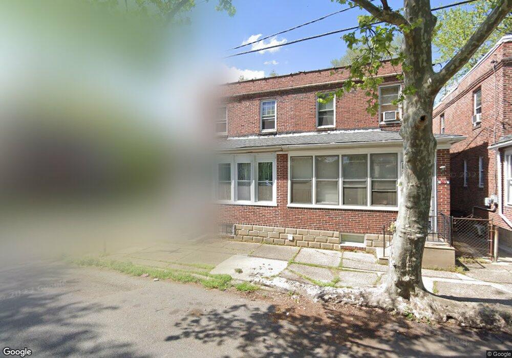
961 Monitor Rd Camden, NJ 08104
Fairview NeighborhoodEstimated Value: $116,000 - $152,000
2
Beds
1
Bath
976
Sq Ft
$139/Sq Ft
Est. Value
About This Home
This home is located at 961 Monitor Rd, Camden, NJ 08104 and is currently estimated at $135,676, approximately $139 per square foot. 961 Monitor Rd is a home located in Camden County with nearby schools including Yorkship Elementary School, Camden High School, and Gloucester Catholic Junior Senior High School.
Ownership History
Date
Name
Owned For
Owner Type
Purchase Details
Closed on
Jan 2, 2011
Sold by
Lisauer Joseph
Bought by
Pristine Propertiesw Llc
Current Estimated Value
Purchase Details
Closed on
May 4, 2005
Sold by
Ramirez Diane
Bought by
Lisauer Joseph
Home Financials for this Owner
Home Financials are based on the most recent Mortgage that was taken out on this home.
Original Mortgage
$58,410
Interest Rate
5.54%
Purchase Details
Closed on
Oct 3, 2002
Sold by
Secr Housing And Urban Dev
Bought by
Ramirez Diana
Purchase Details
Closed on
Aug 7, 1998
Sold by
Morris Robert S
Bought by
Morris Andrew H
Home Financials for this Owner
Home Financials are based on the most recent Mortgage that was taken out on this home.
Original Mortgage
$36,853
Interest Rate
6.9%
Mortgage Type
FHA
Create a Home Valuation Report for This Property
The Home Valuation Report is an in-depth analysis detailing your home's value as well as a comparison with similar homes in the area
Home Values in the Area
Average Home Value in this Area
Purchase History
| Date | Buyer | Sale Price | Title Company |
|---|---|---|---|
| Pristine Propertiesw Llc | $23,157 | -- | |
| Lisauer Joseph | $64,900 | -- | |
| Ramirez Diana | $23,750 | -- | |
| Morris Andrew H | $36,500 | -- |
Source: Public Records
Mortgage History
| Date | Status | Borrower | Loan Amount |
|---|---|---|---|
| Previous Owner | Lisauer Joseph | $58,410 | |
| Previous Owner | Morris Andrew H | $36,853 |
Source: Public Records
Tax History Compared to Growth
Tax History
| Year | Tax Paid | Tax Assessment Tax Assessment Total Assessment is a certain percentage of the fair market value that is determined by local assessors to be the total taxable value of land and additions on the property. | Land | Improvement |
|---|---|---|---|---|
| 2025 | $1,382 | $39,000 | $15,200 | $23,800 |
| 2024 | $1,336 | $39,000 | $15,200 | $23,800 |
| 2023 | $1,336 | $39,000 | $15,200 | $23,800 |
| 2022 | $1,311 | $39,000 | $15,200 | $23,800 |
| 2021 | $1,306 | $39,000 | $15,200 | $23,800 |
| 2020 | $1,240 | $39,000 | $15,200 | $23,800 |
| 2019 | $1,188 | $39,000 | $15,200 | $23,800 |
| 2018 | $1,181 | $39,000 | $15,200 | $23,800 |
| 2017 | $1,152 | $39,000 | $15,200 | $23,800 |
| 2016 | $1,116 | $39,000 | $15,200 | $23,800 |
| 2015 | $1,074 | $39,000 | $15,200 | $23,800 |
| 2014 | $1,728 | $64,300 | $15,200 | $49,100 |
Source: Public Records
Map
Nearby Homes
- 3159 W Ironside Rd
- 3044 Fenwick Rd
- 1029 Ironside Rd
- 1020 Niagara Rd
- 1072 S Merrimac Rd
- 1065 Ironside Rd
- 2870 Kansas Rd
- 1261 S Merrimac Rd
- 2909 Yorkship Rd
- 607 N Johnson Blvd
- 3069 S Chesapeake Rd
- 1300 S Merrimac Rd
- 2845 N Constitution Rd
- 934 Mercer St
- 2828 Yorkship Rd Unit 1
- 1316 S Merrimac Rd
- 3079 Alabama Rd
- 1333 Argus Rd
- 2682 N Congress Rd
- 2931 N Constitution Rd
- 963 Monitor Rd
- 967 Monitor Rd
- 969 Monitor Rd
- 955 Monitor Rd
- 973 Monitor Rd
- 953 Monitor Rd
- 975 Monitor Rd
- 3052 Fenwick Rd
- 949 Monitor Rd
- 3150 Colorado Rd
- 3151 W Ironside Rd
- 3152 Colorado Rd
- 3107 Tuckahoe Rd
- 3153 W Ironside Rd
- 3085 Tuckahoe Rd
- 3117 Tuckahoe Rd
- 3105 Tuckahoe Rd
- 3154 Colorado Rd
- 3050 Fenwick Rd
- 3155 W Ironside Rd