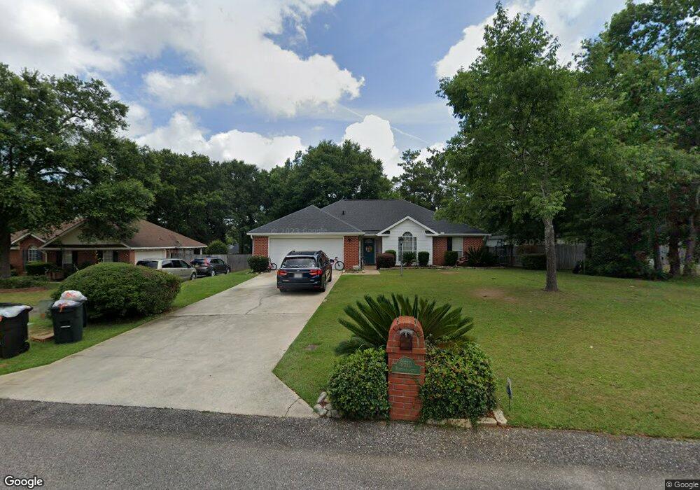
9610 Hanford Ct Mobile, AL 36695
Baker NeighborhoodEstimated Value: $245,000 - $316,000
3
Beds
3
Baths
2,324
Sq Ft
$119/Sq Ft
Est. Value
About This Home
This home is located at 9610 Hanford Ct, Mobile, AL 36695 and is currently estimated at $275,643, approximately $118 per square foot. 9610 Hanford Ct is a home located in Mobile County with nearby schools including Elsie Collier Elementary School, Bernice J Causey Middle School, and Baker High School.
Ownership History
Date
Name
Owned For
Owner Type
Purchase Details
Closed on
Apr 11, 2002
Sold by
Riley Brian G and Riley Sarah L
Bought by
Black Hubert J and Black Melissa D
Current Estimated Value
Home Financials for this Owner
Home Financials are based on the most recent Mortgage that was taken out on this home.
Original Mortgage
$117,800
Outstanding Balance
$48,799
Interest Rate
6.8%
Estimated Equity
$226,844
Purchase Details
Closed on
Jun 1, 1998
Sold by
John Howard Homes Ltd
Bought by
Riley Brian G and Riley Sarah L
Home Financials for this Owner
Home Financials are based on the most recent Mortgage that was taken out on this home.
Original Mortgage
$89,240
Interest Rate
6.87%
Create a Home Valuation Report for This Property
The Home Valuation Report is an in-depth analysis detailing your home's value as well as a comparison with similar homes in the area
Home Values in the Area
Average Home Value in this Area
Purchase History
| Date | Buyer | Sale Price | Title Company |
|---|---|---|---|
| Black Hubert J | -- | -- | |
| Riley Brian G | -- | -- |
Source: Public Records
Mortgage History
| Date | Status | Borrower | Loan Amount |
|---|---|---|---|
| Open | Black Hubert J | $117,800 | |
| Previous Owner | Riley Brian G | $89,240 |
Source: Public Records
Tax History Compared to Growth
Tax History
| Year | Tax Paid | Tax Assessment Tax Assessment Total Assessment is a certain percentage of the fair market value that is determined by local assessors to be the total taxable value of land and additions on the property. | Land | Improvement |
|---|---|---|---|---|
| 2024 | $1,079 | $20,730 | $4,000 | $16,730 |
| 2023 | $1,009 | $19,490 | $4,000 | $15,490 |
| 2022 | $763 | $17,120 | $4,000 | $13,120 |
| 2021 | $751 | $16,850 | $4,000 | $12,850 |
| 2020 | $661 | $15,010 | $3,200 | $11,810 |
| 2019 | $664 | $15,080 | $0 | $0 |
| 2018 | $679 | $15,380 | $0 | $0 |
| 2017 | $663 | $13,600 | $0 | $0 |
| 2016 | $599 | $13,740 | $0 | $0 |
| 2013 | $689 | $14,580 | $0 | $0 |
Source: Public Records
Map
Nearby Homes
- 0 New Neck Rd Unit 387066
- 9425 Yorktowne Way
- 9410 Ashwood Ct
- 9556 Bridgeton Ct
- 860 Trailwood Dr E
- 1111 Valley View Ct
- 11900 Airport Blvd
- 9751 Pine Knoll Rd
- 790 Hale Rd
- 789 Royal Woods Dr W Unit 7
- 821 Copperfield Dr W
- 791 Copperfield Dr W
- 781 Copperfield Dr W
- 1235 Wakefield Dr E
- 750 Hale Rd
- 9721 Royal Woods Dr N
- 10153 Tarawood Ct
- 9841 Shadow Wood Dr
- 11905 Airport Blvd
- 11905 Airport Blvd Unit 3
- 9620 Hanford Ct
- 1260 Colonial Hills Dr
- 9600 Hanford Ct
- 1250 Colonial Hills Dr
- 9600 Oak Forrest Place
- 1240 Colonial Hills Dr
- 9630 Hanford Ct
- 9615 Hanford Ct
- 9605 Hanford Ct
- 9603 Oak Forrest Place
- 9625 Hanford Ct
- 9595 Hanford Ct
- 1230 Colonial Hills Dr
- 9640 Hanford Ct
- 9635 Hanford Ct
- 9555 Bakerfield Ct
- 9613 Oak Forrest Place
- 1275 Colonial Hills Dr
- 1265 Colonial Hills Dr
- 1220 Colonial Hills Dr