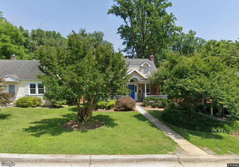
9611 Bristol Ave Silver Spring, MD 20901
Estimated Value: $752,004 - $990,000
Studio
3
Baths
1,984
Sq Ft
$424/Sq Ft
Est. Value
About This Home
This home is located at 9611 Bristol Ave, Silver Spring, MD 20901 and is currently estimated at $840,501, approximately $423 per square foot. 9611 Bristol Ave is a home located in Montgomery County with nearby schools including Sligo Creek Elementary School, Silver Spring International Middle School, and Northwood High School.
Ownership History
Date
Name
Owned For
Owner Type
Purchase Details
Closed on
Oct 17, 2011
Sold by
Holt Patricia M and Holt John T
Bought by
Holt Patricia M
Current Estimated Value
Home Financials for this Owner
Home Financials are based on the most recent Mortgage that was taken out on this home.
Original Mortgage
$374,400
Outstanding Balance
$255,478
Interest Rate
4.11%
Mortgage Type
Stand Alone Second
Estimated Equity
$585,023
Create a Home Valuation Report for This Property
The Home Valuation Report is an in-depth analysis detailing your home's value as well as a comparison with similar homes in the area
Home Values in the Area
Average Home Value in this Area
Purchase History
We collect this data history from publicly available records. To have your information removed, we recommend requesting removal directly through your county’s website.
| Date | Buyer | Sale Price | Title Company |
|---|---|---|---|
| Holt Patricia M | -- | New Era Title Llc |
Source: Public Records
Mortgage History
We collect this data history from publicly available records. To have your information removed, we recommend requesting removal directly through your county’s website.
| Date | Status | Borrower | Loan Amount |
|---|---|---|---|
| Open | Holt Patricia M | $374,400 |
Source: Public Records
Tax History
| Year | Tax Paid | Tax Assessment Tax Assessment Total Assessment is a certain percentage of the fair market value that is determined by local assessors to be the total taxable value of land and additions on the property. | Land | Improvement |
|---|---|---|---|---|
| 2025 | $8,369 | $708,100 | -- | -- |
| 2024 | $8,369 | $663,500 | $280,200 | $383,300 |
| 2023 | $6,063 | $626,333 | $0 | $0 |
| 2022 | $4,749 | $589,167 | $0 | $0 |
| 2021 | $4,945 | $552,000 | $280,200 | $271,800 |
| 2020 | $4,631 | $546,400 | $0 | $0 |
| 2019 | $4,859 | $540,800 | $0 | $0 |
| 2018 | $5,710 | $535,200 | $280,200 | $255,000 |
| 2017 | $5,435 | $513,600 | $0 | $0 |
| 2016 | -- | $492,000 | $0 | $0 |
| 2015 | $5,477 | $470,400 | $0 | $0 |
| 2014 | $5,477 | $470,400 | $0 | $0 |
Source: Public Records
Map
Nearby Homes
- 617 Lycoming St
- 812 Forest Glen Rd
- 9601 Bruce Dr
- 9911 Renfrew Rd
- 9329 Harvey Rd
- 9405 Thornhill Rd
- 10006 Portland Place
- 709 Greyrock Dr
- 1102 Edgevale Rd
- 1213 Dale Dr
- 9200 Watson Rd
- 1310 Midwood Place
- 700 Greyrock Dr
- 10032 Dallas Ave
- 10010 Raynor Rd
- 311 Ellsworth Dr
- 10015 Grayson Ave
- 203 Baden St
- 202 Baden St
- 10128 Hereford Place
- 9613 Bristol Ave
- 9609 Bristol Ave
- 9615 Bristol Ave
- 9607 Bristol Ave
- 9617 Bristol Ave
- 9605 Bristol Ave
- 9610 Bristol Ave
- 9612 Bristol Ave
- 9608 Bristol Ave
- 9614 Bristol Ave
- 9606 Bristol Ave
- 9619 Bristol Ave
- 9616 Brunett Ct
- 9603 Bristol Ave
- 9616 Bristol Ave
- 9602 Bristol Ave
- 9618 Brunett Ct
- 9701 Bristol Ave
- 9614 Brunett Ct
- 9618 Bristol Ave
Your Personal Tour Guide
Ask me questions while you tour the home.