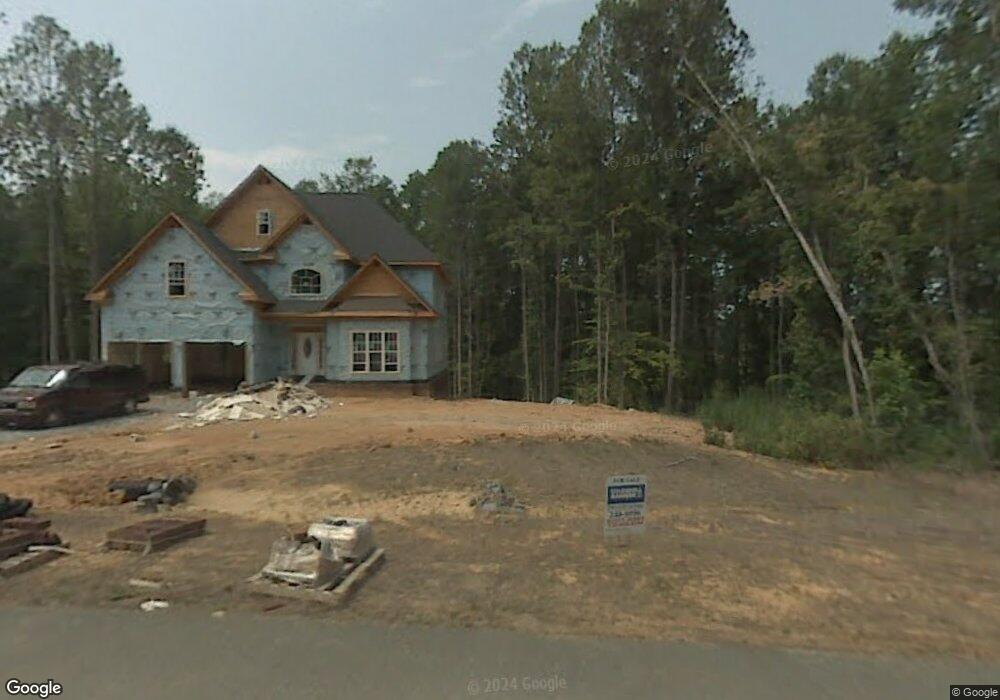
9611 Hampton Rd Lexington, NC 27295
Estimated Value: $295,000 - $304,000
3
Beds
1
Bath
1,204
Sq Ft
$249/Sq Ft
Est. Value
About This Home
This home is located at 9611 Hampton Rd, Lexington, NC 27295 and is currently estimated at $299,500, approximately $248 per square foot. 9611 Hampton Rd is a home located in Davidson County with nearby schools including Northwest Elementary School, North Davidson Middle School, and North Davidson High School.
Ownership History
Date
Name
Owned For
Owner Type
Purchase Details
Closed on
May 29, 2025
Sold by
Walser Delia A
Bought by
Cg2 Homes Inc
Current Estimated Value
Home Financials for this Owner
Home Financials are based on the most recent Mortgage that was taken out on this home.
Original Mortgage
$745,000
Outstanding Balance
$743,095
Interest Rate
6.83%
Mortgage Type
Construction
Estimated Equity
-$443,595
Purchase Details
Closed on
Jun 30, 2004
Sold by
Walser Larry Eugene
Bought by
Walser Larry E
Purchase Details
Closed on
Jul 1, 1998
Create a Home Valuation Report for This Property
The Home Valuation Report is an in-depth analysis detailing your home's value as well as a comparison with similar homes in the area
Home Values in the Area
Average Home Value in this Area
Purchase History
| Date | Buyer | Sale Price | Title Company |
|---|---|---|---|
| Cg2 Homes Inc | $300,000 | None Listed On Document | |
| Walser Larry E | -- | -- | |
| -- | -- | -- |
Source: Public Records
Mortgage History
| Date | Status | Borrower | Loan Amount |
|---|---|---|---|
| Open | Cg2 Homes Inc | $745,000 |
Source: Public Records
Tax History Compared to Growth
Tax History
| Year | Tax Paid | Tax Assessment Tax Assessment Total Assessment is a certain percentage of the fair market value that is determined by local assessors to be the total taxable value of land and additions on the property. | Land | Improvement |
|---|---|---|---|---|
| 2025 | $1,499 | $237,850 | $0 | $0 |
| 2024 | $1,499 | $237,850 | $0 | $0 |
| 2023 | $1,499 | $237,850 | $0 | $0 |
| 2022 | $1,499 | $237,850 | $0 | $0 |
| 2021 | $1,499 | $237,850 | $0 | $0 |
| 2020 | $1,211 | $192,070 | $0 | $0 |
| 2019 | $1,191 | $192,070 | $0 | $0 |
| 2018 | $1,191 | $192,070 | $0 | $0 |
| 2017 | $1,191 | $192,070 | $0 | $0 |
| 2016 | $1,191 | $192,070 | $0 | $0 |
| 2015 | $1,191 | $192,070 | $0 | $0 |
| 2014 | $1,034 | $166,810 | $0 | $0 |
Source: Public Records
Map
Nearby Homes
- 1001 Arvin Hill Ln
- 178 Wickham Ct
- 311 Altavista Dr
- 407 Enclave Dr
- 258 Enclave Dr
- 215 Enclave Dr
- 190 Reedy Creek Ct
- 190 Enclave Dr
- 306 Lenalan Dr
- 172 Enclave Dr
- 275 Lenalan Dr
- 201 Gus Hill Rd
- 348 Reedy Creek Ct
- 0 Dortmund Dr
- 111 Carries Cove Ln
- 0 River Pines Trail
- 0 River Knolls Rd
- 338 River Pines Trail
- 0 Pine River Trail
- 373 Luna Ln
- 9698 Hampton Rd
- 9659 Hampton Rd
- 9661 Hampton Rd
- 9211 Hampton Rd
- 9466 Hampton Rd
- 9475 Hampton Rd
- 9425 Hampton Rd
- 9163 Hampton Rd
- 2121 Muddy Creek Rd
- 1865 Muddy Creek Rd
- 1771 Muddy Creek Rd
- 278 Old Mill Farm Rd
- 1742 Muddy Creek Rd
- 1711 Muddy Creek Rd
- 129 Field View Ct
- 128 Field View Ct
- 338 Old Mill Farm Rd
- 118 Wood View Ln
- 337 Old Mill Farm Rd
- 219 Old Mill Farm Rd