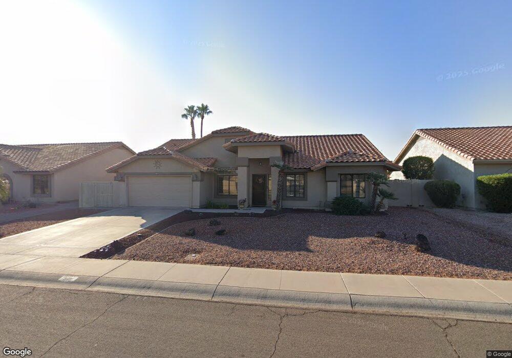
9611 W Menadota Dr Peoria, AZ 85382
Estimated Value: $412,739 - $531,000
2
Beds
2
Baths
2,142
Sq Ft
$227/Sq Ft
Est. Value
About This Home
This home is located at 9611 W Menadota Dr, Peoria, AZ 85382 and is currently estimated at $485,935, approximately $226 per square foot. 9611 W Menadota Dr is a home located in Maricopa County with nearby schools including Apache Elementary School, Sunrise Mountain High School, and Sonoran Science Academy-Peoria.
Ownership History
Date
Name
Owned For
Owner Type
Purchase Details
Closed on
Jul 9, 2018
Sold by
Swelland Gary L and Swelland Ileen M
Bought by
Swelland Gary L and Swelland Ileen M
Current Estimated Value
Purchase Details
Closed on
Nov 14, 2003
Sold by
Skyles Richard E and Skyles Joan L
Bought by
Swelland Gary L and Swelland Ileen M
Home Financials for this Owner
Home Financials are based on the most recent Mortgage that was taken out on this home.
Original Mortgage
$145,900
Outstanding Balance
$67,263
Interest Rate
5.92%
Mortgage Type
New Conventional
Estimated Equity
$418,672
Purchase Details
Closed on
Nov 14, 1995
Sold by
Rozga Wallis Rae and Rozga Pearl O
Bought by
Skyles Richard E and Skyles Joan L
Create a Home Valuation Report for This Property
The Home Valuation Report is an in-depth analysis detailing your home's value as well as a comparison with similar homes in the area
Home Values in the Area
Average Home Value in this Area
Purchase History
| Date | Buyer | Sale Price | Title Company |
|---|---|---|---|
| Swelland Gary L | -- | None Available | |
| Swelland Gary L | $183,500 | Russ Lyon Title | |
| Skyles Richard E | $145,000 | United Title Agency |
Source: Public Records
Mortgage History
| Date | Status | Borrower | Loan Amount |
|---|---|---|---|
| Open | Swelland Gary L | $145,900 |
Source: Public Records
Tax History Compared to Growth
Tax History
| Year | Tax Paid | Tax Assessment Tax Assessment Total Assessment is a certain percentage of the fair market value that is determined by local assessors to be the total taxable value of land and additions on the property. | Land | Improvement |
|---|---|---|---|---|
| 2025 | $2,165 | $27,810 | -- | -- |
| 2024 | $2,132 | $26,486 | -- | -- |
| 2023 | $2,132 | $33,660 | $6,730 | $26,930 |
| 2022 | $2,088 | $27,820 | $5,560 | $22,260 |
| 2021 | $2,235 | $26,260 | $5,250 | $21,010 |
| 2020 | $2,256 | $24,900 | $4,980 | $19,920 |
| 2019 | $2,183 | $23,020 | $4,600 | $18,420 |
| 2018 | $2,111 | $21,680 | $4,330 | $17,350 |
| 2017 | $2,112 | $20,020 | $4,000 | $16,020 |
| 2016 | $2,091 | $18,850 | $3,770 | $15,080 |
| 2015 | $1,951 | $18,670 | $3,730 | $14,940 |
Source: Public Records
Map
Nearby Homes
- 9627 W Menadota Dr
- 9551 W Sierra Pinta Dr
- 9510 W Menadota Dr
- 20424 N 96th Ln
- 9455 W Behrend Dr
- 9403 W Escuda Dr
- 9704 W Tonto Ln
- 9529 W Runion Dr
- 9869 W Chino Dr
- 19562 N 96th Ln Unit 80
- 9832 W Behrend Dr
- 9729 W Burnett Rd
- 9706 W Rimrock Dr Unit 95
- 9708 W Rimrock Dr Unit 96
- 20138 N 92nd Ave
- 20149 N 92nd Ave
- 19702 N 98th Ln
- 9321 W Clara Ln
- 20143 N 92nd Ave
- 9901 W Mescalero Ct
- 9619 W Menadota Dr
- 9603 W Menadota Dr
- 9610 W Sierra Pinta Dr
- 9618 W Sierra Pinta Dr
- 9602 W Sierra Pinta Dr
- 9559 W Menadota Dr
- 9626 W Sierra Pinta Dr
- 9560 W Sierra Pinta Dr
- 9635 W Menadota Dr
- 9551 W Menadota Dr
- 9634 W Sierra Pinta Dr
- 9552 W Sierra Pinta Dr
- 9611 W Sierra Pinta Dr
- 9603 W Sierra Pinta Dr
- 9619 W Sierra Pinta Dr
- 9559 W Sierra Pinta Dr
- 9643 W Menadota Dr
- 9627 W Sierra Pinta Dr
- 9642 W Sierra Pinta Dr
- 9543 W Menadota Dr