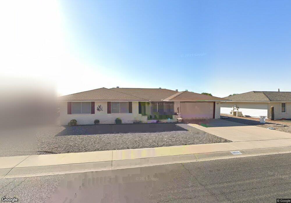
9611 W Newport Dr Sun City, AZ 85351
Estimated Value: $283,359 - $448,000
--
Bed
2
Baths
1,832
Sq Ft
$198/Sq Ft
Est. Value
About This Home
This home is located at 9611 W Newport Dr, Sun City, AZ 85351 and is currently estimated at $363,340, approximately $198 per square foot. 9611 W Newport Dr is a home located in Maricopa County with nearby schools including Sonoran Science Academy-Peoria, Black Mountain Science Academy Montessori, and Arrowhead Montessori.
Ownership History
Date
Name
Owned For
Owner Type
Purchase Details
Closed on
Aug 9, 1995
Sold by
Clarke Dennis Wilson and Clarke Eileen Florence
Bought by
Clarke Dennis Wilson and Clarke Eileen Florence
Current Estimated Value
Purchase Details
Closed on
Jan 10, 1995
Sold by
Smith Norton Robert A and Smith Norton Marcia
Bought by
Clarke Dennis W and Clarke Eileen F
Home Financials for this Owner
Home Financials are based on the most recent Mortgage that was taken out on this home.
Original Mortgage
$63,000
Interest Rate
9.16%
Mortgage Type
Seller Take Back
Create a Home Valuation Report for This Property
The Home Valuation Report is an in-depth analysis detailing your home's value as well as a comparison with similar homes in the area
Home Values in the Area
Average Home Value in this Area
Purchase History
| Date | Buyer | Sale Price | Title Company |
|---|---|---|---|
| Clarke Dennis Wilson | -- | -- | |
| Clarke Dennis W | $121,000 | North American Title Agency |
Source: Public Records
Mortgage History
| Date | Status | Borrower | Loan Amount |
|---|---|---|---|
| Previous Owner | Clarke Dennis W | $63,000 |
Source: Public Records
Tax History Compared to Growth
Tax History
| Year | Tax Paid | Tax Assessment Tax Assessment Total Assessment is a certain percentage of the fair market value that is determined by local assessors to be the total taxable value of land and additions on the property. | Land | Improvement |
|---|---|---|---|---|
| 2025 | $1,346 | $16,727 | -- | -- |
| 2024 | $1,212 | $15,931 | -- | -- |
| 2023 | $1,212 | $25,830 | $5,160 | $20,670 |
| 2022 | $1,138 | $20,320 | $4,060 | $16,260 |
| 2021 | $1,175 | $19,170 | $3,830 | $15,340 |
| 2020 | $1,143 | $17,080 | $3,410 | $13,670 |
| 2019 | $1,128 | $16,100 | $3,220 | $12,880 |
| 2018 | $1,085 | $14,770 | $2,950 | $11,820 |
| 2017 | $1,048 | $13,210 | $2,640 | $10,570 |
| 2016 | $556 | $12,500 | $2,500 | $10,000 |
| 2015 | $937 | $11,650 | $2,330 | $9,320 |
Source: Public Records
Map
Nearby Homes
- 9502 W Pineridge Dr
- 9517 W Indian Hills Dr
- 9702 W Pineridge Dr
- 9502 W Indian Hills Dr
- 9732 W Newport Dr Unit 25
- 9433 W Greenway Rd
- 9414 W Newport Dr Unit 25
- 9445 W Rolling Hills Dr
- 9409 W Indian Hills Dr
- 9437 W Long Hills Dr
- 9442 W Raintree Dr Unit 25
- 9814 W Long Hills Dr Unit 26
- 14618 N Shiprock Dr
- 9713 W Raintree Dr
- 9606 W Long Hills Dr
- 9414 W Greenway Rd
- 14830 N Cameo Dr
- 9434 W Raintree Dr
- 9429 W Rolling Hills Dr
- 15401 N Cameo Dr
- 9601 W Newport Dr
- 9617 W Newport Dr
- 9602 W Brokenstone Dr
- 9614 W Brokenstone Dr
- 9525 W Newport Dr
- 9623 W Newport Dr
- 9608 W Newport Dr
- 9614 W Newport Dr
- 9602 W Newport Dr
- 9620 W Newport Dr
- 9701 W Newport Dr
- 9519 W Newport Dr
- 9520 W Brokenstone Dr
- 9626 W Newport Dr
- 9702 W Brokenstone Dr
- 9601 W Brokenstone Dr
- 9613 W Pineridge Dr
- 9607 W Pineridge Dr
- 9611 W Brokenstone Dr
- 9520 W Newport Dr