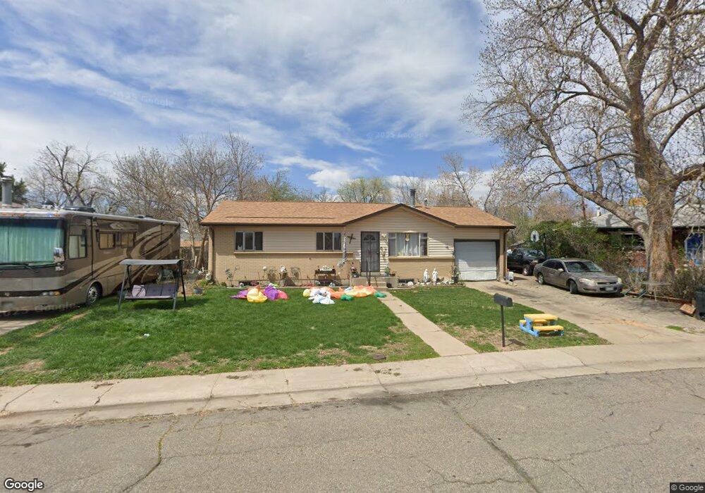
9615 W 62nd Place Arvada, CO 80004
Alta Vista NeighborhoodEstimated Value: $580,000 - $632,000
5
Beds
5
Baths
1,146
Sq Ft
$529/Sq Ft
Est. Value
About This Home
This home is located at 9615 W 62nd Place, Arvada, CO 80004 and is currently estimated at $605,721, approximately $528 per square foot. 9615 W 62nd Place is a home located in Jefferson County with nearby schools including Lawrence Elementary School, Arvada K-8, and Arvada High School.
Ownership History
Date
Name
Owned For
Owner Type
Purchase Details
Closed on
Apr 22, 1998
Sold by
Rock Timothy J and Rock Carolyn M
Bought by
Casados Frank Anthony
Current Estimated Value
Home Financials for this Owner
Home Financials are based on the most recent Mortgage that was taken out on this home.
Original Mortgage
$131,237
Outstanding Balance
$24,891
Interest Rate
7.09%
Mortgage Type
FHA
Estimated Equity
$580,830
Create a Home Valuation Report for This Property
The Home Valuation Report is an in-depth analysis detailing your home's value as well as a comparison with similar homes in the area
Home Values in the Area
Average Home Value in this Area
Purchase History
| Date | Buyer | Sale Price | Title Company |
|---|---|---|---|
| Casados Frank Anthony | $133,000 | -- |
Source: Public Records
Mortgage History
| Date | Status | Borrower | Loan Amount |
|---|---|---|---|
| Open | Casados Frank Anthony | $131,237 |
Source: Public Records
Tax History Compared to Growth
Tax History
| Year | Tax Paid | Tax Assessment Tax Assessment Total Assessment is a certain percentage of the fair market value that is determined by local assessors to be the total taxable value of land and additions on the property. | Land | Improvement |
|---|---|---|---|---|
| 2024 | $3,524 | $36,327 | $17,526 | $18,801 |
| 2023 | $3,524 | $36,327 | $17,526 | $18,801 |
| 2022 | $2,874 | $29,348 | $12,809 | $16,539 |
| 2021 | $2,922 | $30,192 | $13,177 | $17,015 |
| 2020 | $2,627 | $27,219 | $11,117 | $16,102 |
| 2019 | $2,591 | $27,219 | $11,117 | $16,102 |
| 2018 | $2,314 | $23,628 | $6,618 | $17,010 |
| 2017 | $2,118 | $23,628 | $6,618 | $17,010 |
| 2016 | $1,795 | $18,864 | $5,539 | $13,325 |
| 2015 | $1,544 | $18,864 | $5,539 | $13,325 |
| 2014 | $1,544 | $15,252 | $4,872 | $10,380 |
Source: Public Records
Map
Nearby Homes
- 9667 W 63rd Ave
- 9656 Rensselaer Dr
- 6138 Iris Way
- 6371 Brooks Dr
- 9175 Cole Dr
- 6376 Brooks Dr
- 6580 Independence Way
- 6077 Flower St
- 6532 Kipling St
- 6572 Kipling St
- 6009 Lee St
- 6250 Everett Ct Unit E
- 6455 Field St
- 9487 W 58th Ave Unit B
- 9457 W 58th Ave Unit D
- 9457 W 58th Ave Unit B
- 6240 Everett Ct Unit F
- 6114 Miller St
- 10211 W 59th Place
- 9546 W 58th Ave Unit B
- 9635 W 62nd Place
- 9605 W 62nd Place
- 9630 W 63rd Ave
- 9650 W 63rd Ave
- 9650 W 63rd Ave
- 9610 W 63rd Ave
- 6199 Independence St
- 9655 W 62nd Place
- 9600 W 63rd Ave
- 9660 W 63rd Ave
- 9604 W 62nd Place
- 9675 W 62nd Place
- 6197 Independence St
- 9637 W 63rd Ave
- 9670 W 63rd Ave
- 9657 W 63rd Ave
- 9627 W 63rd Ave
- 9614 W 62nd Place
- 9617 W 63rd Ave
- 6209 Iris Way