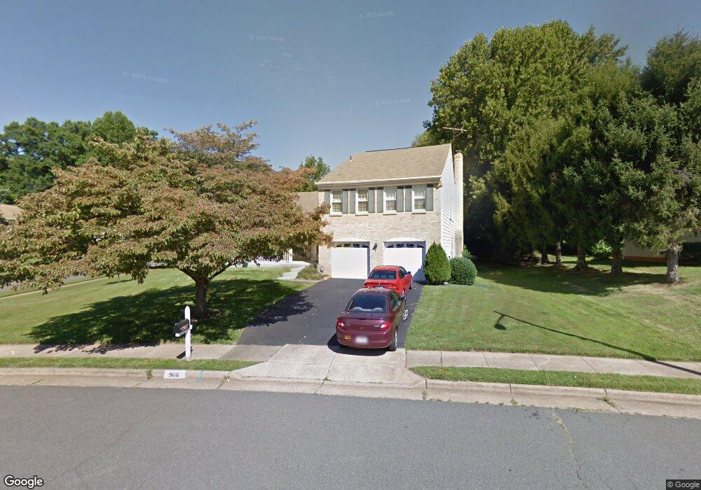
9616 Bronte Dr Fairfax, VA 22032
Estimated Value: $858,361 - $950,000
4
Beds
3
Baths
2,029
Sq Ft
$451/Sq Ft
Est. Value
About This Home
This home is located at 9616 Bronte Dr, Fairfax, VA 22032 and is currently estimated at $914,090, approximately $450 per square foot. 9616 Bronte Dr is a home located in Fairfax County with nearby schools including Laurel Ridge Elementary School, James W Robinson, Jr. Secondary School, and Holy Spirit School.
Ownership History
Date
Name
Owned For
Owner Type
Purchase Details
Closed on
Mar 3, 1999
Sold by
Carnahan Burrus M
Bought by
Caffee Ralph E
Current Estimated Value
Home Financials for this Owner
Home Financials are based on the most recent Mortgage that was taken out on this home.
Original Mortgage
$160,000
Outstanding Balance
$38,756
Interest Rate
6.76%
Estimated Equity
$875,334
Create a Home Valuation Report for This Property
The Home Valuation Report is an in-depth analysis detailing your home's value as well as a comparison with similar homes in the area
Home Values in the Area
Average Home Value in this Area
Purchase History
| Date | Buyer | Sale Price | Title Company |
|---|---|---|---|
| Caffee Ralph E | $245,000 | -- |
Source: Public Records
Mortgage History
| Date | Status | Borrower | Loan Amount |
|---|---|---|---|
| Open | Caffee Ralph E | $160,000 |
Source: Public Records
Tax History
| Year | Tax Paid | Tax Assessment Tax Assessment Total Assessment is a certain percentage of the fair market value that is determined by local assessors to be the total taxable value of land and additions on the property. | Land | Improvement |
|---|---|---|---|---|
| 2025 | -- | $859,520 | $371,000 | $488,520 |
| 2024 | $9,362 | $808,080 | $346,000 | $462,080 |
| 2023 | $8,426 | $746,620 | $316,000 | $430,620 |
| 2022 | $7,933 | $693,720 | $291,000 | $402,720 |
| 2021 | $0 | $652,760 | $271,000 | $381,760 |
| 2020 | $7,578 | $640,270 | $266,000 | $374,270 |
| 2019 | $7,459 | $630,270 | $256,000 | $374,270 |
| 2018 | $6,828 | $593,740 | $226,000 | $367,740 |
| 2017 | $3,686 | $634,910 | $226,000 | $408,910 |
| 2016 | $3,625 | $625,890 | $225,000 | $400,890 |
Source: Public Records
Map
Nearby Homes
- 5342 Guinea Rd
- 5078 Twinbrook Run Dr
- 5122 Pommeroy Dr
- 9502 Wallingford Dr
- 5105 Coleridge Dr
- 9438 Wallingford Dr
- 5401 Kinnerly Ct
- 5037 Head Ct
- 5502 Peppercorn Dr
- 9604 Glenarm Ct
- 9532 Burdett Rd
- 9752 High Water Ct
- 5552 Peppercorn Dr
- 9891 Becket Ct
- 5601 Castlebury Ct
- 9315 Winbourne Rd
- 5635 Sutherland Ct
- 5482 Midship Ct
- 9662 Westport Ln
- 5406 Midship Ct
- 5215 Marvell Ln
- 5208 Tamar Woods Ct
- 5218 Marvell Ln
- 5206 Tamar Woods Ct
- 9615 Bronte Dr
- 9613 Bronte Dr
- 5211 Marvell Ln
- 5216 Marvell Ln
- 5214 Marvell Ln
- 9617 Bronte Dr
- 9611 Bronte Dr
- 5204 Tamar Woods Ct
- 9702 Bronte Dr
- 5212 Marvell Ln
- 5209 Marvell Ln
- 9610 Bronte Dr
- 5223 Herzell Woods Ct
- 5210 Marvell Ln
- 9609 Bronte Dr
- 5207 Tamar Woods Ct
Your Personal Tour Guide
Ask me questions while you tour the home.