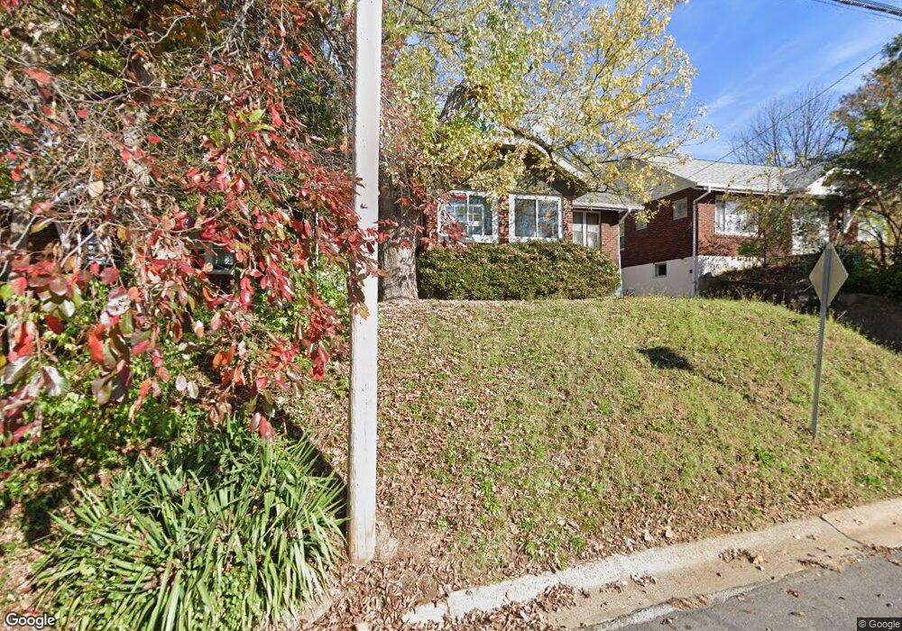
9617 W Milton Ave Saint Louis, MO 63114
Estimated Value: $116,000 - $189,000
3
Beds
1
Bath
1,285
Sq Ft
$121/Sq Ft
Est. Value
About This Home
This home is located at 9617 W Milton Ave, Saint Louis, MO 63114 and is currently estimated at $155,349, approximately $120 per square foot. 9617 W Milton Ave is a home located in St. Louis County with nearby schools including Marion Elementary School, Ritenour Middle School, and Ritenour Senior High School.
Ownership History
Date
Name
Owned For
Owner Type
Purchase Details
Closed on
Nov 8, 2011
Sold by
Secretary Of Housing & Urban Development
Bought by
Perales Christopher Ramiro
Current Estimated Value
Purchase Details
Closed on
Mar 29, 2010
Sold by
Chase Home Finance Llc
Bought by
Secretary Of Housing & Urban Development
Purchase Details
Closed on
Mar 22, 2010
Sold by
Turner Nancy J
Bought by
Chase Home Finance Llc
Purchase Details
Closed on
Nov 6, 2008
Sold by
Stuart Christine B and Stuart B
Bought by
Stuart Christine B and Stuart B
Create a Home Valuation Report for This Property
The Home Valuation Report is an in-depth analysis detailing your home's value as well as a comparison with similar homes in the area
Home Values in the Area
Average Home Value in this Area
Purchase History
| Date | Buyer | Sale Price | Title Company |
|---|---|---|---|
| Perales Christopher Ramiro | $12,051 | None Available | |
| Secretary Of Housing & Urban Development | $51,497 | None Available | |
| Chase Home Finance Llc | $60,511 | None Available | |
| Stuart Christine B | -- | None Available |
Source: Public Records
Tax History Compared to Growth
Tax History
| Year | Tax Paid | Tax Assessment Tax Assessment Total Assessment is a certain percentage of the fair market value that is determined by local assessors to be the total taxable value of land and additions on the property. | Land | Improvement |
|---|---|---|---|---|
| 2025 | $2,029 | $22,650 | $6,710 | $15,940 |
| 2024 | $2,029 | $23,660 | $2,300 | $21,360 |
| 2023 | $1,985 | $23,660 | $2,300 | $21,360 |
| 2022 | $1,862 | $19,460 | $2,680 | $16,780 |
| 2021 | $1,862 | $19,460 | $2,680 | $16,780 |
| 2020 | $1,648 | $15,870 | $3,440 | $12,430 |
| 2019 | $1,631 | $15,870 | $3,440 | $12,430 |
| 2018 | $1,488 | $13,020 | $1,370 | $11,650 |
| 2017 | $1,420 | $13,020 | $1,370 | $11,650 |
| 2016 | $1,176 | $10,950 | $3,060 | $7,890 |
| 2015 | $1,203 | $10,950 | $3,060 | $7,890 |
| 2014 | $1,040 | $9,590 | $1,630 | $7,960 |
Source: Public Records
Map
Nearby Homes
- 9640 Tennyson Ave
- 2528 Leslie Ave
- 2529 Leslie Ave
- 9515 Marlowe Ave
- 2412 Wallis Ave
- 2326 Hood Ave
- 9432 Tudor Ave
- 9911 Dennison Ave
- 2812 Woodson Rd
- 9922 Carlyle Ave
- 3205 Airway Ave
- 2327 Gaebler Ave
- 3213 Airway Ave
- 3219 Coles Ave
- 3219 Royalton Ave
- 3222 W Tennyson Ave
- 3294 W Tennyson Ave
- 2223 Burns Ave
- 3301 Suncrest Ave
- 3316 Edmundson Rd
- 9615 W Milton Ave
- 9619 W Milton Ave
- 9611 W Milton Ave
- 9621 W Milton Ave
- 9632 Holtwood Rd
- 9628 Holtwood Rd
- 9609 W Milton Ave
- 9634 Holtwood Rd
- 9620 W Milton Ave
- 9624 Holtwood Rd
- 9616 W Milton Ave
- 9618 W Milton Ave
- 9614 W Milton Ave
- 94369438 Holtwood Rd
- 9628 W Milton Ave
- 9632 W Milton Ave
- 9620 Holtwood Rd
- 9612 W Milton Ave
- 9624 W Milton Ave
- 9610 W Milton Ave