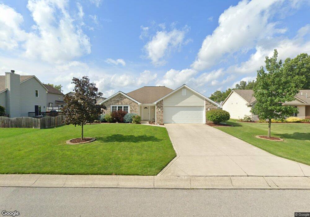
9619 Shellbrook Dr Fort Wayne, IN 46835
Northeast Fort Wayne NeighborhoodEstimated Value: $259,000 - $269,000
3
Beds
2
Baths
2,792
Sq Ft
$94/Sq Ft
Est. Value
About This Home
This home is located at 9619 Shellbrook Dr, Fort Wayne, IN 46835 and is currently estimated at $262,965, approximately $94 per square foot. 9619 Shellbrook Dr is a home located in Allen County with nearby schools including Arlington Elementary School, Jefferson Middle School, and Northrop High School.
Ownership History
Date
Name
Owned For
Owner Type
Purchase Details
Closed on
May 17, 2023
Sold by
Maureen K Mcdonald Revocable Trust
Bought by
Mcdonald Maureen K and Lara Holly
Current Estimated Value
Purchase Details
Closed on
Feb 14, 2004
Sold by
Mcdonald Maureen K
Bought by
Mcdonald Maureen K and Maureen K Mcdonald Revocable Trust
Purchase Details
Closed on
Aug 26, 2003
Sold by
Lancia Homes Inc
Bought by
Mcdonald Maureen K
Create a Home Valuation Report for This Property
The Home Valuation Report is an in-depth analysis detailing your home's value as well as a comparison with similar homes in the area
Home Values in the Area
Average Home Value in this Area
Purchase History
| Date | Buyer | Sale Price | Title Company |
|---|---|---|---|
| Mcdonald Maureen K | -- | Centurion Land Title | |
| Mcdonald Maureen K | -- | -- | |
| Mcdonald Maureen K | -- | Three Rivers Title Co Inc |
Source: Public Records
Tax History
| Year | Tax Paid | Tax Assessment Tax Assessment Total Assessment is a certain percentage of the fair market value that is determined by local assessors to be the total taxable value of land and additions on the property. | Land | Improvement |
|---|---|---|---|---|
| 2025 | $2,484 | $255,800 | $44,200 | $211,600 |
| 2024 | $2,427 | $218,000 | $44,200 | $173,800 |
| 2022 | $2,116 | $188,500 | $44,200 | $144,300 |
| 2021 | $2,021 | $180,900 | $25,300 | $155,600 |
| 2020 | $1,710 | $157,300 | $25,300 | $132,000 |
| 2019 | $1,678 | $155,100 | $25,300 | $129,800 |
| 2018 | $1,565 | $144,100 | $25,300 | $118,800 |
| 2017 | $1,399 | $128,400 | $25,300 | $103,100 |
| 2016 | $1,372 | $127,600 | $25,300 | $102,300 |
| 2014 | $1,216 | $118,200 | $25,300 | $92,900 |
| 2013 | $1,168 | $113,700 | $25,300 | $88,400 |
Source: Public Records
Map
Nearby Homes
- 9818 Sea View Cove
- 9528 Carine Cove
- 8517 Greyhawk Dr
- 5511 Quail Canyon Dr
- 7912 Welland Ct
- 7920 Wethersfield Cove
- 10128 Privet Dr
- 7755 Tumnus Trail
- 10255 Tirian Place
- 10249 Tirian Place
- 10299 Tirian Place
- 10263 Tirian Place
- 7348 Schwartz Rd
- 7746 Tumnus Trail Unit 70
- 8204 Meadow Hills Dr
- 8146 Easthampton Blvd
- 9516 Chapmans Blvd
- 7885 Sunbeam Cove
- Harmony Plan at Trader's Trace
- Stamford Plan at Trader's Trace
- 9625 Shellbrook Dr
- 6722 Orial Place
- 9618 Greyhawk Dr
- 6728 Orial Place
- 9631 Shellbrook Dr
- 9626 Greyhawk Dr
- 9620 Shellbrook Dr
- 9626 Shellbrook Dr
- 6734 Orial Place
- 9614 Shellbrook Dr
- 9632 Shellbrook Dr
- 9705 Forest Creek Dr
- 9634 Greyhawk Dr
- 6627 Drakes Bay Run Unit 1 201008986
- 9608 Shellbrook Dr
- 6717 Orial Place
- 6723 Orial Place
- 9711 Forest Creek Dr
- 9530 Greyhawk Dr
- 9633 Greyhawk Dr
Your Personal Tour Guide
Ask me questions while you tour the home.