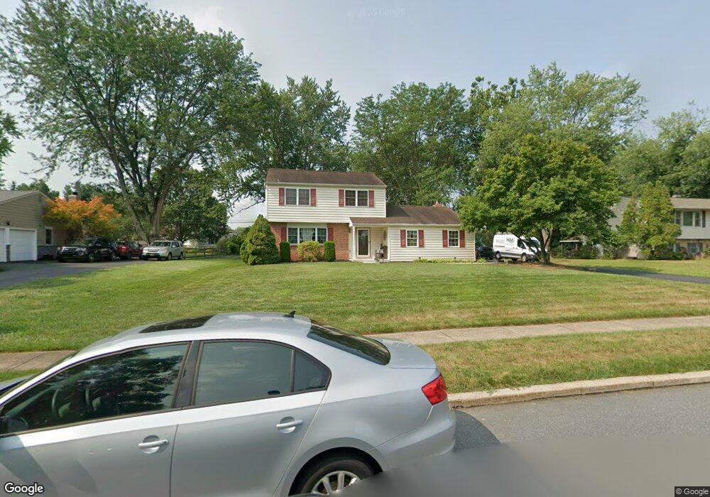
962 Anders Rd Lansdale, PA 19446
Upper Gwynedd Township NeighborhoodEstimated Value: $463,762 - $592,000
4
Beds
2
Baths
1,660
Sq Ft
$307/Sq Ft
Est. Value
About This Home
This home is located at 962 Anders Rd, Lansdale, PA 19446 and is currently estimated at $509,191, approximately $306 per square foot. 962 Anders Rd is a home located in Montgomery County with nearby schools including Gwynedd Square Elementary School, Penndale Middle School, and North Penn Senior High School.
Ownership History
Date
Name
Owned For
Owner Type
Purchase Details
Closed on
Aug 27, 2010
Sold by
Morin Christopher
Bought by
Pimpinella John F and Pimpinella Rebecca
Current Estimated Value
Home Financials for this Owner
Home Financials are based on the most recent Mortgage that was taken out on this home.
Original Mortgage
$315,648
Outstanding Balance
$216,827
Interest Rate
5.25%
Mortgage Type
FHA
Estimated Equity
$292,365
Purchase Details
Closed on
Jun 30, 2009
Sold by
Solt Faith C and Solt John J
Bought by
Morin Christopher
Home Financials for this Owner
Home Financials are based on the most recent Mortgage that was taken out on this home.
Original Mortgage
$309,294
Interest Rate
5.31%
Purchase Details
Closed on
Dec 13, 2001
Sold by
Solt John J and Solt Faith C
Bought by
Solt John J and Solt Faith C
Purchase Details
Closed on
Jun 26, 2000
Sold by
Solt John J and Solt Lisa L
Bought by
Solt John J
Create a Home Valuation Report for This Property
The Home Valuation Report is an in-depth analysis detailing your home's value as well as a comparison with similar homes in the area
Home Values in the Area
Average Home Value in this Area
Purchase History
| Date | Buyer | Sale Price | Title Company |
|---|---|---|---|
| Pimpinella John F | $319,900 | None Available | |
| Morin Christopher | $315,000 | None Available | |
| Solt John J | -- | -- | |
| Solt John J | -- | -- |
Source: Public Records
Mortgage History
| Date | Status | Borrower | Loan Amount |
|---|---|---|---|
| Open | Pimpinella John F | $315,648 | |
| Previous Owner | Morin Christopher | $309,294 |
Source: Public Records
Tax History Compared to Growth
Tax History
| Year | Tax Paid | Tax Assessment Tax Assessment Total Assessment is a certain percentage of the fair market value that is determined by local assessors to be the total taxable value of land and additions on the property. | Land | Improvement |
|---|---|---|---|---|
| 2025 | $4,888 | $133,200 | $57,390 | $75,810 |
| 2024 | $4,888 | $133,200 | $57,390 | $75,810 |
| 2023 | $4,658 | $133,200 | $57,390 | $75,810 |
| 2022 | $4,492 | $133,200 | $57,390 | $75,810 |
| 2021 | $4,374 | $133,200 | $57,390 | $75,810 |
| 2020 | $4,261 | $133,200 | $57,390 | $75,810 |
| 2019 | $4,182 | $133,200 | $57,390 | $75,810 |
| 2018 | $4,183 | $133,200 | $57,390 | $75,810 |
| 2017 | $4,007 | $133,200 | $57,390 | $75,810 |
| 2016 | $3,955 | $133,200 | $57,390 | $75,810 |
| 2015 | $3,776 | $133,200 | $57,390 | $75,810 |
| 2014 | $3,776 | $133,200 | $57,390 | $75,810 |
Source: Public Records
Map
Nearby Homes
- 980 Jacks Ln
- 1040 Hunter Hill Dr
- 1627 Clearbrook Rd
- 210 Berwick Place Unit 20E
- 1959 Supplee Rd
- 911 Tricorn Dr
- 172 Oberlin Terrace
- 144 Oberlin Terrace Unit 15-B
- 1653 Bridle Path Dr
- 108 Hickory Ct
- 177 Oberlin Terrace Unit 18-L
- 2015 Creek Way
- 1622 Samantha Ct
- 2806 Morris Rd
- 3053 Sunny Ayre Dr
- 1255 Scobee Dr
- 846 Fulton Ave
- 749 Aldrin Ave
- 825 Morris Rd
- 10 Wheatley Walk
- 966 Anders Rd
- 958 Anders Rd
- 941 General Nash Dr
- 970 Anders Rd
- 954 Anders Rd
- 945 General Nash Dr
- 961 Anders Rd
- 951 Anders Rd
- 965 Anders Rd
- 974 Anders Rd
- 969 Anders Rd
- 949 General Nash Dr
- 950 Anders Rd
- 939 Anders Rd
- 973 Anders Rd
- 933 General Nash Dr
- 938 General Nash Dr
- 946 Anders Rd
- 978 Anders Rd
- 942 General Nash Dr