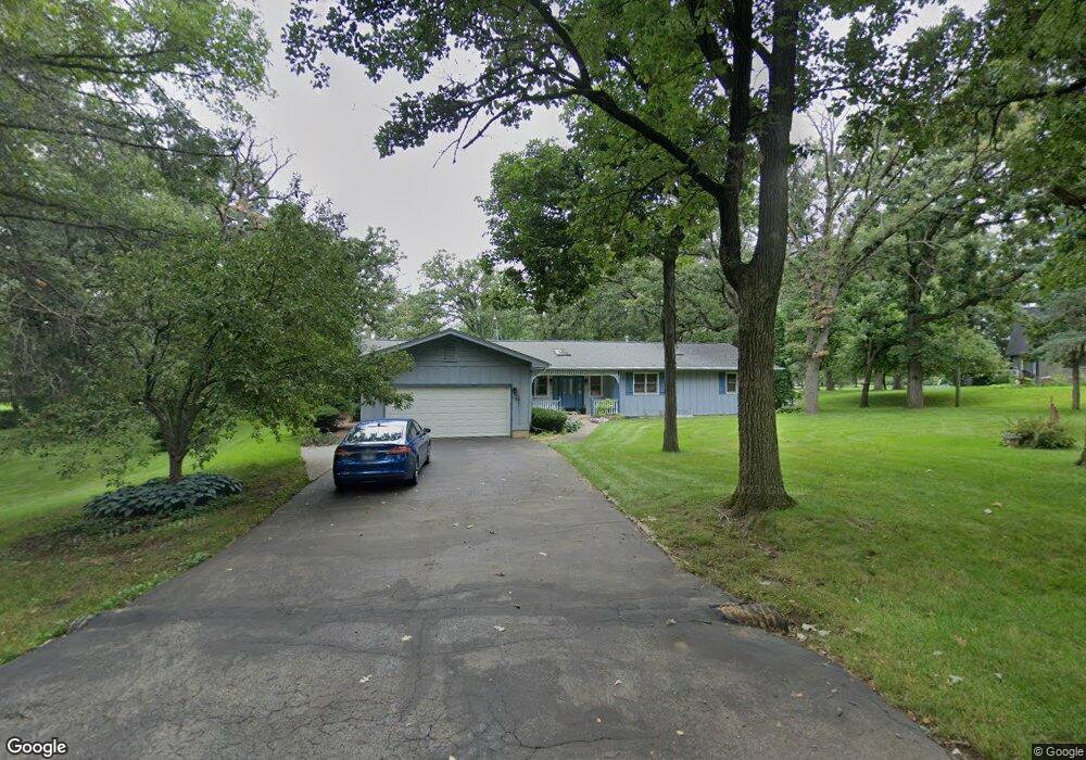
9620 Knolltop Rd Union, IL 60180
Riley NeighborhoodEstimated Value: $405,417 - $474,000
--
Bed
--
Bath
2,164
Sq Ft
$209/Sq Ft
Est. Value
About This Home
This home is located at 9620 Knolltop Rd, Union, IL 60180 and is currently estimated at $452,854, approximately $209 per square foot. 9620 Knolltop Rd is a home located in McHenry County with nearby schools including Leggee Elementary School, Heineman Middle School, and Huntley High School.
Ownership History
Date
Name
Owned For
Owner Type
Purchase Details
Closed on
Feb 28, 2001
Sold by
Grinsteiner James J and Grinsteiner Delores M
Bought by
Rinkel John D and Rinkel Kelly M
Current Estimated Value
Home Financials for this Owner
Home Financials are based on the most recent Mortgage that was taken out on this home.
Original Mortgage
$182,000
Outstanding Balance
$66,470
Interest Rate
7.06%
Estimated Equity
$386,384
Purchase Details
Closed on
Jul 8, 1998
Sold by
Grinsteiner James J and Grinsteiner Delores M
Bought by
Grinsteiner James J and Grinsteiner Delores M
Create a Home Valuation Report for This Property
The Home Valuation Report is an in-depth analysis detailing your home's value as well as a comparison with similar homes in the area
Home Values in the Area
Average Home Value in this Area
Purchase History
| Date | Buyer | Sale Price | Title Company |
|---|---|---|---|
| Rinkel John D | $242,000 | Fox Title Company | |
| Grinsteiner James J | -- | -- |
Source: Public Records
Mortgage History
| Date | Status | Borrower | Loan Amount |
|---|---|---|---|
| Open | Rinkel John D | $182,000 |
Source: Public Records
Tax History Compared to Growth
Tax History
| Year | Tax Paid | Tax Assessment Tax Assessment Total Assessment is a certain percentage of the fair market value that is determined by local assessors to be the total taxable value of land and additions on the property. | Land | Improvement |
|---|---|---|---|---|
| 2024 | $7,589 | $122,059 | $20,617 | $101,442 |
| 2023 | $7,475 | $110,380 | $18,644 | $91,736 |
| 2022 | $6,983 | $98,441 | $22,803 | $75,638 |
| 2021 | $6,754 | $92,825 | $21,502 | $71,323 |
| 2020 | $6,669 | $90,429 | $20,947 | $69,482 |
| 2019 | $6,429 | $86,518 | $20,041 | $66,477 |
| 2018 | $5,781 | $79,550 | $19,127 | $60,423 |
| 2017 | $5,782 | $76,779 | $18,461 | $58,318 |
| 2016 | $5,838 | $73,855 | $17,758 | $56,097 |
| 2013 | -- | $69,582 | $16,731 | $52,851 |
Source: Public Records
Map
Nearby Homes
- 9601 Mels Way
- 9618 Emily Ln
- 9617 Mels Way
- 9513 Mels Way
- 9404 Emily Ln
- 9517 Emily Ln
- 9314 Emily Ln
- 16214 Stacy Ln
- 16218 Stacy Ln
- 15805 Lerita Dr
- 16302 Stacy Ln
- 16301 Stacy Ln
- 9604 Emily Ln
- 9915 Henning Dr
- 9907 Henning Dr
- 10208 Oakdale Dr
- 10304 Oakdale Dr
- 14511 Marengo Rd
- 10019 Henning Dr
- 10410 Oakdale Dr
- 9712 Knolltop Rd
- 9701 Knolltop Rd
- 9612 Knolltop Rd
- 9715 Knolltop Rd
- 9718 Knolltop Rd
- 9611 Stacy Ln
- 9711 Knolltop Rd
- 9619 Knoll Top Rd
- 9719 Knolltop Rd
- 9619 Knolltop Rd Unit 2
- 9606 Knolltop Rd
- 9611 Knolltop Rd
- 9704 Stacy Ln
- 9607 Knolltop Rd
- 9618 Stacy Ln
- 9710 Stacy Ln
- 9514 Knolltop Rd
- 9612 Stacy Ln
- 9510 Knolltop Rd
- 9530 Knolltop Rd Unit I