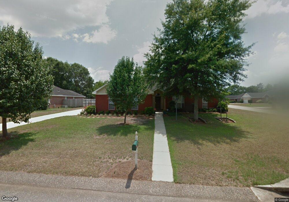
9623 Oak Forrest Place Mobile, AL 36695
Baker NeighborhoodEstimated Value: $211,485 - $250,000
3
Beds
2
Baths
1,625
Sq Ft
$146/Sq Ft
Est. Value
About This Home
This home is located at 9623 Oak Forrest Place, Mobile, AL 36695 and is currently estimated at $237,871, approximately $146 per square foot. 9623 Oak Forrest Place is a home located in Mobile County with nearby schools including Elsie Collier Elementary School, Bernice J Causey Middle School, and Baker High School.
Ownership History
Date
Name
Owned For
Owner Type
Purchase Details
Closed on
Sep 11, 2006
Sold by
Mcbryde Jennifer Joan
Bought by
Mcbryde Robert Andrew
Current Estimated Value
Purchase Details
Closed on
Dec 4, 1998
Sold by
John Howard Homes Ltd
Bought by
Mcbryde Robert Andrew and Mcbryde Jennifer Joan
Home Financials for this Owner
Home Financials are based on the most recent Mortgage that was taken out on this home.
Original Mortgage
$97,500
Interest Rate
6.84%
Create a Home Valuation Report for This Property
The Home Valuation Report is an in-depth analysis detailing your home's value as well as a comparison with similar homes in the area
Home Values in the Area
Average Home Value in this Area
Purchase History
| Date | Buyer | Sale Price | Title Company |
|---|---|---|---|
| Mcbryde Robert Andrew | -- | None Available | |
| Mcbryde Robert Andrew | -- | -- |
Source: Public Records
Mortgage History
| Date | Status | Borrower | Loan Amount |
|---|---|---|---|
| Previous Owner | Mcbryde Robert Andrew | $97,500 |
Source: Public Records
Tax History Compared to Growth
Tax History
| Year | Tax Paid | Tax Assessment Tax Assessment Total Assessment is a certain percentage of the fair market value that is determined by local assessors to be the total taxable value of land and additions on the property. | Land | Improvement |
|---|---|---|---|---|
| 2024 | $817 | $17,790 | $4,000 | $13,790 |
| 2023 | $748 | $17,110 | $4,000 | $13,110 |
| 2022 | $607 | $15,410 | $4,000 | $11,410 |
| 2021 | $590 | $15,010 | $4,000 | $11,010 |
| 2020 | $697 | $15,750 | $3,200 | $12,550 |
| 2019 | $697 | $15,760 | $0 | $0 |
| 2018 | $704 | $15,900 | $0 | $0 |
| 2017 | $695 | $14,260 | $0 | $0 |
| 2016 | $631 | $14,400 | $0 | $0 |
| 2013 | $716 | $15,280 | $0 | $0 |
Source: Public Records
Map
Nearby Homes
- 0 New Neck Rd Unit 387066
- 9556 Bridgeton Ct
- 9410 Ashwood Ct
- 9425 Yorktowne Way
- 860 Trailwood Dr E
- 11900 Airport Blvd
- 9751 Pine Knoll Rd
- 789 Royal Woods Dr W Unit 7
- 790 Hale Rd
- 1111 Valley View Ct
- 821 Copperfield Dr W
- 791 Copperfield Dr W
- 1235 Wakefield Dr E
- 750 Hale Rd
- 781 Copperfield Dr W
- 9721 Royal Woods Dr N
- 9841 Shadow Wood Dr
- 10153 Tarawood Ct
- 10164 Waterford Way
- 653 Begeman Rd
- 9613 Oak Forrest Place
- 9655 Oak Forrest Dr
- 9625 Oak Forrest Dr
- 9603 Oak Forrest Place
- 9650 Oak Forrest Dr
- 9640 Oak Forrest Dr
- 9660 Oak Forrest Dr
- 9620 Oak Forrest Place
- 9630 Oak Forrest Dr Unit 2
- 9630 Hanford Ct
- 9675 Oak Forrest Dr
- 9615 Oak Forrest Dr
- 9670 Oak Forrest Dr
- 9610 Oak Forrest Place
- 9640 Hanford Ct
- 9600 Oak Forrest Place
- 9620 Oak Forrest Dr
- 9620 Oak Forrest Dr
- 9685 Oak Forrest Dr
- 9605 Oak Forrest Dr