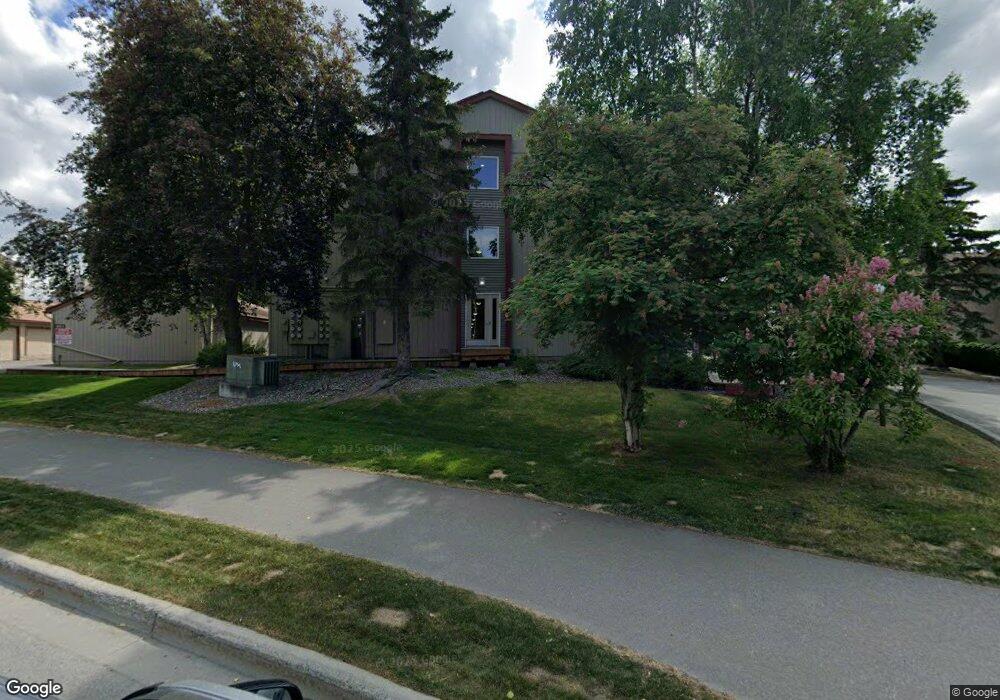
9625 Independence Dr Anchorage, AK 99507
Abbott Loop NeighborhoodEstimated Value: $82,000 - $156,685
1
Bed
1
Bath
501
Sq Ft
$261/Sq Ft
Est. Value
About This Home
This home is located at 9625 Independence Dr, Anchorage, AK 99507 and is currently estimated at $130,895, approximately $261 per square foot. 9625 Independence Dr is a home located in Anchorage Municipality with nearby schools including Spring Hill Elementary School, Hanshew Middle School, and Service High School.
Ownership History
Date
Name
Owned For
Owner Type
Purchase Details
Closed on
Sep 5, 2024
Sold by
Hansen Allen L and Hansen Diana L
Bought by
Campbell Kimberly
Current Estimated Value
Purchase Details
Closed on
Nov 23, 2016
Sold by
Henschel James S
Bought by
Hansen Allen L and Hansen Diana L
Home Financials for this Owner
Home Financials are based on the most recent Mortgage that was taken out on this home.
Original Mortgage
$78,000
Interest Rate
3.47%
Mortgage Type
New Conventional
Purchase Details
Closed on
Mar 21, 2013
Sold by
Southside Holdings Llc
Bought by
Henschel James S
Home Financials for this Owner
Home Financials are based on the most recent Mortgage that was taken out on this home.
Original Mortgage
$86,430
Interest Rate
3.49%
Mortgage Type
VA
Create a Home Valuation Report for This Property
The Home Valuation Report is an in-depth analysis detailing your home's value as well as a comparison with similar homes in the area
Home Values in the Area
Average Home Value in this Area
Purchase History
| Date | Buyer | Sale Price | Title Company |
|---|---|---|---|
| Campbell Kimberly | -- | First American Title | |
| Hansen Allen L | -- | Sta | |
| Henschel James S | -- | Stewart Title Company |
Source: Public Records
Mortgage History
| Date | Status | Borrower | Loan Amount |
|---|---|---|---|
| Previous Owner | Hansen Allen L | $78,000 | |
| Previous Owner | Henschel James S | $86,430 |
Source: Public Records
Tax History Compared to Growth
Tax History
| Year | Tax Paid | Tax Assessment Tax Assessment Total Assessment is a certain percentage of the fair market value that is determined by local assessors to be the total taxable value of land and additions on the property. | Land | Improvement |
|---|---|---|---|---|
| 2025 | $1,936 | $143,300 | -- | $143,300 |
| 2024 | $1,936 | $119,900 | $0 | $119,900 |
| 2023 | $1,800 | $105,700 | $0 | $105,700 |
| 2022 | $1,780 | $105,700 | $0 | $105,700 |
| 2021 | $1,773 | $98,400 | $0 | $98,400 |
| 2020 | $1,870 | $110,000 | $0 | $110,000 |
| 2019 | $1,644 | $100,500 | $0 | $100,500 |
| 2018 | $1,599 | $97,500 | $0 | $97,500 |
| 2017 | $1,577 | $100,700 | $0 | $100,700 |
| 2016 | $1,389 | $95,500 | $0 | $95,500 |
| 2015 | $1,389 | $87,400 | $0 | $87,400 |
| 2014 | $1,389 | $87,600 | $0 | $87,600 |
Source: Public Records
Map
Nearby Homes
- 9720 Vanguard Dr Unit 23
- 2310 Sentry Dr Unit 703
- 1917 Colony Place Unit 33
- 1905 Colony Place Unit 30
- 1914 Sturbridge Ct Unit 3
- 9321 Flintlock St
- 10211 Jamestown Dr Unit 303
- 10135 Nantucket Loop
- 10250 Jamestown Dr Unit B09
- 10175 Nantucket Loop
- 10260 Jamestown Dr Unit A8
- 10260 Jamestown Dr Unit A28
- 10260 Jamestown Dr Unit A14
- 10284 Valley Park Dr
- 9130 Golovin St
- 8000 Independence Park Dr
- 10300 Ridge Park Dr
- 9599 Brayton Dr Unit 422
- 1900-1941 Marthas Vineyard Cir
- 1611 Betula Cir
- 9625 Independence Dr
- 9625 Independence Dr
- 9625 Independence Dr
- 9625 Independence Dr
- 9625 Independence Dr
- 9625 Independence Dr
- 9625 Independence Dr
- 9625 Independence Dr
- 9625 Independence Dr
- 9625 Independence Dr
- 9625 Independence Dr
- 9625 Independence Dr
- 9625 Independence Dr
- 9625 Independence Dr
- 9625 Independence Dr
- 9625 Independence Dr
- 9625 Independence Dr
- 9625 Independence Dr
- 9625 Independence Dr
- 9625 Independence Dr