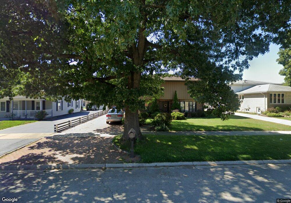
9626 Menard Ave Oak Lawn, IL 60453
Estimated Value: $356,000 - $420,000
3
Beds
2
Baths
2,248
Sq Ft
$172/Sq Ft
Est. Value
About This Home
This home is located at 9626 Menard Ave, Oak Lawn, IL 60453 and is currently estimated at $386,981, approximately $172 per square foot. 9626 Menard Ave is a home located in Cook County with nearby schools including Columbus Manor Elementary School, Simmons Middle School, and Oak Lawn Community High School.
Ownership History
Date
Name
Owned For
Owner Type
Purchase Details
Closed on
Jun 22, 1998
Sold by
Kasch Walter J and Kasch Dorothy J
Bought by
Kurnyta Andrzej and Kurnyta Magdalena
Current Estimated Value
Home Financials for this Owner
Home Financials are based on the most recent Mortgage that was taken out on this home.
Original Mortgage
$90,000
Outstanding Balance
$18,162
Interest Rate
7.15%
Estimated Equity
$368,819
Create a Home Valuation Report for This Property
The Home Valuation Report is an in-depth analysis detailing your home's value as well as a comparison with similar homes in the area
Home Values in the Area
Average Home Value in this Area
Purchase History
| Date | Buyer | Sale Price | Title Company |
|---|---|---|---|
| Kurnyta Andrzej | $157,000 | Professional National Title |
Source: Public Records
Mortgage History
| Date | Status | Borrower | Loan Amount |
|---|---|---|---|
| Open | Kurnyta Andrzej | $90,000 |
Source: Public Records
Tax History Compared to Growth
Tax History
| Year | Tax Paid | Tax Assessment Tax Assessment Total Assessment is a certain percentage of the fair market value that is determined by local assessors to be the total taxable value of land and additions on the property. | Land | Improvement |
|---|---|---|---|---|
| 2024 | $7,754 | $30,000 | $4,623 | $25,377 |
| 2023 | $7,249 | $30,000 | $4,623 | $25,377 |
| 2022 | $7,249 | $24,059 | $4,020 | $20,039 |
| 2021 | $7,055 | $24,059 | $4,020 | $20,039 |
| 2020 | $6,988 | $24,059 | $4,020 | $20,039 |
| 2019 | $6,495 | $23,434 | $3,618 | $19,816 |
| 2018 | $6,222 | $23,434 | $3,618 | $19,816 |
| 2017 | $6,329 | $23,434 | $3,618 | $19,816 |
| 2016 | $5,899 | $20,069 | $3,015 | $17,054 |
| 2015 | $5,812 | $20,069 | $3,015 | $17,054 |
| 2014 | $5,779 | $20,069 | $3,015 | $17,054 |
| 2013 | $5,315 | $20,302 | $3,015 | $17,287 |
Source: Public Records
Map
Nearby Homes
- 5810 W 97th St
- 9540 S Mayfield Ave Unit 103S
- 9520 S Mayfield Ave Unit N105
- 9542 Parkside Ave
- 9545 Southwest Hwy Unit 5
- 9609 S Austin Ave Unit 1E
- 9420 Massasoit Ave
- 9600 Central Ave
- 9624 W Shore Dr
- 9704 W Shore Dr
- 9712 W Shore Dr
- 9422 Central Ave
- 9714 Mcvicker Ave
- 10440 S Mayfield Ave Unit 1A
- 9935 Menard Ave
- 9807 Washington Ave
- 6120 W 98th St
- 9735 S 55th Ave
- 9429 S 55th Ave
- 5424 Franklin Ave
- 9616 Menard Ave
- 9630 Menard Ave
- 9612 Menard Ave
- 9638 Menard Ave
- 9627 Mansfield Ave
- 9619 Mansfield Ave
- 9635 Mansfield Ave
- 9610 Menard Ave
- 9639 Mansfield Ave
- 9613 Mansfield Ave
- 9623 Menard Ave
- 9619 Menard Ave
- 9629 Menard Ave
- 9658 Menard Ave
- 9613 Menard Ave
- 9609 Mansfield Ave
- 5814 W 97th St
- 9633 Menard Ave
- 9604 Menard Ave
- 9609 Menard Ave