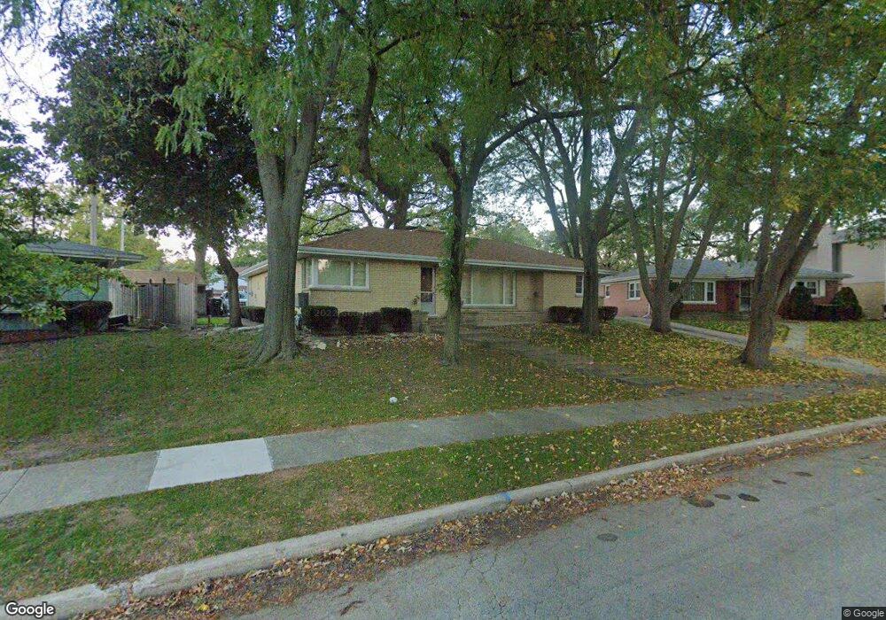
9626 W Shore Dr Oak Lawn, IL 60453
Estimated Value: $277,000 - $306,000
3
Beds
2
Baths
1,270
Sq Ft
$230/Sq Ft
Est. Value
About This Home
This home is located at 9626 W Shore Dr, Oak Lawn, IL 60453 and is currently estimated at $291,931, approximately $229 per square foot. 9626 W Shore Dr is a home located in Cook County with nearby schools including J Covington Elementary School, Sward Elementary School, and Hometown Elementary School.
Ownership History
Date
Name
Owned For
Owner Type
Purchase Details
Closed on
Jul 13, 2023
Sold by
Johnston-Carritano Family Living Trust
Bought by
Perez Martin and Perez Denise A
Current Estimated Value
Home Financials for this Owner
Home Financials are based on the most recent Mortgage that was taken out on this home.
Original Mortgage
$6,000
Interest Rate
6.71%
Mortgage Type
New Conventional
Purchase Details
Closed on
Mar 5, 2021
Sold by
Garritano Barbara and Johnston James M
Bought by
Johnston James M and Garritano Barbara L
Create a Home Valuation Report for This Property
The Home Valuation Report is an in-depth analysis detailing your home's value as well as a comparison with similar homes in the area
Home Values in the Area
Average Home Value in this Area
Purchase History
| Date | Buyer | Sale Price | Title Company |
|---|---|---|---|
| Perez Martin | $236,000 | None Listed On Document | |
| Johnston James M | -- | Attorney |
Source: Public Records
Mortgage History
| Date | Status | Borrower | Loan Amount |
|---|---|---|---|
| Closed | Perez Martin | $6,000 | |
| Open | Perez Martin | $212,400 |
Source: Public Records
Tax History Compared to Growth
Tax History
| Year | Tax Paid | Tax Assessment Tax Assessment Total Assessment is a certain percentage of the fair market value that is determined by local assessors to be the total taxable value of land and additions on the property. | Land | Improvement |
|---|---|---|---|---|
| 2024 | $3,195 | $13,431 | $2,389 | $11,042 |
| 2023 | $2,034 | $13,431 | $2,389 | $11,042 |
| 2022 | $2,034 | $8,449 | $2,091 | $6,358 |
| 2021 | $2,019 | $8,447 | $2,090 | $6,357 |
| 2020 | $2,053 | $8,447 | $2,090 | $6,357 |
| 2019 | $2,261 | $9,321 | $1,891 | $7,430 |
| 2018 | $2,173 | $9,321 | $1,891 | $7,430 |
| 2017 | $2,196 | $9,321 | $1,891 | $7,430 |
| 2016 | $2,139 | $7,980 | $1,592 | $6,388 |
| 2015 | $2,077 | $7,980 | $1,592 | $6,388 |
| 2014 | $2,070 | $7,980 | $1,592 | $6,388 |
| 2013 | $2,171 | $9,000 | $1,592 | $7,408 |
Source: Public Records
Map
Nearby Homes
- 9624 W Shore Dr
- 9704 W Shore Dr
- 9600 Central Ave
- 9712 W Shore Dr
- 9542 Parkside Ave
- 5424 Franklin Ave
- 9735 S 55th Ave
- 9807 Washington Ave
- 5368 W 96th St Unit 2S
- 9422 Central Ave
- 9429 S 55th Ave
- 5810 W 97th St
- 9828 Warren Ave
- 9420 Massasoit Ave
- 9535 S 53rd Ave Unit 3S
- 9520 S Mayfield Ave Unit N105
- 9540 S Mayfield Ave Unit 103S
- 9706 S 52nd Ave
- 9239 S 55th Ct
- 10440 S Mayfield Ave Unit 1A
- 9626 W Shore Dr
- 9622 W Shore Dr
- 9630 W Shore Dr
- 9630 W Shore Dr
- 9618 W Shore Dr
- 9619 Central Ave
- 9632 Central Ave
- 9636 Central Ave
- 9628 Central Ave
- 9640 Central Ave
- 9620 Central Ave
- 9640 W Shore Dr
- 9616 Central Ave
- 9614 W Shore Dr
- 9646 Central Ave
- 9606 Central Ave
- 5569 W 96th St
- 5565 W 96th St
- 9700 W Shore Dr