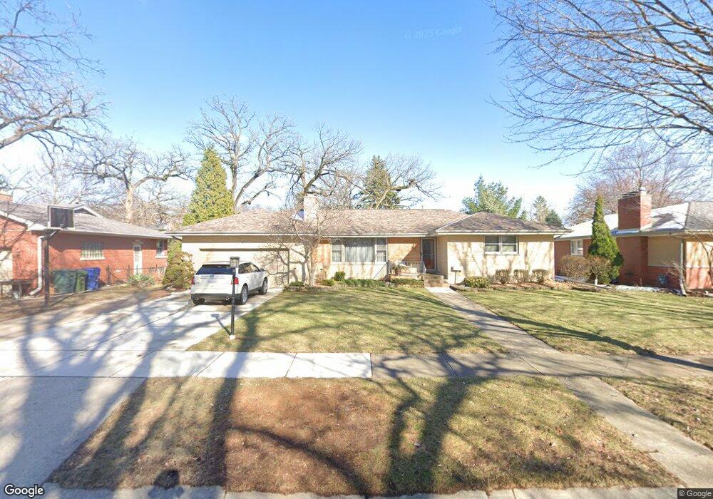
9627 Major Ave Oak Lawn, IL 60453
Estimated Value: $338,000 - $372,000
4
Beds
3
Baths
1,595
Sq Ft
$223/Sq Ft
Est. Value
About This Home
This home is located at 9627 Major Ave, Oak Lawn, IL 60453 and is currently estimated at $356,457, approximately $223 per square foot. 9627 Major Ave is a home located in Cook County with nearby schools including Columbus Manor Elementary School, Simmons Middle School, and Oak Lawn Community High School.
Ownership History
Date
Name
Owned For
Owner Type
Purchase Details
Closed on
Mar 9, 2022
Sold by
Gilligan Gerald C and Gilligan Denise M
Bought by
Denise M Gilligan Trust
Current Estimated Value
Purchase Details
Closed on
Nov 13, 1996
Sold by
First National Bank Of Evergreen
Bought by
Gilligan Gerald C and Gilligan Denise M
Home Financials for this Owner
Home Financials are based on the most recent Mortgage that was taken out on this home.
Original Mortgage
$90,000
Interest Rate
7.94%
Create a Home Valuation Report for This Property
The Home Valuation Report is an in-depth analysis detailing your home's value as well as a comparison with similar homes in the area
Home Values in the Area
Average Home Value in this Area
Purchase History
| Date | Buyer | Sale Price | Title Company |
|---|---|---|---|
| Denise M Gilligan Trust | -- | None Listed On Document | |
| Gilligan Gerald C | $186,000 | -- |
Source: Public Records
Mortgage History
| Date | Status | Borrower | Loan Amount |
|---|---|---|---|
| Previous Owner | Gilligan Gerald C | $90,000 |
Source: Public Records
Tax History Compared to Growth
Tax History
| Year | Tax Paid | Tax Assessment Tax Assessment Total Assessment is a certain percentage of the fair market value that is determined by local assessors to be the total taxable value of land and additions on the property. | Land | Improvement |
|---|---|---|---|---|
| 2024 | $7,463 | $29,000 | $6,592 | $22,408 |
| 2023 | $6,378 | $29,000 | $6,592 | $22,408 |
| 2022 | $6,378 | $21,582 | $5,733 | $15,849 |
| 2021 | $6,211 | $21,580 | $5,732 | $15,848 |
| 2020 | $6,162 | $21,580 | $5,732 | $15,848 |
| 2019 | $6,375 | $23,065 | $5,159 | $17,906 |
| 2018 | $6,107 | $23,065 | $5,159 | $17,906 |
| 2017 | $6,213 | $23,065 | $5,159 | $17,906 |
| 2016 | $4,835 | $16,900 | $4,299 | $12,601 |
| 2015 | $5,670 | $19,642 | $4,299 | $15,343 |
| 2014 | $5,638 | $19,642 | $4,299 | $15,343 |
| 2013 | $5,931 | $22,350 | $4,299 | $18,051 |
Source: Public Records
Map
Nearby Homes
- 9542 Parkside Ave
- 9600 Central Ave
- 9624 W Shore Dr
- 9704 W Shore Dr
- 9712 W Shore Dr
- 5810 W 97th St
- 9807 Washington Ave
- 9422 Central Ave
- 9420 Massasoit Ave
- 9735 S 55th Ave
- 5424 Franklin Ave
- 9520 S Mayfield Ave Unit N105
- 9540 S Mayfield Ave Unit 103S
- 9429 S 55th Ave
- 5368 W 96th St Unit 2S
- 9828 Warren Ave
- 9609 S Austin Ave Unit 1E
- 9545 Southwest Hwy Unit 5
- 10440 S Mayfield Ave Unit 1A
- 9814 Austin Ave
- 9637 Major Ave
- 9619 Major Ave
- 9626 Parkside Ave
- 9636 Parkside Ave
- 9641 Major Ave
- 9613 Major Ave
- 5646 W 97th St
- 9616 Parkside Ave
- 9645 Major Ave
- 9626 Major Ave
- 9638 Major Ave
- 9646 Parkside Ave
- 9640 Major Ave
- 9618 Major Ave
- 9607 Major Ave
- 9610 Major Ave
- 9606 Parkside Ave
- 9625 Parkside Ave
- 9601 Major Ave