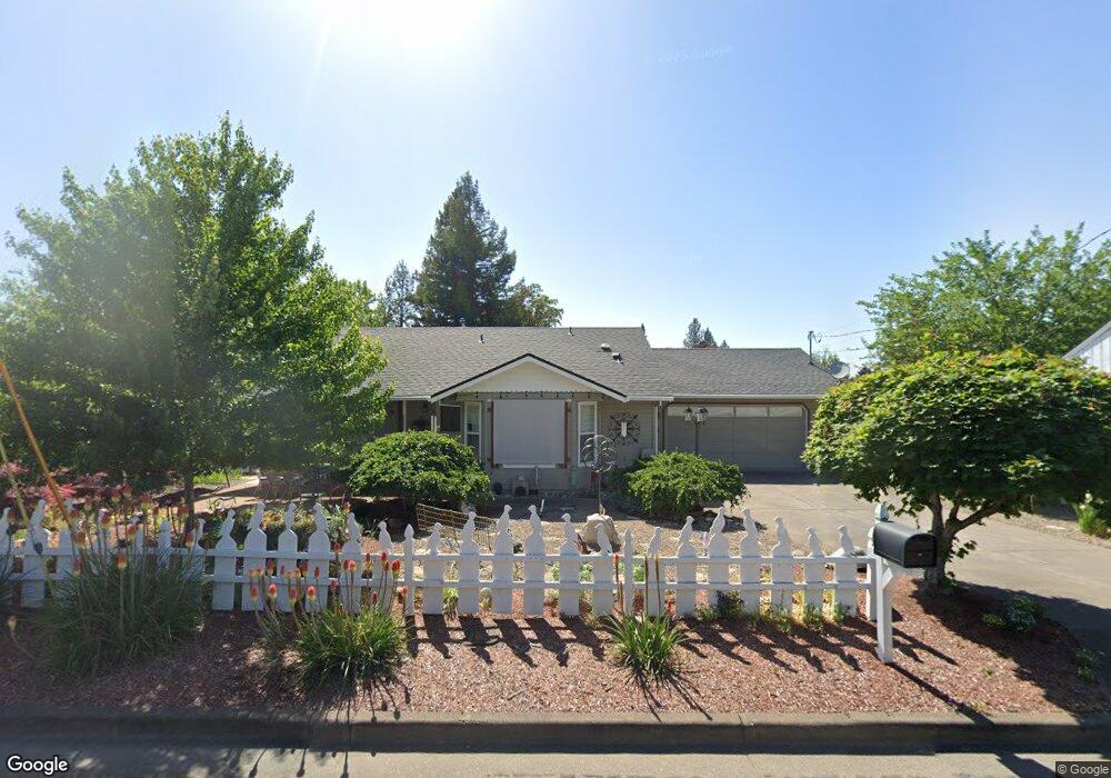
963 Brookdale Ave Medford, OR 97504
Estimated Value: $360,979 - $396,000
2
Beds
2
Baths
1,298
Sq Ft
$294/Sq Ft
Est. Value
About This Home
This home is located at 963 Brookdale Ave, Medford, OR 97504 and is currently estimated at $382,245, approximately $294 per square foot. 963 Brookdale Ave is a home located in Jackson County with nearby schools including Lone Pine Elementary School, Hedrick Middle School, and North Medford High School.
Ownership History
Date
Name
Owned For
Owner Type
Purchase Details
Closed on
Dec 13, 2010
Sold by
Prosper Stephen Anthony
Bought by
Prosper Stephen Anthony and Prosper Margaret
Current Estimated Value
Purchase Details
Closed on
Feb 17, 2009
Sold by
Franzen Paul Edward and Franzen John Jeffry
Bought by
Prosper Stephen A
Home Financials for this Owner
Home Financials are based on the most recent Mortgage that was taken out on this home.
Original Mortgage
$140,000
Outstanding Balance
$87,594
Interest Rate
4.91%
Mortgage Type
Purchase Money Mortgage
Estimated Equity
$294,651
Create a Home Valuation Report for This Property
The Home Valuation Report is an in-depth analysis detailing your home's value as well as a comparison with similar homes in the area
Home Values in the Area
Average Home Value in this Area
Purchase History
| Date | Buyer | Sale Price | Title Company |
|---|---|---|---|
| Prosper Stephen Anthony | -- | None Available | |
| Prosper Stephen A | $175,000 | Ticor Title |
Source: Public Records
Mortgage History
| Date | Status | Borrower | Loan Amount |
|---|---|---|---|
| Open | Prosper Stephen A | $140,000 |
Source: Public Records
Tax History Compared to Growth
Tax History
| Year | Tax Paid | Tax Assessment Tax Assessment Total Assessment is a certain percentage of the fair market value that is determined by local assessors to be the total taxable value of land and additions on the property. | Land | Improvement |
|---|---|---|---|---|
| 2025 | $3,179 | $219,190 | $119,850 | $99,340 |
| 2024 | $3,179 | $212,810 | $116,360 | $96,450 |
| 2023 | $3,082 | $206,620 | $112,970 | $93,650 |
| 2022 | $3,006 | $206,620 | $112,970 | $93,650 |
| 2021 | $2,929 | $200,610 | $109,680 | $90,930 |
| 2020 | $2,867 | $194,770 | $106,480 | $88,290 |
| 2019 | $2,799 | $183,600 | $100,360 | $83,240 |
| 2018 | $2,727 | $178,260 | $97,440 | $80,820 |
| 2017 | $2,678 | $178,260 | $97,440 | $80,820 |
| 2016 | $2,696 | $168,030 | $91,850 | $76,180 |
| 2015 | $2,591 | $168,030 | $91,850 | $76,180 |
| 2014 | $2,546 | $158,390 | $86,570 | $71,820 |
Source: Public Records
Map
Nearby Homes
- 2327 Derry Ct
- 1089 Brookdale Ave
- 721 Brookdale Ave
- 1277 Gardendale Ave
- 451 S Stoneham Cir
- 1224 N Modoc Ave Unit 57
- 1460 Brookdale Ave
- 1501 Brookdale Ave
- 2500 Capital Ave
- 2020 Ridge Way
- 1258 Paulita Dr
- 889 Valley View Dr
- 1569 Papago Dr
- 1759 Carrera Cir
- 91 Black Oak Dr
- 1813 Cascadia Cir
- 3228 Auburn Way
- 1928 Hannah Ln
- 1841 Cascadia Cir
- 1560 Cambridge Cir
- 2394 Spring St
- 945 Brookdale Ave
- 2370 Spring St
- 2333 Derry Ct
- 2412 Spring St
- 944 Brookdale Ave
- 937 Brookdale Ave
- 2343 Derry Ct
- 2360 Spring St
- 936 Brookdale Ave
- 1011 Brookdale Ave
- 2344 Derry Ct
- 2391 Spring St
- 927 Brookdale Ave
- 2424 Spring St
- 2433 Spring St
- 2357 Spring St
- 2405 Spring St Unit 1
- 2319 Derry Ct
- 934 Brookdale Ave