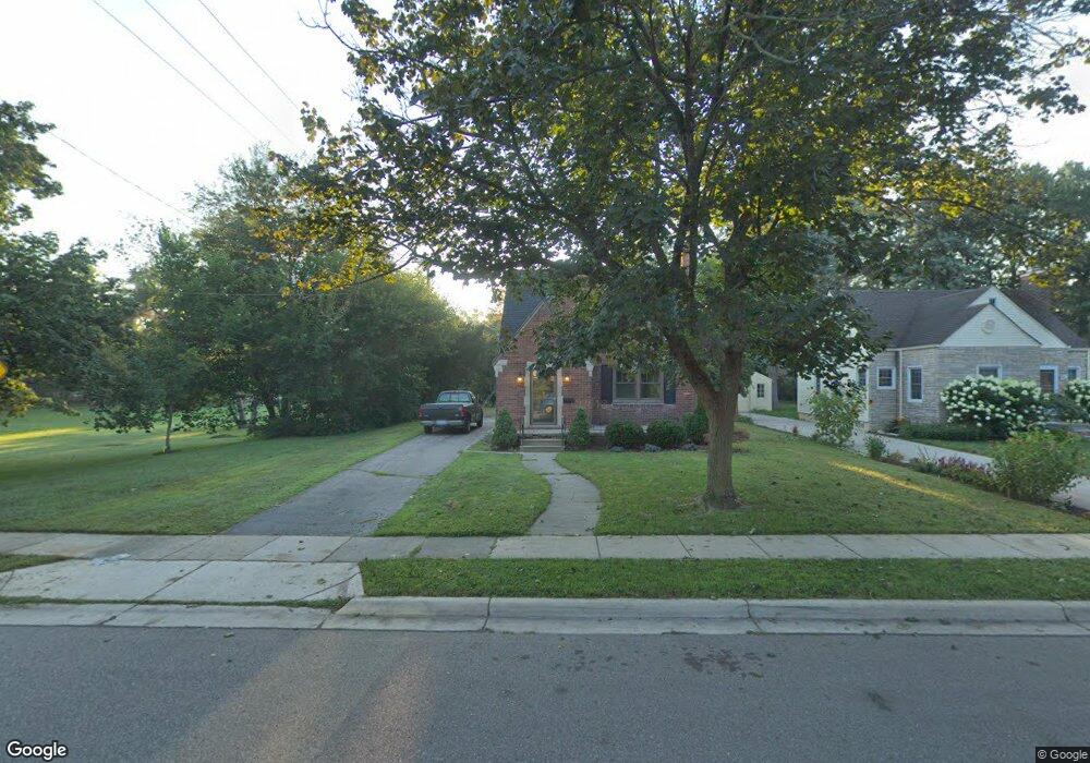
963 Harding St Plymouth, MI 48170
Estimated Value: $476,000 - $781,792
3
Beds
2
Baths
1,459
Sq Ft
$449/Sq Ft
Est. Value
About This Home
This home is located at 963 Harding St, Plymouth, MI 48170 and is currently estimated at $655,198, approximately $449 per square foot. 963 Harding St is a home located in Wayne County with nearby schools including Canton High School, Smith Elementary School, and East Middle School.
Ownership History
Date
Name
Owned For
Owner Type
Purchase Details
Closed on
Oct 26, 2018
Sold by
Wilcox Brandon
Bought by
Wilcox Brandon and Wilcox Brooke
Current Estimated Value
Home Financials for this Owner
Home Financials are based on the most recent Mortgage that was taken out on this home.
Original Mortgage
$450,000
Outstanding Balance
$394,058
Interest Rate
4.6%
Mortgage Type
New Conventional
Estimated Equity
$261,140
Purchase Details
Closed on
Feb 8, 2011
Sold by
Ducharme Louise and Yoe Timothy C
Bought by
Wilcox Brandon
Create a Home Valuation Report for This Property
The Home Valuation Report is an in-depth analysis detailing your home's value as well as a comparison with similar homes in the area
Home Values in the Area
Average Home Value in this Area
Purchase History
| Date | Buyer | Sale Price | Title Company |
|---|---|---|---|
| Wilcox Brandon | -- | None Available | |
| Wilcox Brandon | $187,000 | Minnesota Title Agency |
Source: Public Records
Mortgage History
| Date | Status | Borrower | Loan Amount |
|---|---|---|---|
| Open | Wilcox Brandon | $450,000 |
Source: Public Records
Tax History Compared to Growth
Tax History
| Year | Tax Paid | Tax Assessment Tax Assessment Total Assessment is a certain percentage of the fair market value that is determined by local assessors to be the total taxable value of land and additions on the property. | Land | Improvement |
|---|---|---|---|---|
| 2025 | $8,437 | $344,500 | $0 | $0 |
| 2024 | $8,437 | $347,500 | $0 | $0 |
| 2023 | $8,218 | $328,800 | $0 | $0 |
| 2022 | $8,711 | $292,600 | $0 | $0 |
| 2021 | $8,441 | $283,600 | $0 | $0 |
| 2020 | $7,377 | $251,100 | $0 | $0 |
| 2019 | $5,955 | $219,600 | $0 | $0 |
| 2018 | $4,419 | $167,900 | $0 | $0 |
| 2017 | $936 | $160,700 | $0 | $0 |
| 2016 | $4,814 | $165,500 | $0 | $0 |
| 2015 | $11,027 | $144,770 | $0 | $0 |
| 2013 | $10,682 | $110,730 | $0 | $0 |
| 2011 | -- | $110,290 | $0 | $0 |
Source: Public Records
Map
Nearby Homes
- 775 Deer Ct Unit 104
- 685 Ross St
- 844 Ross St
- 543 Deer St
- 278 Maple St
- 256 Maple St
- 628 Maple St
- 644 Maple St
- 636 Maple St
- 525 W Ann Arbor Trail
- 660 Maple St
- 668 Maple St
- 381 Hamilton St
- 221 Pinewood Cir Unit 25
- 1125 Sutherland St
- 1338 S Harvey St
- 1078 Simpson St
- 638 S Harvey St
- 300 Hamilton St Unit 201
- 300 Hamilton St Unit 306
- 985 Harding St
- 1007 Harding St
- 1029 Harding St
- 964 Coolidge St
- 986 Coolidge St
- 607 Burroughs St
- 1008 Coolidge St
- 1051 Harding St
- 986 Harding St
- 1008 Harding St
- 627 Burroughs St
- 1030 Coolidge St
- 1030 Harding St
- 964 Harding St
- 1052 Coolidge St
- 643 Burroughs St
- 1052 Harding St
- 560 Hartsough St
- 526 Hartsough St
- 508 Hartsough St