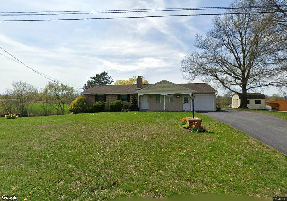
963 Leid Rd East Earl, PA 17519
Estimated Value: $363,000 - $557,000
3
Beds
1
Bath
1,748
Sq Ft
$275/Sq Ft
Est. Value
About This Home
This home is located at 963 Leid Rd, East Earl, PA 17519 and is currently estimated at $481,318, approximately $275 per square foot. 963 Leid Rd is a home located in Lancaster County with nearby schools including Garden Spot Middle School and Garden Spot Senior High School.
Ownership History
Date
Name
Owned For
Owner Type
Purchase Details
Closed on
Sep 12, 2024
Sold by
Martin Ruth Ann and Glen H Weaver And Ruth Ann Weaver Family
Bought by
Martin Waylon
Current Estimated Value
Home Financials for this Owner
Home Financials are based on the most recent Mortgage that was taken out on this home.
Original Mortgage
$265,000
Outstanding Balance
$260,746
Interest Rate
6.73%
Mortgage Type
New Conventional
Estimated Equity
$220,572
Create a Home Valuation Report for This Property
The Home Valuation Report is an in-depth analysis detailing your home's value as well as a comparison with similar homes in the area
Home Values in the Area
Average Home Value in this Area
Purchase History
| Date | Buyer | Sale Price | Title Company |
|---|---|---|---|
| Martin Waylon | $510,000 | None Listed On Document |
Source: Public Records
Mortgage History
| Date | Status | Borrower | Loan Amount |
|---|---|---|---|
| Open | Martin Waylon | $265,000 |
Source: Public Records
Tax History Compared to Growth
Tax History
| Year | Tax Paid | Tax Assessment Tax Assessment Total Assessment is a certain percentage of the fair market value that is determined by local assessors to be the total taxable value of land and additions on the property. | Land | Improvement |
|---|---|---|---|---|
| 2025 | $3,156 | $187,800 | $86,900 | $100,900 |
| 2024 | $3,156 | $183,400 | $86,900 | $96,500 |
| 2023 | $3,092 | $183,400 | $86,900 | $96,500 |
| 2022 | $3,038 | $183,400 | $86,900 | $96,500 |
| 2021 | $2,886 | $183,400 | $86,900 | $96,500 |
| 2020 | $2,886 | $183,400 | $86,900 | $96,500 |
| 2019 | $2,852 | $183,400 | $86,900 | $96,500 |
| 2018 | $4,543 | $183,400 | $86,900 | $96,500 |
| 2017 | $2,720 | $142,800 | $50,200 | $92,600 |
| 2016 | $2,719 | $142,800 | $50,200 | $92,600 |
| 2015 | $572 | $142,800 | $50,200 | $92,600 |
| 2014 | $2,058 | $142,800 | $50,200 | $92,600 |
Source: Public Records
Map
Nearby Homes
- 534 High Point Dr
- 602 Greenview Dr
- 111 Oatfield Dr
- 133 Millstone Dr
- 420 Linden St
- 412 Linden St
- 55 Hawk Valley Ln
- 117 Hawk Valley Ln Unit 105
- 114 Hawk Valley Ln Unit 104
- 154 W Maple Grove Rd
- 101 Hawk Valley Ln
- 32 Hawk Valley Ln
- 01 W Valley Rd
- 1328 Union Grove Rd
- 103 Lynwood Dr
- 208 New St
- Bridgemont Plan at Hawk Valley Estates
- Sullivan Plan at Hawk Valley Estates
- Silverbrooke Plan at Hawk Valley Estates
- Wesley Plan at Hawk Valley Estates
- 951 Leid Rd
- 342 Pleasant Valley Rd
- 332 Pleasant Valley Rd
- 373 Long Ln
- 407 Pleasant Valley Rd
- 1016 Messner Ln
- 1029 Messner Ln
- 430 Pleasant Valley Rd
- 265 Spook Ln
- 1031 Messner Ln
- 1047 Messner Ln
- 268 Pleasant Valley Rd
- 264 Pleasant Valley Rd
- 109 Sunset Dr
- 107 Sunset Dr
- 110 Sunset Dr
- 105 Sunset Dr
- 108 Sunset Dr
- 846 Leid Rd
- 103 Sunset Dr