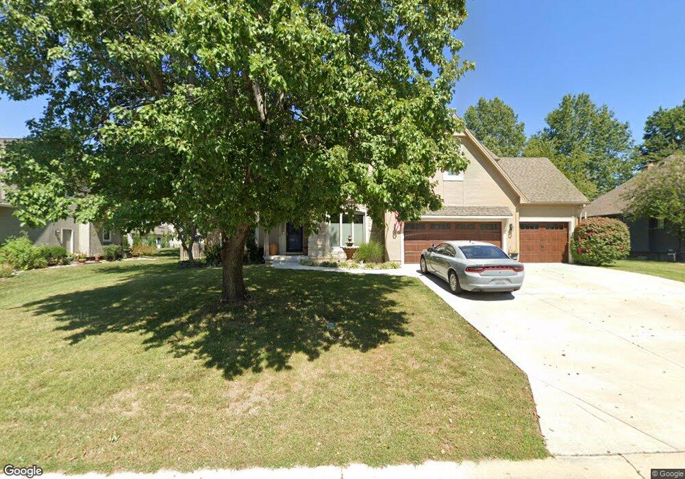
963 NW High Point Dr Lees Summit, MO 64081
Estimated Value: $446,000 - $520,000
4
Beds
3
Baths
2,776
Sq Ft
$175/Sq Ft
Est. Value
About This Home
This home is located at 963 NW High Point Dr, Lees Summit, MO 64081 and is currently estimated at $486,576, approximately $175 per square foot. 963 NW High Point Dr is a home located in Jackson County with nearby schools including Cedar Creek Elementary School, Bernard C. Campbell Middle School, and Lee's Summit North High School.
Ownership History
Date
Name
Owned For
Owner Type
Purchase Details
Closed on
Apr 13, 2010
Sold by
Dietrick Wendy L and Dietrick Joseph M
Bought by
Poletis Kris R and Poletis Karen C
Current Estimated Value
Purchase Details
Closed on
Nov 5, 2001
Sold by
Keller Daniel G and Keller Joyce E
Bought by
Sarff Bryan A and Sarff Laura R
Home Financials for this Owner
Home Financials are based on the most recent Mortgage that was taken out on this home.
Original Mortgage
$220,875
Interest Rate
7.15%
Mortgage Type
Purchase Money Mortgage
Purchase Details
Closed on
Sep 12, 1996
Sold by
Olinger Curtis K and Olinger Lisa E
Bought by
Whiting Jeffrey A and Whiting Carolyn J
Home Financials for this Owner
Home Financials are based on the most recent Mortgage that was taken out on this home.
Original Mortgage
$152,000
Interest Rate
5.75%
Mortgage Type
Purchase Money Mortgage
Create a Home Valuation Report for This Property
The Home Valuation Report is an in-depth analysis detailing your home's value as well as a comparison with similar homes in the area
Home Values in the Area
Average Home Value in this Area
Purchase History
| Date | Buyer | Sale Price | Title Company |
|---|---|---|---|
| Poletis Kris R | -- | Chicago Title | |
| Sarff Bryan A | -- | Chicago Title Co | |
| Whiting Jeffrey A | -- | Chicago Title Insurance Co |
Source: Public Records
Mortgage History
| Date | Status | Borrower | Loan Amount |
|---|---|---|---|
| Previous Owner | Sarff Bryan A | $220,875 | |
| Previous Owner | Whiting Jeffrey A | $152,000 |
Source: Public Records
Tax History
| Year | Tax Paid | Tax Assessment Tax Assessment Total Assessment is a certain percentage of the fair market value that is determined by local assessors to be the total taxable value of land and additions on the property. | Land | Improvement |
|---|---|---|---|---|
| 2025 | $5,672 | $79,151 | $13,591 | $65,560 |
| 2024 | $5,672 | $78,557 | $9,196 | $69,361 |
| 2023 | $5,631 | $78,557 | $9,196 | $69,361 |
| 2022 | $4,831 | $59,850 | $7,010 | $52,840 |
| 2021 | $4,931 | $59,850 | $7,010 | $52,840 |
| 2020 | $4,983 | $59,880 | $7,010 | $52,870 |
| 2019 | $4,846 | $59,880 | $7,010 | $52,870 |
| 2018 | $4,545 | $52,115 | $6,101 | $46,014 |
| 2017 | $4,545 | $52,115 | $6,101 | $46,014 |
| 2016 | $4,480 | $50,844 | $6,365 | $44,479 |
| 2014 | $4,080 | $45,387 | $6,371 | $39,016 |
Source: Public Records
Map
Nearby Homes
- 2430 NW Windwood Dr
- 507 NW Ashurst Ct
- 2224 NW Summerfield Dr
- 13004 E 99th St
- 2635 NW Ashurst Ln
- 334 NW Ambersham Dr
- 321 NW Nutall Dr
- 336 NW Thoreau Cir
- 10401 View High Dr
- 2809 NW Audubon Ln
- 2122 NW Ashurst Dr
- 2110 NW Ashurst Dr
- 317 NW Lovins
- 316 NW Lovins
- 320 NW Lovins
- 321 NW Lovins
- 433 NW Kaylea Ct
- 321 NW Earle Ln
- 3104 NW Berkebile Ln
- 12400 E Bannister Rd
- 959 NW High Point Dr
- 967 NW High Point Dr
- 960 NW High Point Dr
- 964 NW High Point Dr
- 968 NW High Point Dr
- 956 NW High Point Dr
- 1009 NW High Point Dr
- 1015 NW High Point Dr
- 1001 NW High Point Dr
- 951 NW High Point Dr
- 972 NW High Point Dr
- 952 NW High Point Dr
- 1021 NW High Point Dr
- 976 NW High Point Dr
- 1008 NW High Point Dr
- 1027 NW High Point Dr
- 947 NW High Point Dr
- 1012 NW High Point Dr
- 1016 NW High Point Dr
- 1004 NW High Point Dr
Your Personal Tour Guide
Ask me questions while you tour the home.