Estimated Value: $552,000 - $586,549
4
Beds
3
Baths
2,756
Sq Ft
$207/Sq Ft
Est. Value
About This Home
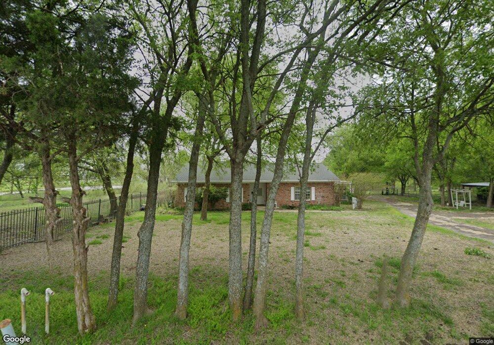
This home is located at 963 Ponderosa Rd, Howe, TX 75459 and is currently estimated at $569,275, approximately $206 per square foot. 963 Ponderosa Rd is a home located in Grayson County with nearby schools including Summit Hill Elementary School, Howe Middle School, and Howe High School.
Ownership History
Date
Name
Owned For
Owner Type
Purchase Details
Closed on
May 19, 2023
Sold by
Hurst Andrea Kent
Bought by
Andrea Kent Hurst Revocable Trust and Hurst
Current Estimated Value
Purchase Details
Closed on
Apr 29, 2005
Sold by
Medford James D
Bought by
Hurst John D and Hurst Andrea Kent
Home Financials for this Owner
Home Financials are based on the most recent Mortgage that was taken out on this home.
Original Mortgage
$157,000
Interest Rate
5.93%
Mortgage Type
Fannie Mae Freddie Mac
Create a Home Valuation Report for This Property
The Home Valuation Report is an in-depth analysis detailing your home's value as well as a comparison with similar homes in the area
Home Values in the Area
Average Home Value in this Area
Purchase History
| Date | Buyer | Sale Price | Title Company |
|---|---|---|---|
| Andrea Kent Hurst Revocable Trust | -- | None Listed On Document | |
| Hurst John D | -- | -- |
Source: Public Records
Mortgage History
| Date | Status | Borrower | Loan Amount |
|---|---|---|---|
| Previous Owner | Hurst John D | $157,000 |
Source: Public Records
Tax History Compared to Growth
Tax History
| Year | Tax Paid | Tax Assessment Tax Assessment Total Assessment is a certain percentage of the fair market value that is determined by local assessors to be the total taxable value of land and additions on the property. | Land | Improvement |
|---|---|---|---|---|
| 2025 | $916 | $514,460 | -- | -- |
| 2024 | $7,014 | $467,691 | $0 | $0 |
| 2023 | $914 | $425,174 | $0 | $0 |
| 2022 | $6,671 | $386,522 | $0 | $0 |
| 2021 | $6,826 | $375,864 | $89,688 | $286,176 |
| 2020 | $6,488 | $365,407 | $87,894 | $277,513 |
| 2019 | $6,315 | $363,444 | $67,650 | $295,794 |
| 2018 | $5,392 | $341,742 | $53,300 | $288,442 |
| 2017 | $4,959 | $240,000 | $44,588 | $195,412 |
| 2016 | $4,584 | $240,000 | $44,588 | $195,412 |
| 2015 | $3,089 | $244,657 | $43,313 | $201,344 |
| 2014 | $2,999 | $181,979 | $32,625 | $149,354 |
Source: Public Records
Map
Nearby Homes
- Tract One Ponderosa Rd
- 502 Ponderosa Rd
- LOT 3 Ponderosa Rd
- LOT 2 Ponderosa Rd
- 1206 E Fm 902
- 1210 E Fm 902
- 0000 Farm To Market 902
- TBD Farm To Market 902
- TBD Lot 6 Farm To Market 902
- TBD Lot 5 Farm To Market 902
- TBD Lot 3 Farm To Market 902
- TBD Lot 2 Farm To Market 902
- 1214 Farm To Market 902
- 999 E Fm 902
- 341 Stark Ln
- 516 Stark Ln
- 0001 Farm To Market 902
- 818 N Hughes St
- 718 N Denny St
- 391 Bennett Rd
- Ponderosa RD Ponderosa Rd
- 784 Ponderosa Rd
- 714 Ponderosa Rd
- 704 Ponderosa Rd
- 670 Ponderosa Rd
- 634 Ponderosa Rd
- 552 Ponderosa Rd
- 574 Ponderosa Rd
- 600 Ponderosa Rd
- 482 Ponderosa Rd
- 1111 E Fm 902
- 1111 Hwy 902
- 1016 E Fm 902
- 1014 E Fm 902
- 182 Stark Ln
- 1010 E Fm 902
- 104 Stark Ln
- 1018 Farm To Market 902
- 1102 Farm To Market 902
- 20 Stark Ln