Estimated Value: $327,000 - $349,000
4
Beds
3
Baths
2,120
Sq Ft
$158/Sq Ft
Est. Value
About This Home
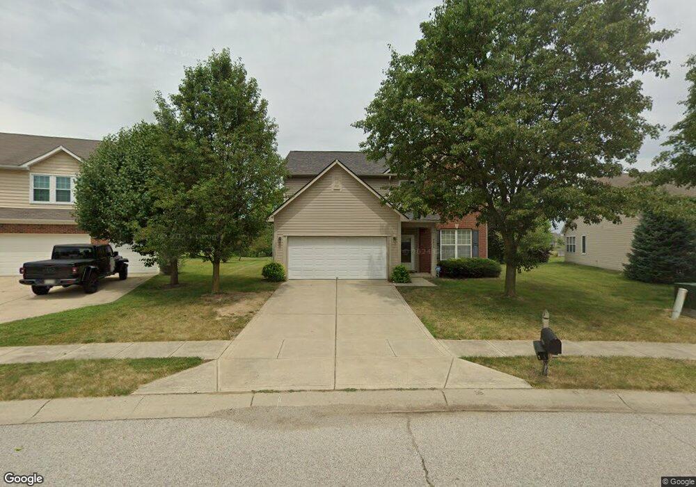
This home is located at 9634 Lomax Dr, Avon, IN 46123 and is currently estimated at $334,918, approximately $157 per square foot. 9634 Lomax Dr is a home located in Hendricks County with nearby schools including Maple Elementary School, White Oak Elementary School, and Avon Middle School North.
Ownership History
Date
Name
Owned For
Owner Type
Purchase Details
Closed on
Mar 24, 2006
Sold by
Beazer Homes Indiana Llp
Bought by
Carter Charnell Y and Carter Myron D
Current Estimated Value
Home Financials for this Owner
Home Financials are based on the most recent Mortgage that was taken out on this home.
Original Mortgage
$152,970
Outstanding Balance
$96,327
Interest Rate
8.6%
Mortgage Type
Adjustable Rate Mortgage/ARM
Estimated Equity
$238,591
Create a Home Valuation Report for This Property
The Home Valuation Report is an in-depth analysis detailing your home's value as well as a comparison with similar homes in the area
Home Values in the Area
Average Home Value in this Area
Purchase History
| Date | Buyer | Sale Price | Title Company |
|---|---|---|---|
| Carter Charnell Y | -- | None Available |
Source: Public Records
Mortgage History
| Date | Status | Borrower | Loan Amount |
|---|---|---|---|
| Open | Carter Charnell Y | $152,970 |
Source: Public Records
Tax History
| Year | Tax Paid | Tax Assessment Tax Assessment Total Assessment is a certain percentage of the fair market value that is determined by local assessors to be the total taxable value of land and additions on the property. | Land | Improvement |
|---|---|---|---|---|
| 2025 | $3,007 | $311,900 | $42,800 | $269,100 |
| 2024 | $3,007 | $307,000 | $42,800 | $264,200 |
| 2023 | $2,593 | $269,700 | $37,200 | $232,500 |
| 2022 | $2,637 | $259,000 | $35,400 | $223,600 |
| 2021 | $1,780 | $195,100 | $33,700 | $161,400 |
| 2020 | $1,483 | $182,200 | $33,700 | $148,500 |
| 2019 | $1,320 | $171,900 | $31,800 | $140,100 |
| 2018 | $1,450 | $166,700 | $31,800 | $134,900 |
| 2017 | $1,070 | $158,300 | $30,300 | $128,000 |
| 2016 | $1,062 | $154,400 | $30,300 | $124,100 |
| 2014 | $848 | $139,700 | $27,800 | $111,900 |
Source: Public Records
Map
Nearby Homes
- 9663 Stonewall Ln
- 883 Hollowood Ln
- 781 Hollowood Ln
- 9847 Kenwood St
- 1245 Newton St
- 575 Corbin Way
- 542 Dalton Way
- 571 Corbin Way
- 9605 Beckett St
- 539 Corbin Way
- 9586 Beckett St
- 9991 Ellsworth Ln
- 825 Stone Trace Ct
- 9652 Beckett St
- 745 Stone Trace Ct
- 1244 Sunset Blvd
- 721 Stone Trace Ct
- 9681 Crossfield Rd
- 555 Dylan Dr
- 1134 N County Road 900 E
- 9624 Lomax Dr
- 9644 Lomax Dr
- 9654 Lomax Dr
- 9614 Lomax Dr
- 9655 Rhodes Ct
- 9649 Lomax Dr
- 9664 Lomax Dr
- 9604 Lomax Dr
- 9665 Rhodes Ct
- 9665 Lomax Dr
- 9541 E County Road 100 N
- 9652 Rhodes Ct
- 9638 Stonewall Ln
- 9602 Lomax Dr
- 838 Pearson Pass
- 9602 Lomax Dr
- 9674 Lomax Dr
- 9675 Lomax Dr
- 9648 Stonewall Ln
- 9679 Rhodes Ct
Your Personal Tour Guide
Ask me questions while you tour the home.