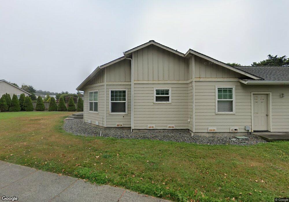
96365 Dawson Rd Brookings, OR 97415
Estimated Value: $532,000 - $604,631
3
Beds
2
Baths
1,677
Sq Ft
$339/Sq Ft
Est. Value
About This Home
This home is located at 96365 Dawson Rd, Brookings, OR 97415 and is currently estimated at $568,316, approximately $338 per square foot. 96365 Dawson Rd is a home located in Curry County with nearby schools including Kalmiopsis Elementary School, Azalea Middle School, and Brookings-Harbor High School.
Ownership History
Date
Name
Owned For
Owner Type
Purchase Details
Closed on
Apr 14, 2014
Sold by
Perry Ernest C and Perry Janet
Bought by
Taylor Jason P and Cervantes Nancy
Current Estimated Value
Home Financials for this Owner
Home Financials are based on the most recent Mortgage that was taken out on this home.
Original Mortgage
$250,381
Outstanding Balance
$189,689
Interest Rate
4.25%
Mortgage Type
FHA
Estimated Equity
$378,627
Purchase Details
Closed on
Jan 28, 2005
Sold by
Perry Ernest C and Perry Janet
Bought by
Perry Ernest C and Perry Janet
Home Financials for this Owner
Home Financials are based on the most recent Mortgage that was taken out on this home.
Original Mortgage
$215,800
Interest Rate
5.5%
Mortgage Type
Adjustable Rate Mortgage/ARM
Purchase Details
Closed on
Jan 24, 2005
Sold by
Perry Ernest C and Perry Janet
Bought by
Perry Ernest C and Perry Janet
Home Financials for this Owner
Home Financials are based on the most recent Mortgage that was taken out on this home.
Original Mortgage
$215,800
Interest Rate
5.5%
Mortgage Type
Adjustable Rate Mortgage/ARM
Create a Home Valuation Report for This Property
The Home Valuation Report is an in-depth analysis detailing your home's value as well as a comparison with similar homes in the area
Home Values in the Area
Average Home Value in this Area
Purchase History
| Date | Buyer | Sale Price | Title Company |
|---|---|---|---|
| Taylor Jason P | $255,000 | First American Title Company | |
| Perry Ernest C | -- | First American Title Co | |
| Perry Ernest C | -- | First American Title Co |
Source: Public Records
Mortgage History
| Date | Status | Borrower | Loan Amount |
|---|---|---|---|
| Open | Taylor Jason P | $250,381 | |
| Previous Owner | Perry Ernest C | $215,800 |
Source: Public Records
Tax History Compared to Growth
Tax History
| Year | Tax Paid | Tax Assessment Tax Assessment Total Assessment is a certain percentage of the fair market value that is determined by local assessors to be the total taxable value of land and additions on the property. | Land | Improvement |
|---|---|---|---|---|
| 2024 | $3,117 | $329,730 | -- | -- |
| 2023 | $3,026 | $320,130 | $0 | $0 |
| 2022 | $2,938 | $310,810 | $0 | $0 |
| 2021 | $2,853 | $301,760 | $0 | $0 |
| 2020 | $2,944 | $292,980 | $0 | $0 |
| 2019 | $2,704 | $284,450 | $0 | $0 |
| 2018 | $2,820 | $276,170 | $0 | $0 |
| 2017 | $2,715 | $276,170 | $0 | $0 |
| 2016 | $2,650 | $260,330 | $0 | $0 |
| 2015 | $2,443 | $240,130 | $0 | $0 |
| 2014 | $2,443 | $239,230 | $0 | $0 |
Source: Public Records
Map
Nearby Homes
- 96408 Oceanside Dr E
- 17116 Pacific Heights
- 96335 Dawson Rd
- 96370 North Dr Unit 8
- 17120 Pacific Heights
- 96441 Shorewood Terrace
- 96424 Shorewood Terrace
- 0 Deer Park Dr Unit 331094166
- 1735 Arch Ln
- 1538 Seacrest Ln
- 1734 Arch Ln
- 1455 Seacrest Ln Unit 3
- 1455 Seacrest Ln Unit 1A
- 1341 Nautical Heights Dr
- 1229 Lighthouse Ln
- 1236 Lighthouse Ln
- 1232 Lighthouse Ln
- 96465 Coverdell Rd Unit 8
- 96465 Coverdell Rd Unit 37
- 96465 Coverdell Rd Unit 34
- 96361 Dawson Rd
- 96401 Oceanside Dr E
- 96359 Dawson Rd
- 0 Oceanside Dr E Unit 8 21575433
- 0 Oceanside Dr E Unit Lot 9 21499150
- 0 Oceanside Dr E Unit 8 20124459
- 0 Oceanside Dr E Unit 8076018
- 0 Oceanside Dr E Unit 7 9009272
- 0 Oceanside Dr E Unit 11674354
- 0 Oceanside Dr E Unit 7 11463940
- 0 Oceanside Dr E Unit 7 15469180
- 0 Oceanside Dr E Unit 8 15329368
- 0 Oceanside Dr E Unit 16255048
- 0 Oceanside Dr E Unit 6 16069835
- 0 Oceanside Dr E Unit 16385305
- 0 Oceanside Dr E Unit 6 16562174
- 0 Oceanside Dr E Unit 5 17331414
- 0 Oceanside Dr E Unit 17244233
- 0 Oceanside Dr E Unit 7
- 96403 Oceanside Dr E