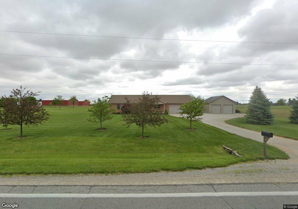
9637 W State Route 718 Covington, OH 45318
Estimated Value: $304,000 - $502,000
3
Beds
2
Baths
1,560
Sq Ft
$236/Sq Ft
Est. Value
About This Home
This home is located at 9637 W State Route 718, Covington, OH 45318 and is currently estimated at $367,597, approximately $235 per square foot. 9637 W State Route 718 is a home with nearby schools including Newton Elementary School and Newton High School.
Ownership History
Date
Name
Owned For
Owner Type
Purchase Details
Closed on
Jul 23, 2009
Sold by
Wills William W and Wills Dianna M
Bought by
Keiser Jeffrey L and Keiser Michelle D
Current Estimated Value
Purchase Details
Closed on
Aug 5, 2004
Sold by
Chase Manhattan Mortgage Corp
Bought by
Miller Randy L
Purchase Details
Closed on
May 21, 2004
Sold by
Deeter Christopher
Bought by
Hud
Create a Home Valuation Report for This Property
The Home Valuation Report is an in-depth analysis detailing your home's value as well as a comparison with similar homes in the area
Home Values in the Area
Average Home Value in this Area
Purchase History
| Date | Buyer | Sale Price | Title Company |
|---|---|---|---|
| Keiser Jeffrey L | $19,000 | -- | |
| Miller Randy L | $41,500 | -- | |
| Hud | -- | -- |
Source: Public Records
Tax History Compared to Growth
Tax History
| Year | Tax Paid | Tax Assessment Tax Assessment Total Assessment is a certain percentage of the fair market value that is determined by local assessors to be the total taxable value of land and additions on the property. | Land | Improvement |
|---|---|---|---|---|
| 2024 | $2,785 | $76,030 | $9,630 | $66,400 |
| 2023 | $2,785 | $76,030 | $9,630 | $66,400 |
| 2022 | $2,829 | $76,030 | $9,630 | $66,400 |
| 2021 | $2,519 | $63,360 | $8,020 | $55,340 |
| 2020 | $2,526 | $63,360 | $8,020 | $55,340 |
| 2019 | $2,362 | $63,360 | $8,020 | $55,340 |
| 2018 | $1,912 | $51,350 | $7,980 | $43,370 |
| 2017 | $1,930 | $51,350 | $7,980 | $43,370 |
| 2016 | $1,906 | $51,350 | $7,980 | $43,370 |
| 2015 | $2,014 | $49,360 | $7,670 | $41,690 |
| 2014 | $2,014 | $49,360 | $7,670 | $41,690 |
| 2013 | $2,034 | $49,360 | $7,670 | $41,690 |
Source: Public Records
Map
Nearby Homes
- 9980 Ohio 718
- 120 Piper's Pine Dr
- 120 Pipers Pine Dr
- State Route 48
- 115 W Hill St
- 106 W Hill St
- 0 N Furlong Rd
- 1 N Main St
- 201 E High St
- 203 Chestnut St
- 5845 Fenner Rd
- 8341 W Covington Gettysburg Rd
- 5225 N Front St
- 221 Henry Ct
- 219 Henry Ct
- 200 Charles Ct
- 201 Charles Ct
- 202 Charles Ct
- 203 Charles Ct
- 205 Charles Ct
- 9500 W State Route 718
- 9590 W State Route 718
- 9740 W State Route 718
- 9693 W State Route 718
- 9710 W State Route 718
- 1005 Leonard Rd
- 1005 N Leonard Rd
- 1045 Leonard Rd
- 1091 Leonard Rd
- 9835 W State Route 718
- 9820 W State Route 718
- 1000 N Rangeline Rd
- 1122 N Rangeline Rd
- 1192 Leonard Rd
- 930 N Rangeline Rd
- 1095 N Rangeline Rd
- 9980 W State Route 718
- 910 N Rangeline Rd
- 888 N Rangeline Rd
- 754 N Rangeline Rd