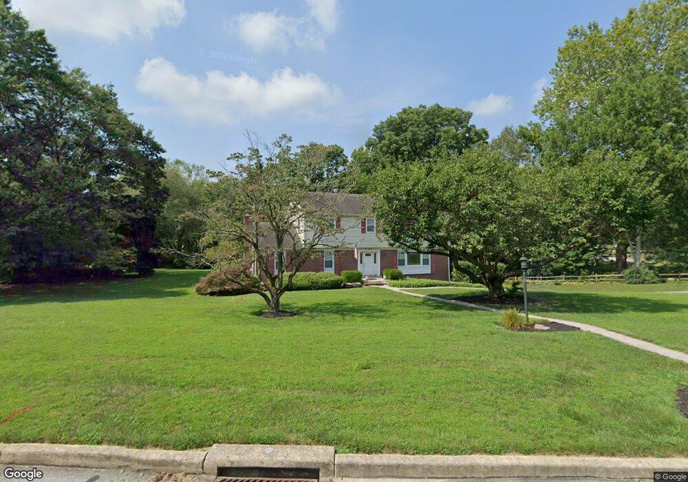
964 Embree Ln West Chester, PA 19380
Estimated Value: $738,833 - $801,000
4
Beds
3
Baths
2,742
Sq Ft
$277/Sq Ft
Est. Value
About This Home
This home is located at 964 Embree Ln, West Chester, PA 19380 and is currently estimated at $758,458, approximately $276 per square foot. 964 Embree Ln is a home located in Chester County with nearby schools including Hillsdale Elementary School, E.N. Peirce Middle School, and Henderson High School.
Ownership History
Date
Name
Owned For
Owner Type
Purchase Details
Closed on
Oct 21, 1994
Sold by
Holmes Wayne D and Holmes Caroline A
Bought by
Butler Daniel E and Butler Stephanie K
Current Estimated Value
Home Financials for this Owner
Home Financials are based on the most recent Mortgage that was taken out on this home.
Original Mortgage
$196,000
Interest Rate
9.16%
Create a Home Valuation Report for This Property
The Home Valuation Report is an in-depth analysis detailing your home's value as well as a comparison with similar homes in the area
Home Values in the Area
Average Home Value in this Area
Purchase History
| Date | Buyer | Sale Price | Title Company |
|---|---|---|---|
| Butler Daniel E | $218,000 | -- |
Source: Public Records
Mortgage History
| Date | Status | Borrower | Loan Amount |
|---|---|---|---|
| Previous Owner | Butler Daniel E | $196,000 |
Source: Public Records
Tax History Compared to Growth
Tax History
| Year | Tax Paid | Tax Assessment Tax Assessment Total Assessment is a certain percentage of the fair market value that is determined by local assessors to be the total taxable value of land and additions on the property. | Land | Improvement |
|---|---|---|---|---|
| 2025 | $5,816 | $200,640 | $43,450 | $157,190 |
| 2024 | $5,816 | $200,640 | $43,450 | $157,190 |
| 2023 | $5,816 | $200,640 | $43,450 | $157,190 |
| 2022 | $5,741 | $200,640 | $43,450 | $157,190 |
| 2021 | $5,661 | $200,640 | $43,450 | $157,190 |
| 2020 | $5,624 | $200,640 | $43,450 | $157,190 |
| 2019 | $5,546 | $200,640 | $43,450 | $157,190 |
| 2018 | $5,428 | $200,640 | $43,450 | $157,190 |
| 2017 | $5,310 | $200,640 | $43,450 | $157,190 |
| 2016 | $4,340 | $200,640 | $43,450 | $157,190 |
| 2015 | $4,340 | $200,640 | $43,450 | $157,190 |
| 2014 | $4,340 | $200,640 | $43,450 | $157,190 |
Source: Public Records
Map
Nearby Homes
- 112 Crosspointe Dr
- 530 Legion Dr
- 911 Baylowell Dr
- 1103 Judson Dr
- 751 Mccardle Dr Unit 27
- 744 Mccardle Dr Unit 35
- 626 N Matlack St
- 505 S Maryland Ave
- 532 N Walnut St
- 723 Hillside Dr
- 797 Tree Ln
- 806 Downingtown Pike
- 204 Ford Cir
- 303 W Washington St
- 303 Star Tavern Ln
- 324 Star Tavern Ln
- 737 Bradford Terrace Unit 252
- 765 Bradford Terrace Unit 238
- 345 Star Tavern Ln
- 347 E Biddle St
- 322 Chrislena Ln
- 960 Embree Ln
- 963 Embree Ln
- 327 Chrislena Ln
- 223 Chrislena Ln
- 956 Embree Ln
- 959 Embree Ln
- 961 N New St
- 333 Chrislena Ln
- 963 N New St
- 218 Chrislena Ln
- 219 Chrislena Ln
- 906 Gated Ln
- 959 N New St
- 904 Gated Ln
- 325 Taylors Mill Rd
- 967 N New St
- 223 Taylors Mill Rd
- 975 N New St
- 327 Taylors Mill Rd