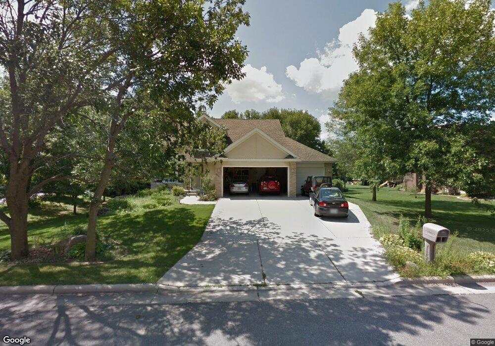
964 Lori Ln Sun Prairie, WI 53590
Renstone NeighborhoodEstimated Value: $540,000 - $614,000
4
Beds
4
Baths
2,217
Sq Ft
$265/Sq Ft
Est. Value
About This Home
This home is located at 964 Lori Ln, Sun Prairie, WI 53590 and is currently estimated at $587,447, approximately $264 per square foot. 964 Lori Ln is a home located in Dane County with nearby schools including Bird Elementary School, Patrick Marsh Middle School, and Peace Lutheran School & Prekindergarten.
Ownership History
Date
Name
Owned For
Owner Type
Purchase Details
Closed on
Mar 29, 2023
Sold by
Hawkins John Gary
Bought by
Hawkins Kathleen Lynn
Current Estimated Value
Purchase Details
Closed on
Aug 12, 2005
Sold by
Opem Jonathan D and Opem Michele M
Bought by
Hawkins John Gary and Hawkins Kathleen Lynn
Home Financials for this Owner
Home Financials are based on the most recent Mortgage that was taken out on this home.
Original Mortgage
$379,000
Interest Rate
5.66%
Mortgage Type
Purchase Money Mortgage
Create a Home Valuation Report for This Property
The Home Valuation Report is an in-depth analysis detailing your home's value as well as a comparison with similar homes in the area
Home Values in the Area
Average Home Value in this Area
Purchase History
| Date | Buyer | Sale Price | Title Company |
|---|---|---|---|
| Hawkins Kathleen Lynn | -- | -- | |
| Hawkins John Gary | $379,000 | None Available |
Source: Public Records
Mortgage History
| Date | Status | Borrower | Loan Amount |
|---|---|---|---|
| Previous Owner | Hawkins John Gary | $379,000 |
Source: Public Records
Tax History Compared to Growth
Tax History
| Year | Tax Paid | Tax Assessment Tax Assessment Total Assessment is a certain percentage of the fair market value that is determined by local assessors to be the total taxable value of land and additions on the property. | Land | Improvement |
|---|---|---|---|---|
| 2024 | $10,265 | $539,800 | $78,700 | $461,100 |
| 2023 | $9,338 | $539,800 | $78,700 | $461,100 |
| 2021 | $9,349 | $441,900 | $76,000 | $365,900 |
| 2020 | $9,535 | $441,900 | $76,000 | $365,900 |
| 2019 | $9,813 | $402,800 | $69,100 | $333,700 |
| 2018 | $9,063 | $402,800 | $69,100 | $333,700 |
| 2017 | $8,673 | $402,800 | $69,100 | $333,700 |
| 2016 | $8,507 | $357,800 | $57,700 | $300,100 |
| 2015 | $8,259 | $357,800 | $57,700 | $300,100 |
| 2014 | $8,073 | $347,300 | $57,700 | $289,600 |
| 2013 | $8,129 | $347,300 | $57,700 | $289,600 |
Source: Public Records
Map
Nearby Homes
- 1822 Cobblestone Ct
- 933 Allison St
- 1500 Calico Ln
- 1847 Windemere Ct
- 1824 Chadsworth Dr
- 1294 Saint Albert the Great Dr
- 643 Eddington Dr
- 1801 Frawley Dr
- 1792 Frawley Dr
- 1013 Vandenburg St
- 1010 Andrews Dr
- 1325 Bunker Hill Dr Unit 3104
- 1759 Waverly Way
- 1767 Waverly Way
- 921 Pine St
- 1295 Stonehaven Dr
- 1712 Waverly Way
- The Emerald Plan at The Reserve - Veridian Homes
- The Beryl Plan at The Reserve - Veridian Homes
- The Hoffman Plan at The Reserve - Veridian Homes