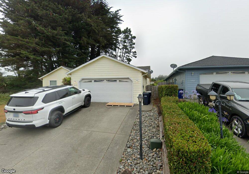
96400 Oceanside Dr E Brookings, OR 97415
Estimated Value: $623,472 - $685,000
3
Beds
2
Baths
1,825
Sq Ft
$358/Sq Ft
Est. Value
About This Home
This home is located at 96400 Oceanside Dr E, Brookings, OR 97415 and is currently estimated at $654,236, approximately $358 per square foot. 96400 Oceanside Dr E is a home located in Curry County with nearby schools including Kalmiopsis Elementary School, Azalea Middle School, and Brookings-Harbor High School.
Ownership History
Date
Name
Owned For
Owner Type
Purchase Details
Closed on
Nov 2, 2022
Sold by
Macken James G and Macken Danon
Bought by
Danon C Macken And James G Macken 2022 Revoca
Current Estimated Value
Purchase Details
Closed on
Mar 2, 2005
Sold by
Desmond Deborah
Bought by
Macken James G and Macken Danon
Home Financials for this Owner
Home Financials are based on the most recent Mortgage that was taken out on this home.
Original Mortgage
$115,000
Interest Rate
4.57%
Mortgage Type
Adjustable Rate Mortgage/ARM
Purchase Details
Closed on
Feb 9, 2005
Sold by
Latham Walter
Bought by
Desmond Deborah
Home Financials for this Owner
Home Financials are based on the most recent Mortgage that was taken out on this home.
Original Mortgage
$115,000
Interest Rate
4.57%
Mortgage Type
Adjustable Rate Mortgage/ARM
Create a Home Valuation Report for This Property
The Home Valuation Report is an in-depth analysis detailing your home's value as well as a comparison with similar homes in the area
Home Values in the Area
Average Home Value in this Area
Purchase History
| Date | Buyer | Sale Price | Title Company |
|---|---|---|---|
| Danon C Macken And James G Macken 2022 Revoca | -- | -- | |
| Macken James G | $330,000 | First American Title Co | |
| Desmond Deborah | -- | First American Title Co |
Source: Public Records
Mortgage History
| Date | Status | Borrower | Loan Amount |
|---|---|---|---|
| Previous Owner | Macken James G | $115,000 |
Source: Public Records
Tax History
| Year | Tax Paid | Tax Assessment Tax Assessment Total Assessment is a certain percentage of the fair market value that is determined by local assessors to be the total taxable value of land and additions on the property. | Land | Improvement |
|---|---|---|---|---|
| 2025 | $3,228 | $341,500 | -- | -- |
| 2024 | $3,134 | $331,560 | -- | -- |
| 2023 | $3,043 | $321,910 | $0 | $0 |
| 2022 | $2,954 | $312,540 | $0 | $0 |
| 2021 | $2,868 | $303,440 | $0 | $0 |
| 2020 | $2,960 | $294,610 | $0 | $0 |
| 2019 | $2,719 | $286,030 | $0 | $0 |
| 2018 | $2,835 | $277,700 | $0 | $0 |
| 2017 | $2,731 | $277,700 | $0 | $0 |
| 2016 | $2,664 | $269,620 | $0 | $0 |
Source: Public Records
Map
Nearby Homes
- 96370 North Dr Unit 8
- 96448 Shorewood Terrace
- 17197 S Passley Rd
- 96503 Ridgeway St
- 0 Holmes Dr
- 96441 Shorewood Terrace
- 96546 Sunridge Terrace
- 15130 U S 101
- 0 Deer Park Dr Unit 500
- 1733 Arch Ln
- 1735 Arch Ln
- 1538 Seacrest Ln
- 1734 Arch Ln
- 1730 Arch Ln
- 1475 Seacrest Ln
- 1455 Seacrest Ln Unit 1A
- 1455 Seacrest Ln Unit 3
- 1425 Seacrest Ln Unit 4D
- 1236 Lighthouse Ln
- 1229 Lighthouse Ln
- 96402 Oceanside Dr E
- 0 Oceanside Dr E Unit 8 21575433
- 0 Oceanside Dr E Unit Lot 9 21499150
- 0 Oceanside Dr E Unit 8 20124459
- 0 Oceanside Dr E Unit 8076018
- 0 Oceanside Dr E Unit 7 9009272
- 0 Oceanside Dr E Unit 11674354
- 0 Oceanside Dr E Unit 7 11463940
- 0 Oceanside Dr E Unit 7 15469180
- 0 Oceanside Dr E Unit 8 15329368
- 0 Oceanside Dr E Unit 16255048
- 0 Oceanside Dr E Unit 6 16069835
- 0 Oceanside Dr E Unit 16385305
- 0 Oceanside Dr E Unit 6 16562174
- 0 Oceanside Dr E Unit 5 17331414
- 0 Oceanside Dr E Unit 17244233
- 0 Oceanside Dr E Unit 7
- 96404 Oceanside Dr E
- 96401 Oceanside Dr E
- 96377 Dawson Rd
Your Personal Tour Guide
Ask me questions while you tour the home.