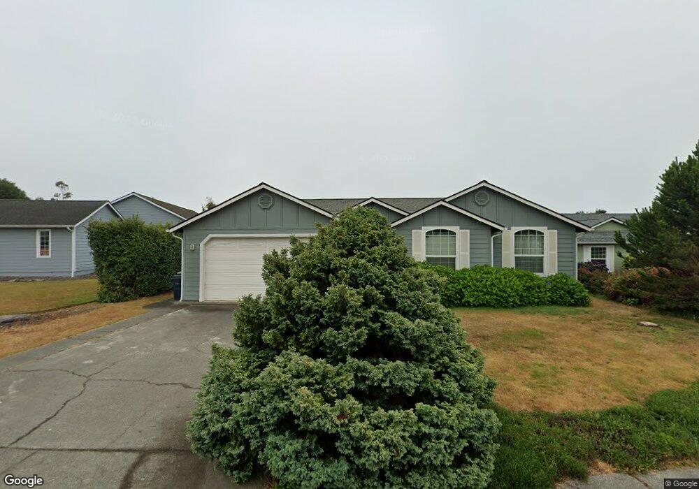
96407 Oceanside Dr E Brookings, OR 97415
Estimated Value: $570,217 - $671,000
3
Beds
2
Baths
1,600
Sq Ft
$388/Sq Ft
Est. Value
About This Home
This home is located at 96407 Oceanside Dr E, Brookings, OR 97415 and is currently estimated at $620,609, approximately $387 per square foot. 96407 Oceanside Dr E is a home located in Curry County with nearby schools including Kalmiopsis Elementary School, Azalea Middle School, and Brookings-Harbor High School.
Ownership History
Date
Name
Owned For
Owner Type
Purchase Details
Closed on
May 13, 2024
Sold by
Rings Loren
Bought by
Loren Rings Living Trust and Ring
Current Estimated Value
Purchase Details
Closed on
Apr 17, 2007
Sold by
Carlson Suzanne J
Bought by
Rings Loren and Rings Ann C
Home Financials for this Owner
Home Financials are based on the most recent Mortgage that was taken out on this home.
Original Mortgage
$150,000
Interest Rate
6.11%
Mortgage Type
New Conventional
Purchase Details
Closed on
Nov 22, 2005
Sold by
Heidger Robert Charles
Bought by
Carlson Suzanne J
Home Financials for this Owner
Home Financials are based on the most recent Mortgage that was taken out on this home.
Original Mortgage
$272,000
Interest Rate
2.5%
Mortgage Type
Adjustable Rate Mortgage/ARM
Create a Home Valuation Report for This Property
The Home Valuation Report is an in-depth analysis detailing your home's value as well as a comparison with similar homes in the area
Home Values in the Area
Average Home Value in this Area
Purchase History
| Date | Buyer | Sale Price | Title Company |
|---|---|---|---|
| Loren Rings Living Trust | -- | None Listed On Document | |
| Rings Loren | $320,000 | First American Title Co | |
| Carlson Suzanne J | $340,000 | Curry County Title Inc |
Source: Public Records
Mortgage History
| Date | Status | Borrower | Loan Amount |
|---|---|---|---|
| Previous Owner | Rings Loren | $150,000 | |
| Previous Owner | Carlson Suzanne J | $272,000 |
Source: Public Records
Tax History Compared to Growth
Tax History
| Year | Tax Paid | Tax Assessment Tax Assessment Total Assessment is a certain percentage of the fair market value that is determined by local assessors to be the total taxable value of land and additions on the property. | Land | Improvement |
|---|---|---|---|---|
| 2024 | $2,974 | $314,640 | -- | -- |
| 2023 | $2,888 | $305,480 | $0 | $0 |
| 2022 | $2,804 | $296,590 | $0 | $0 |
| 2021 | $2,722 | $287,960 | $0 | $0 |
| 2020 | $2,809 | $279,580 | $0 | $0 |
| 2019 | $2,580 | $271,440 | $0 | $0 |
| 2018 | $2,691 | $263,540 | $0 | $0 |
| 2017 | $2,591 | $263,540 | $0 | $0 |
| 2016 | $2,528 | $255,870 | $0 | $0 |
| 2015 | $2,431 | $238,210 | $0 | $0 |
| 2014 | $2,431 | $238,110 | $0 | $0 |
Source: Public Records
Map
Nearby Homes
- 96408 Oceanside Dr E
- 17116 Pacific Heights
- 96335 Dawson Rd
- 96370 North Dr Unit 8
- 17120 Pacific Heights
- 96441 Shorewood Terrace
- 96424 Shorewood Terrace
- 0 Deer Park Dr Unit 331094166
- 1735 Arch Ln
- 1538 Seacrest Ln
- 1734 Arch Ln
- 1455 Seacrest Ln Unit 3
- 1455 Seacrest Ln Unit 1A
- 1236 Lighthouse Ln
- 1341 Nautical Heights Dr
- 1229 Lighthouse Ln
- 1232 Lighthouse Ln
- 96465 Coverdell Rd Unit 8
- 96465 Coverdell Rd Unit 37
- 96465 Coverdell Rd Unit 34
- 96409 Oceanside Dr E
- 96411 Oceanside Dr E
- 96403 Oceanside Dr E
- 96406 Oceanside Dr E
- 96404 Oceanside Dr E
- 96413 Oceanside Dr E
- 0 Oceanside Dr E Unit 8 21575433
- 0 Oceanside Dr E Unit Lot 9 21499150
- 0 Oceanside Dr E Unit 8 20124459
- 0 Oceanside Dr E Unit 8076018
- 0 Oceanside Dr E Unit 7 9009272
- 0 Oceanside Dr E Unit 11674354
- 0 Oceanside Dr E Unit 7 11463940
- 0 Oceanside Dr E Unit 7 15469180
- 0 Oceanside Dr E Unit 8 15329368
- 0 Oceanside Dr E Unit 16255048
- 0 Oceanside Dr E Unit 6 16069835
- 0 Oceanside Dr E Unit 16385305
- 0 Oceanside Dr E Unit 6 16562174
- 0 Oceanside Dr E Unit 5 17331414