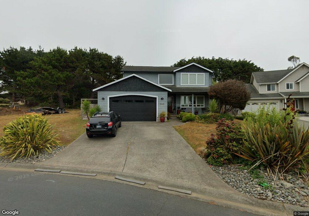
96418 Oceanside Dr E Brookings, OR 97415
Estimated Value: $693,294 - $697,000
4
Beds
2
Baths
1,970
Sq Ft
$353/Sq Ft
Est. Value
About This Home
This home is located at 96418 Oceanside Dr E, Brookings, OR 97415 and is currently estimated at $695,147, approximately $352 per square foot. 96418 Oceanside Dr E is a home located in Curry County with nearby schools including Kalmiopsis Elementary School, Azalea Middle School, and Brookings-Harbor High School.
Ownership History
Date
Name
Owned For
Owner Type
Purchase Details
Closed on
Oct 25, 2016
Sold by
Murdock Edward B and Murdock Tamra H
Bought by
Christopher Shannon M and Corner Dewayne
Current Estimated Value
Home Financials for this Owner
Home Financials are based on the most recent Mortgage that was taken out on this home.
Original Mortgage
$255,200
Outstanding Balance
$203,778
Interest Rate
3.42%
Mortgage Type
New Conventional
Estimated Equity
$491,369
Create a Home Valuation Report for This Property
The Home Valuation Report is an in-depth analysis detailing your home's value as well as a comparison with similar homes in the area
Home Values in the Area
Average Home Value in this Area
Purchase History
| Date | Buyer | Sale Price | Title Company |
|---|---|---|---|
| Christopher Shannon M | $319,000 | Curry County Title |
Source: Public Records
Mortgage History
| Date | Status | Borrower | Loan Amount |
|---|---|---|---|
| Open | Christopher Shannon M | $255,200 |
Source: Public Records
Tax History
| Year | Tax Paid | Tax Assessment Tax Assessment Total Assessment is a certain percentage of the fair market value that is determined by local assessors to be the total taxable value of land and additions on the property. | Land | Improvement |
|---|---|---|---|---|
| 2025 | $3,429 | $362,740 | -- | -- |
| 2024 | $3,329 | $352,180 | -- | -- |
| 2023 | $3,232 | $341,930 | $0 | $0 |
| 2022 | $3,138 | $331,980 | $0 | $0 |
| 2021 | $3,047 | $322,320 | $0 | $0 |
| 2020 | $3,145 | $312,940 | $0 | $0 |
| 2019 | $2,888 | $303,830 | $0 | $0 |
| 2018 | $3,012 | $294,990 | $0 | $0 |
| 2017 | $2,900 | $294,990 | $0 | $0 |
| 2016 | $2,830 | $286,400 | $0 | $0 |
Source: Public Records
Map
Nearby Homes
- 17197 S Passley Rd
- 96503 Ridgeway St
- 96448 Shorewood Terrace
- 96546 Sunridge Terrace
- 96370 North Dr Unit 8
- 96441 Shorewood Terrace
- 15130 U S 101
- 0 Holmes Dr
- 1733 Arch Ln
- 1735 Arch Ln
- 1538 Seacrest Ln
- 1734 Arch Ln
- 1730 Arch Ln
- 0 Deer Park Dr Unit 500
- 1475 Seacrest Ln
- 1455 Seacrest Ln Unit 1A
- 1455 Seacrest Ln Unit 3
- 1425 Seacrest Ln Unit 4D
- 1236 Lighthouse Ln
- 1229 Lighthouse Ln
- 96420 Oceanside Dr E
- 96511 Westcliff Dr
- 96422 Oceanside Dr E Unit 12
- 96409 Oceanside Dr E
- 96509 Westcliff Dr
- 96424 Oceanside Dr E
- 17170 Ocean Park Ct
- 96412 Oceanside Dr E
- 0 W Cliff Dr Unit 2200 19020936
- 96411 Oceanside Dr E
- 96407 Oceanside Dr E
- 96507 Westcliff Dr
- 96410 Oceanside Dr E
- 96413 Oceanside Dr E
- 17171 Ocean Park Ct
- 96405 Oceanside Dr E
- 96339 Dawson Rd
- 17164 Ocean Park Ct
- 96505 Westcliff Dr
- 96337 Dawson Rd
Your Personal Tour Guide
Ask me questions while you tour the home.