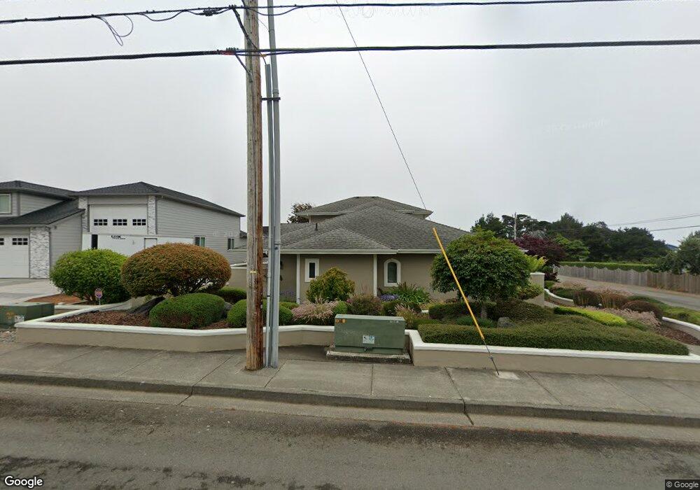
96435 Dawson Rd Brookings, OR 97415
Estimated Value: $754,086 - $781,000
1
Bed
2
Baths
2,665
Sq Ft
$288/Sq Ft
Est. Value
About This Home
This home is located at 96435 Dawson Rd, Brookings, OR 97415 and is currently estimated at $767,543, approximately $288 per square foot. 96435 Dawson Rd is a home located in Curry County with nearby schools including Kalmiopsis Elementary School, Azalea Middle School, and Brookings-Harbor High School.
Ownership History
Date
Name
Owned For
Owner Type
Purchase Details
Closed on
Jul 22, 2019
Sold by
Gordon Cheryl A
Bought by
Cheryl A Gordon T
Current Estimated Value
Purchase Details
Closed on
Feb 16, 2007
Sold by
Woodruff Enterprises Inc
Bought by
Gordon Cheryl A
Home Financials for this Owner
Home Financials are based on the most recent Mortgage that was taken out on this home.
Original Mortgage
$400,000
Interest Rate
6.21%
Mortgage Type
New Conventional
Create a Home Valuation Report for This Property
The Home Valuation Report is an in-depth analysis detailing your home's value as well as a comparison with similar homes in the area
Home Values in the Area
Average Home Value in this Area
Purchase History
| Date | Buyer | Sale Price | Title Company |
|---|---|---|---|
| Cheryl A Gordon T | -- | -- | |
| Gordon Cheryl A | $500,000 | First American |
Source: Public Records
Mortgage History
| Date | Status | Borrower | Loan Amount |
|---|---|---|---|
| Previous Owner | Gordon Cheryl A | $400,000 |
Source: Public Records
Tax History Compared to Growth
Tax History
| Year | Tax Paid | Tax Assessment Tax Assessment Total Assessment is a certain percentage of the fair market value that is determined by local assessors to be the total taxable value of land and additions on the property. | Land | Improvement |
|---|---|---|---|---|
| 2024 | $3,952 | $418,040 | -- | -- |
| 2023 | $3,837 | $405,870 | $0 | $0 |
| 2022 | $3,725 | $394,050 | $0 | $0 |
| 2021 | $3,617 | $382,580 | $0 | $0 |
| 2020 | $3,733 | $371,440 | $0 | $0 |
| 2019 | $3,428 | $360,630 | $0 | $0 |
| 2018 | $3,575 | $350,130 | $0 | $0 |
| 2017 | $3,443 | $350,130 | $0 | $0 |
| 2016 | $3,359 | $339,940 | $0 | $0 |
| 2015 | $3,176 | $330,040 | $0 | $0 |
| 2014 | $3,176 | $311,100 | $0 | $0 |
Source: Public Records
Map
Nearby Homes
- 96408 Oceanside Dr E
- 96370 North Dr Unit 8
- 17116 Pacific Heights
- 96335 Dawson Rd
- 17120 Pacific Heights
- 0 Deer Park Dr Unit 331094166
- 96441 Shorewood Terrace
- 96424 Shorewood Terrace
- 1735 Arch Ln
- 1538 Seacrest Ln
- 1734 Arch Ln
- 96465 Coverdell Rd Unit 8
- 96465 Coverdell Rd Unit 37
- 96465 Coverdell Rd Unit 34
- 96465 Coverdell Rd Unit 20
- 1346 Nautical Heights Dr
- 1229 Lighthouse Ln
- 1341 Nautical Heights Dr
- 1455 Seacrest Ln Unit 3
- 1455 Seacrest Ln Unit 1A
- 96300 Spindrift Ln
- 96439 Dawson Rd
- 96302 Spindrift Ln
- 96424 Dawson Rd
- 96432 Dawson Rd
- 96422 Dawson Rd
- 0 Spindrift Ln Unit 8 16085096
- 0 Spindrift Ln Unit 8
- 96301 Spindrift Ln
- 96447 Dawson Rd
- 96447 Spindrift Ln
- 96304 Spindrift Ln
- 96303 Spindrift Ln
- 96392 Dawson Rd
- 96307 Spindrift Ln
- 17304 Blueberry Dr
- 96391 Dawson Rd
- 96434 Dawson Rd
- 17310 Blueberry Dr
- 96305 Spindrift Ln