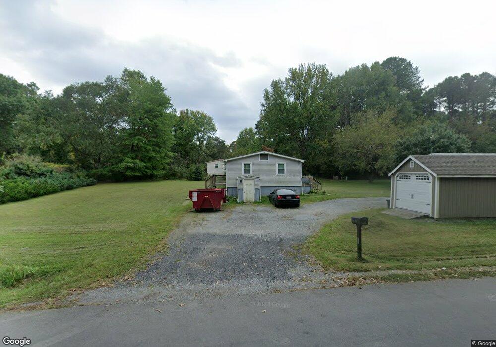
9645 Michael Dr King George, VA 22485
Estimated Value: $272,000 - $391,000
3
Beds
1
Bath
984
Sq Ft
$315/Sq Ft
Est. Value
About This Home
This home is located at 9645 Michael Dr, King George, VA 22485 and is currently estimated at $310,427, approximately $315 per square foot. 9645 Michael Dr is a home located in King George County with nearby schools including Sealston Elementary School, King George Middle School, and King George High School.
Ownership History
Date
Name
Owned For
Owner Type
Purchase Details
Closed on
Mar 24, 2025
Sold by
Creekside Homes Llc
Bought by
Smith William
Current Estimated Value
Home Financials for this Owner
Home Financials are based on the most recent Mortgage that was taken out on this home.
Original Mortgage
$375,000
Outstanding Balance
$373,081
Interest Rate
6.87%
Mortgage Type
VA
Estimated Equity
-$62,654
Purchase Details
Closed on
Nov 15, 2024
Sold by
Burrell David and Burrell Carolyn
Bought by
Creekside Homes Llc
Purchase Details
Closed on
May 16, 2006
Sold by
Burrell Fred H
Bought by
Burrell David
Home Financials for this Owner
Home Financials are based on the most recent Mortgage that was taken out on this home.
Original Mortgage
$172,000
Interest Rate
6.42%
Mortgage Type
New Conventional
Create a Home Valuation Report for This Property
The Home Valuation Report is an in-depth analysis detailing your home's value as well as a comparison with similar homes in the area
Home Values in the Area
Average Home Value in this Area
Purchase History
| Date | Buyer | Sale Price | Title Company |
|---|---|---|---|
| Smith William | $375,000 | Commonwealth Land Title | |
| Creekside Homes Llc | $270,000 | Fidelity National Title | |
| Creekside Homes Llc | $270,000 | Fidelity National Title | |
| Burrell David | $215,000 | -- |
Source: Public Records
Mortgage History
| Date | Status | Borrower | Loan Amount |
|---|---|---|---|
| Open | Smith William | $375,000 | |
| Previous Owner | Burrell David | $172,000 |
Source: Public Records
Tax History Compared to Growth
Tax History
| Year | Tax Paid | Tax Assessment Tax Assessment Total Assessment is a certain percentage of the fair market value that is determined by local assessors to be the total taxable value of land and additions on the property. | Land | Improvement |
|---|---|---|---|---|
| 2025 | $1,336 | $196,400 | $55,000 | $141,400 |
| 2024 | $1,336 | $196,400 | $55,000 | $141,400 |
| 2023 | $1,336 | $196,400 | $55,000 | $141,400 |
| 2022 | $1,257 | $196,400 | $55,000 | $141,400 |
| 2021 | $1,056 | $144,700 | $51,000 | $93,700 |
| 2020 | $1,013 | $144,700 | $51,000 | $93,700 |
| 2019 | $1,013 | $144,700 | $51,000 | $93,700 |
| 2018 | $1,013 | $144,700 | $51,000 | $93,700 |
| 2017 | $944 | $134,800 | $51,000 | $83,800 |
| 2016 | $917 | $134,800 | $51,000 | $83,800 |
| 2015 | -- | $134,800 | $51,000 | $83,800 |
| 2014 | -- | $134,800 | $51,000 | $83,800 |
Source: Public Records
Map
Nearby Homes
- LOT 2 Indiantown Rd
- LOT 7 Indiantown Rd
- 10048 Dahlgren Rd
- 10287 Dahlgren Rd
- 9760 Mohawk Dr
- 8110 Hobson Ln
- 8311 Daisy Ln
- 8152 Hobson Ln
- 11041 Lee St
- Washington Plan at Indiantown Rd
- Mt. Vernon Plan at Indiantown Rd
- Lafayette Plan at Indiantown Rd
- Spencer Plan at Indiantown Rd
- Kirkland Plan at Indiantown Rd
- Tyler Plan at Indiantown Rd
- Annapolis Plan at Indiantown Rd
- Emma Plan at Indiantown Rd
- Patriot Plan at Indiantown Rd
- Colson Plan at Indiantown Rd
- Monticello Plan at Indiantown Rd
- 8366 Indiantown Rd
- 9638 Michael Dr
- 8334 Indiantown Rd
- 9637 Michael Dr
- 8201 Todd St
- 8392 Indiantown Rd
- 8217 Todd St
- 9621 Michael Dr
- 8312 Indiantown Rd
- 8231 Todd St
- 8167 Todd St
- 8406 Indiantown Rd
- 8329 Indiantown Rd
- 8300 Indiantown Rd
- 8243 Todd St
- 8375 Indiantown Rd
- 8416 Indiantown Rd
- 8198 Todd St
- 8157 Todd St
- 8212 Todd St